1960s Maps of Lower Smoky Valley, Nevada
Explore 2 historic maps of Lower Smoky Valley from the 1960s. These maps offer a rare glimpse into what life looked like during the 1960s — showing old roads, neighborhoods, homes, and landmarks that have changed or disappeared over time.
Whether you're researching your family's past, planning a metal detecting trip, or studying how Lower Smoky Valley's landscape evolved across the 1960s, these high-resolution maps are a powerful tool for exploring the history of this region.
- Focus on a specific era: All maps on this page are from the 1960s, giving you a focused view of this time period.
- See what’s changed: Compare century-old streets, trails, and buildings to today's modern landscape using overlays and satellite layers.
- Research with precision: Use these maps for genealogy, historical research, land use analysis, or educational projects.
- View, download, or print: Maps are fully viewable online in high resolution, and can be downloaded or printed for your own records.
Start exploring Lower Smoky Valley's history through authentic maps from the 1960s. This is your window into the past.
Lower Smoky Valley, NV maps
(2)- 1962 Map of Tonopah
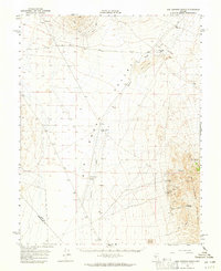
 1962 Tonopah1962 Print · USGSCentral Nevada's high desert mining country is captured here during the early sixties, showing the enduring footprint of the silver and gold rushes. Researchers can trace the decline of historic camps and locate industrial sites like the Tybo Mine, Victory Tungsten Mine, and the Mt. Moriah Cemetery.2 unique versions available
 - 1964 Map of San Antonio Ranch, 1965 Print
 1964 San Antonio Ranch1965 Print · USGSThe high desert of central Nevada in the mid-1960s reveals a sparse landscape shaped by mining and ranching. Researchers can trace the heritage of the San Antonio Mountains through the San Antonio Mine, Liberty Mine, and the historic Midway Station (Site).2 unique versions available
End of results
Showing maps 1-2 of 2
Frequently asked questions
- What are the different types of historical maps available for Lower Smoky Valley?
- What is the oldest map of Lower Smoky Valley?
- Where can I purchase historical maps of Lower Smoky Valley for my home or office?
- Where can I download high-res historical maps of Lower Smoky Valley?
- Are there historical topographic maps available for Lower Smoky Valley?
- Is there historical aerial imagery available for Lower Smoky Valley?
- Where are historical maps of Lower Smoky Valley sourced from?