2020s Maps of Tonopah, Nevada
Explore 3 historic maps of Tonopah from the 2020s. These maps offer a rare glimpse into what life looked like during the 2020s — showing old roads, neighborhoods, homes, and landmarks that have changed or disappeared over time.
Whether you're researching your family's past, planning a metal detecting trip, or studying how Tonopah's landscape evolved across the 2020s, these high-resolution maps are a powerful tool for exploring the history of this region.
- Focus on a specific era: All maps on this page are from the 2020s, giving you a focused view of this time period.
- See what’s changed: Compare century-old streets, trails, and buildings to today's modern landscape using overlays and satellite layers.
- Research with precision: Use these maps for genealogy, historical research, land use analysis, or educational projects.
- View, download, or print: Maps are fully viewable online in high resolution, and can be downloaded or printed for your own records.
Start exploring Tonopah's history through authentic maps from the 2020s. This is your window into the past.
Tonopah, NV maps
(3)- 2021 Map of Mount Butte, 2021 Print
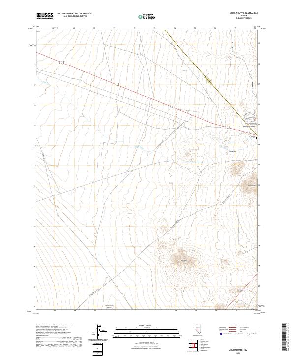 2021 Mount Butte2021 Print · USGSThe high-desert terrain of the Esmeralda and Nye county line is captured here in the early twenty-first century. Genealogists and historians can trace the roads into Tonopah Cem and locate landmarks like Mt Butte or the William P Beko Justice Complex.
 - 2021 Map of Crescent Dunes, 2021 Print
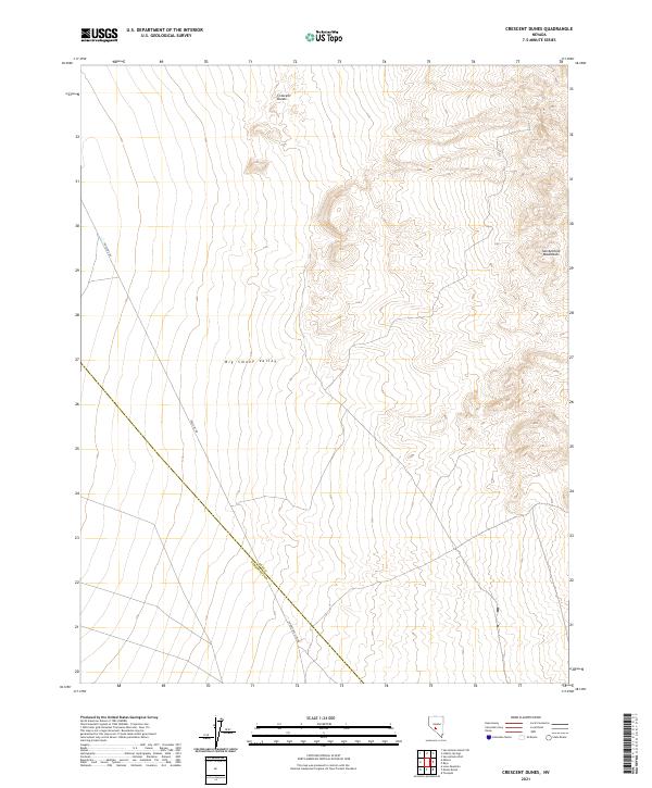 2021 Crescent Dunes2021 Print · USGSThe high desert of central Nevada is captured here in the early twenty-first century, spanning the border between Nye and Esmeralda counties. Geologists and desert travelers can trace the contours of the Crescent Dunes and follow the long stretches of Gabbs Pole Line Rd as it cuts through the Big Smoky Valley.
 - 2021 Map of Tonopah, 2021 Print
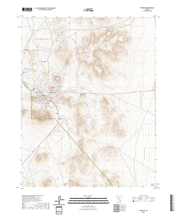 2021 Tonopah2021 Print · USGSTonopah stands at the edge of the desert at the start of the 2020s, showing the town's modern layout amid its famous mineral-rich hills. Researchers can trace the proximity of the settlement to Mizpah Hill, Mt Butler, and the Klondyke Hills.
End of results
Showing maps 1-3 of 3
Top neighborhoods of Tonopah
Frequently asked questions
- What are the different types of historical maps available for Tonopah?
- What is the oldest map of Tonopah?
- Where can I purchase historical maps of Tonopah for my home or office?
- Where can I download high-res historical maps of Tonopah?
- Are there historical topographic maps available for Tonopah?
- Is there historical aerial imagery available for Tonopah?
- Where are historical maps of Tonopah sourced from?