1980s Maps of Meredith, New Hampshire
Explore 7 historic maps of Meredith from the 1980s. These maps offer a rare glimpse into what life looked like during the 1980s — showing old roads, neighborhoods, homes, and landmarks that have changed or disappeared over time.
Whether you're researching your family's past, planning a metal detecting trip, or studying how Meredith's landscape evolved across the 1980s, these high-resolution maps are a powerful tool for exploring the history of this region.
- Focus on a specific era: All maps on this page are from the 1980s, giving you a focused view of this time period.
- See what’s changed: Compare century-old streets, trails, and buildings to today's modern landscape using overlays and satellite layers.
- Research with precision: Use these maps for genealogy, historical research, land use analysis, or educational projects.
- View, download, or print: Maps are fully viewable online in high resolution, and can be downloaded or printed for your own records.
Start exploring Meredith's history through authentic maps from the 1980s. This is your window into the past.
Meredith, NH maps
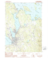
(7)- 1986 Map of Lake Winnipesaukee
 1986 Lake Winnipesaukee1986 Print · USGSThe Lakes Region in the mid-eighties shows a landscape of dense water bodies and mountain ranges at the peak of its twentieth-century character. Trace the legacy of old rail lines like the Boston and Maine RR and locate historic centers from Rumney Depot to Melvin Village.2 unique versions available
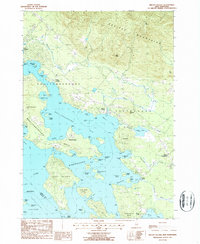
 - 1987 Map of Winnisquam Lake
 1987 Winnisquam Lake1987 Print · USGSThe Lakes Region of New Hampshire appears here in the late twentieth century, showing a landscape of interconnected basins and protected woodlands. Genealogists and local researchers can trace family landmarks near Meredith Center, Gaza, and the Bay Meetinghouse.
 - 1987 Map of Holderness
 1987 Holderness1987 Print · USGSThe Lakes Region at the close of the twentieth century shows a landscape of interconnected waters and rising hills. Genealogists and local historians can trace family landmarks like Dolloff Hill, rural Cem sites, and the extent of Sky Pond State Forest.
 - 1987 Map of Bristol
 1987 Bristol1987 Print · USGSCentral New Hampshire in the late eighties reveals a landscape of river valleys and timbered peaks across Grafton and Belknap counties. Genealogists and hikers can trace family-named landmarks like Huses Mountain or explore Sugar Hill State Forest and New Hampton.
 - 1987 Map of Laconia
 1987 Laconia1987 Print · USGSBelknap County's lakefront communities and recreation centers are captured here during the late eighties. Researchers can trace the development of the Laconia waterfront, find landmarks like the Drive-In Theater, or explore the slopes of Gunstock Mtn.2 unique versions available
 - 1987 Map of Center Harbor
 1987 Center Harbor1987 Print · USGSThe northern waters of Lake Winnipesaukee meet the heights of Red Hill in the late eighties. Genealogists and local historians can trace the lakeside docks of Center Harbor, the cemetery at Sunset Hill, and the scattered islands from Bear Island to Jolly Island.
 - 1987 Map of Melvin Village
 1987 Melvin Village1987 Print · USGSLake Winnipesaukee's northern shores are captured in the late eighties, showing a landscape defined by historic landings and the transition into the Ossipee Mountains. Genealogists and local historians can trace family locations near Melvin Village, Center Tuftonboro, and the working waterfront at Union Wharf.
End of results
Showing maps 1-7 of 7
Top cities near Meredith
- Laconia historical maps
- Franklin historical maps
- Gilford historical maps
- Belmont historical maps
- Northfield historical maps
- Loudon historical maps
See more
Top neighborhoods of Meredith
- Bear Island historical maps
- Boardmans Point historical maps
- East Bear Island historical maps
- Hornets Nest Point historical maps
- Jerry Point historical maps
- Lovejoy Sands historical maps
See more
Frequently asked questions
- What are the different types of historical maps available for Meredith?
- What is the oldest map of Meredith?
- Where can I purchase historical maps of Meredith for my home or office?
- Where can I download high-res historical maps of Meredith?
- Are there historical topographic maps available for Meredith?
- Is there historical aerial imagery available for Meredith?
- Where are historical maps of Meredith sourced from?