2020s Maps of Pittsburg, New Hampshire
Explore 23 historic maps of Pittsburg from the 2020s. These maps offer a rare glimpse into what life looked like during the 2020s — showing old roads, neighborhoods, homes, and landmarks that have changed or disappeared over time.
Whether you're researching your family's past, planning a metal detecting trip, or studying how Pittsburg's landscape evolved across the 2020s, these high-resolution maps are a powerful tool for exploring the history of this region.
- Focus on a specific era: All maps on this page are from the 2020s, giving you a focused view of this time period.
- See what’s changed: Compare century-old streets, trails, and buildings to today's modern landscape using overlays and satellite layers.
- Research with precision: Use these maps for genealogy, historical research, land use analysis, or educational projects.
- View, download, or print: Maps are fully viewable online in high resolution, and can be downloaded or printed for your own records.
Start exploring Pittsburg's history through authentic maps from the 2020s. This is your window into the past.
Pittsburg, NH maps
(23)- 2021 Map of Moose Bog, 2021 Print
 2021 Moose Bog2021 Print · USGSCovers Pittsburg, including Notre-Dame-des-Bois, Parmachenee Township, and other nearby areas
 - 2021 Map of Rump Mountain, 2021 Print
 2021 Rump Mountain2021 Print · USGSCovers Pittsburg, including Parmachenee Township, Lynchtown Township, and other nearby areas
 - 2021 Map of Bosebuck Mountain, 2021 Print
 2021 Bosebuck Mountain2021 Print · USGSCovers Pittsburg, including Lynchtown Township, Atkinson and Gilmanton Academy Grant, and other nearby areas
 - 2021 Map of Magalloway Mountain, 2021 Print
 2021 Magalloway Mountain2021 Print · USGSCovers Pittsburg, including Clarksville, Atkinson and Gilmanton Academy Grant, and other nearby areas
 - 2021 Map of Lake Francis, 2021 Print
 2021 Lake Francis2021 Print · USGSCovers Pittsburg, including Clarksville, Happy Corner, and other nearby areas
 - 2021 Map of Metallak Mountain, 2021 Print
 2021 Metallak Mountain2021 Print · USGSCovers Pittsburg, including Saint-Isidore-de-Clifton, Saint-Malo, and other nearby areas
 - 2021 Map of Pittsburg, 2021 Print
 2021 Pittsburg2021 Print · USGSCovers Pittsburg, including Stewartstown, Canaan, and other nearby areas
 - 2021 Map of Greeley Brook, 2021 Print
 2021 Greeley Brook2021 Print · USGSCovers Pittsburg, including Newport, Saint-Isidore-de-Clifton, and other nearby areas
 - 2021 Map of Second Connecticut Lake, 2021 Print
 2021 Second Connecticut Lake2021 Print · USGSCovers Pittsburg, including Notre-Dame-des-Bois, Chartierville, and other nearby areas
 - 2021 Map of Cowen Hill, 2021 Print
 2021 Cowen Hill2021 Print · USGSCovers Pittsburg, including Saint-Isidore-de-Clifton, Coos County, and other nearby areas
 - 2021 Map of Prospect Hill, 2021 Print
 2021 Prospect Hill2021 Print · USGSCovers Pittsburg, including Notre-Dame-des-Bois, La Patrie, and other nearby areas
 - 2024 Map of Rump Mountain, 2024 Print
 2024 Rump Mountain2024 Print · USGSThe northern wilderness of Oxford County meets the New Hampshire border in this recent survey of the Magalloway headwaters. Outdoor historians and topographic researchers can trace the high ridgelines of Rump Mtn and Mt Kent or locate water features like Rump Pond and Moose Bog Brook.
 - 2024 Map of Bosebuck Mountain, 2024 Print
 2024 Bosebuck Mountain2024 Print · USGSThe northern borderlands of Maine and New Hampshire come into focus here, showing the remote high-country drainage basins of the early twenty-first century. Outdoorsmen and historians can trace the paths to Garfield Falls or locate landmarks like Bosebuck Mtn and Aziscohos Lake.
 - 2024 Map of Moose Bog, 2024 Print
 2024 Moose Bog2024 Print · USGSThe international border and the Maine-New Hampshire state line meet in this remote northern timberland during the early twenty-first century. Researchers can trace historic access routes like Magalloway Rd and map the drainages of Boundary Pond and the West Branch Magalloway River.
 - 2024 Map of Prospect Hill, 2024 Print
 2024 Prospect Hill2024 Print · USGSThe northern border of Coos County meets Canada at the summit of Prospect Hill in this modern survey of the international line. Researchers can trace the headwaters of several rivers including Rivière-Ditton Ouest and the aptly named Ruisseau Mining.
 - 2024 Map of Metallak Mountain, 2024 Print
 2024 Metallak Mountain2024 Print · USGSThe northern borderlands of Coos County are captured here in the early twenty-first century, where the international boundary follows the path of Halls Stream. Researchers can trace the elevation of Metallak Mtn and find the source of numerous local waters like Jobbers Brook and Leighton Brook.
 - 2024 Map of Pittsburg, 2024 Print
 2024 Pittsburg2024 Print · USGSThe northern tip of New Hampshire meets the Vermont and Canadian borders in this modern survey of the Pittsburg region. Researchers can locate family landmarks like Indian Stream Cem, Young Cem, and the village of Beecher Falls.
 - 2024 Map of Lake Francis, 2024 Print
 2024 Lake Francis2024 Print · USGSNorthern New Hampshire’s timberlands and river headwaters are captured here at the start of the twenty-first century. Genealogists and hikers can trace the shoreline of First Connecticut Lake, locate Pittsburg Hollow Cem, and follow the Cedar Stream Rd.
 - 2024 Map of Magalloway Mountain, 2024 Print
 2024 Magalloway Mountain2024 Print · USGSCoos County’s northern wilderness is captured here in the 2020s, showing the high ridges and river headwaters of the Great North Woods. Researchers can trace the network of forest trails and old logging routes like Magalloway Rd between Magalloway Mtn and the shores of First Connecticut Lake.
 - 2024 Map of Cowen Hill, 2024 Print
 2024 Cowen Hill2024 Print · USGSThe northern wilderness of Coos County is revealed in this modern survey of the international border region. Researchers can trace the complex headwaters of Indian Stream and locate remote landmarks like Cowen Hill and Coon Brook Bog.
 - 2024 Map of Second Connecticut Lake, 2024 Print
 2024 Second Connecticut Lake2024 Print · USGSThe headwaters of the Connecticut River at the Canadian border are captured in this modern survey of the North Country's lake chain. Outdoor enthusiasts and local historians can trace the remote paths near Idlewilde, Moose Falls, and the high peaks of Salmon Mtn.
 - 2024 Map of Greeley Brook, 2024 Print
 2024 Greeley Brook2024 Print · USGSThe northern reaches of Coos County meet the Canadian border in this recent survey of the New Hampshire wilderness. Researchers and outdoorsmen can trace the rugged timber and hunting access routes like E Branch Rd, Last Deer Camp Trl, and the remote Indian Stream.
 - 2024 Map of Monadnock Mountain OE N, 2024 Print
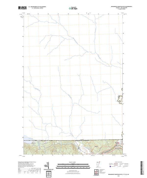 2024 Monadnock Mountain OE N2024 Print · USGSThe international borderlands of Vermont and New Hampshire meet here along the Canadian frontier in the modern era. Genealogists and local researchers can locate the Alice Hunt Cem, the rail history of the Upper Coos Recreational Rail Trl, and the village of Beecher Falls.
End of results
Showing maps 1-23 of 23
Top cities near Pittsburg
- Colebrook historical maps
- Stewartstown historical maps
- Canaan historical maps
- Clarksville historical maps
- Lincoln Plantation historical maps
- Dixville historical maps
See more
Top neighborhoods of Pittsburg
- The Glen historical maps
- Timberland historical maps
- Happy Corner historical maps
- Idlewilde historical maps
Frequently asked questions
- What are the different types of historical maps available for Pittsburg?
- What is the oldest map of Pittsburg?
- Where can I purchase historical maps of Pittsburg for my home or office?
- Where can I download high-res historical maps of Pittsburg?
- Are there historical topographic maps available for Pittsburg?
- Is there historical aerial imagery available for Pittsburg?
- Where are historical maps of Pittsburg sourced from?