1990s Maps of Randolph, New Hampshire
Explore 6 historic maps of Randolph from the 1990s. These maps offer a rare glimpse into what life looked like during the 1990s — showing old roads, neighborhoods, homes, and landmarks that have changed or disappeared over time.
Whether you're researching your family's past, planning a metal detecting trip, or studying how Randolph's landscape evolved across the 1990s, these high-resolution maps are a powerful tool for exploring the history of this region.
- Focus on a specific era: All maps on this page are from the 1990s, giving you a focused view of this time period.
- See what’s changed: Compare century-old streets, trails, and buildings to today's modern landscape using overlays and satellite layers.
- Research with precision: Use these maps for genealogy, historical research, land use analysis, or educational projects.
- View, download, or print: Maps are fully viewable online in high resolution, and can be downloaded or printed for your own records.
Start exploring Randolph's history through authentic maps from the 1990s. This is your window into the past.
Randolph, NH maps
(6)- 1995 Map of Mount Washington, 1999 Print
 1995 Mount Washington1999 Print · USGSThe Presidential Range in the mid-1990s is captured here in detail, showcasing the iconic Cog Railroad and the high-alpine terrain of the Great Gulf Wilderness. Researchers can trace historic hiking routes like the Appalachian Trail and locate remote landmarks such as Lakes of the Clouds Hut and Madison Hut.
 - 1995 Map of Mount Crescent, 1999 Print
 1995 Mount Crescent1999 Print · USGSThe White Mountains in the mid-1990s showcase a high-elevation landscape of state hatcheries and historic hill settlements. Researchers can trace local landmarks like the Randolph Church, the remote Pond of Safety, and the dramatic terrain of Ice Gulch.
 - 1995 Map of Mount Dartmouth, 2000 Print
 1995 Mount Dartmouth2000 Print · USGSThe high peaks and resort valleys of the White Mountains are shown here in the mid-1990s as the regional landscape balanced tourism and conservation. Researchers can trace historic land grants and local landmarks like Bretton Woods, Fabyan, and Mount Dartmouth.
 - 1995 Map of Carter Dome, 2000 Print
 1995 Carter Dome2000 Print · USGSThe high peaks and forest grants of the White Mountains are shown here in the mid-nineties, capturing a landscape of alpine recreation and timber-era boundaries. Researchers can trace the Appalachian National Scenic Trail past the Carter Notch Hut and locate historical landmarks like Glen House.
 - 1995 Map of Jefferson, 2000 Print
 1995 Jefferson2000 Print · USGSThe northern reaches of the White Mountains are captured here in the mid-nineties, showing the valley communities of Jefferson and Jefferson Highland tucked against the high peaks. Genealogists and hikers can trace local roots at Forest Vale Cemetery or follow historic paths through Bunnell Notch.
 - 1995 Map of Berlin, 2001 Print
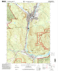 1995 Berlin2001 Print · USGSThe industrial corridor of the North Country comes into sharp focus during the 1990s as the Androscoggin River winds through the mill towns. Genealogists and local historians can trace the foundations of these communities through landmarks like Notre Dame High Sch, City Cemetery, and the St Lawrence and Atlantic RR.
End of results
Showing maps 1-6 of 6
Top cities near Randolph
- Berlin historical maps
- Lancaster historical maps
- Gorham historical maps
- Whitefield historical maps
- Northumberland historical maps
- Milan historical maps
See more
Top neighborhoods of Randolph
Frequently asked questions
- What are the different types of historical maps available for Randolph?
- What is the oldest map of Randolph?
- Where can I purchase historical maps of Randolph for my home or office?
- Where can I download high-res historical maps of Randolph?
- Are there historical topographic maps available for Randolph?
- Is there historical aerial imagery available for Randolph?
- Where are historical maps of Randolph sourced from?