2000s (21st Century) Maps of Randolph, New Hampshire
Explore 30 historic maps of Randolph from the 2000s (21st Century). These maps offer a rare glimpse into what life looked like during the 2000s — showing old roads, neighborhoods, homes, and landmarks that have changed or disappeared over time.
Whether you're researching your family's past, planning a metal detecting trip, or studying how Randolph's landscape evolved across the 2000s, these high-resolution maps are a powerful tool for exploring the history of this region.
- Focus on a specific era: All maps on this page are from the 2000s, giving you a focused view of this time period.
- See what’s changed: Compare century-old streets, trails, and buildings to today's modern landscape using overlays and satellite layers.
- Research with precision: Use these maps for genealogy, historical research, land use analysis, or educational projects.
- View, download, or print: Maps are fully viewable online in high resolution, and can be downloaded or printed for your own records.
Start exploring Randolph's history through authentic maps from the 2000s. This is your window into the past.
Randolph, NH maps
(30)- 2012 Map of Mount Washington, 2012 Print
 2012 Mount Washington2012 Print · USGSCovers Randolph, including Bean's Grant, Bowman, and other nearby areas
 - 2012 Map of Carter Dome, 2012 Print
 2012 Carter Dome2012 Print · USGSCovers Randolph, including Gorham, Shelburne, and other nearby areas
 - 2012 Map of Mount Dartmouth, 2012 Print
 2012 Mount Dartmouth2012 Print · USGSCovers Randolph, including Jefferson, Bethlehem, and other nearby areas
 - 2012 Map of Berlin, 2012 Print
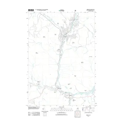 2012 Berlin2012 Print · USGSCovers Randolph, including Berlin, Gorham, and other nearby areas
 - 2012 Map of Mount Crescent, 2012 Print
 2012 Mount Crescent2012 Print · USGSCovers Randolph, including Berlin, Kilkenny, and other nearby areas
 - 2012 Map of Jefferson, 2012 Print
 2012 Jefferson2012 Print · USGSCovers Randolph, including Berlin, Lancaster, and other nearby areas
 - 2015 Map of Carter Dome, 2015 Print
 2015 Carter Dome2015 Print · USGSCovers Randolph, including Gorham, Shelburne, and other nearby areas
 - 2015 Map of Mount Dartmouth, 2015 Print
 2015 Mount Dartmouth2015 Print · USGSCovers Randolph, including Jefferson, Bethlehem, and other nearby areas
 - 2015 Map of Berlin, 2015 Print
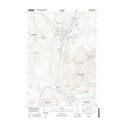 2015 Berlin2015 Print · USGSCovers Randolph, including Berlin, Gorham, and other nearby areas
 - 2015 Map of Mount Crescent, 2015 Print
 2015 Mount Crescent2015 Print · USGSCovers Randolph, including Berlin, Kilkenny, and other nearby areas
 - 2015 Map of Jefferson, 2015 Print
 2015 Jefferson2015 Print · USGSCovers Randolph, including Berlin, Lancaster, and other nearby areas
 - 2015 Map of Mount Washington, 2015 Print
 2015 Mount Washington2015 Print · USGSCovers Randolph, including Bean's Grant, Bowman, and other nearby areas
 - 2018 Map of Berlin, 2018 Print
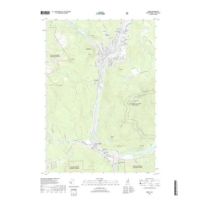 2018 Berlin2018 Print · USGSCovers Randolph, including Berlin, Gorham, and other nearby areas
 - 2018 Map of Carter Dome, 2018 Print
 2018 Carter Dome2018 Print · USGSCovers Randolph, including Gorham, Shelburne, and other nearby areas
 - 2018 Map of Jefferson, 2018 Print
 2018 Jefferson2018 Print · USGSCovers Randolph, including Berlin, Lancaster, and other nearby areas
 - 2018 Map of Mount Crescent, 2018 Print
 2018 Mount Crescent2018 Print · USGSCovers Randolph, including Berlin, Kilkenny, and other nearby areas
 - 2018 Map of Mount Washington, 2018 Print
 2018 Mount Washington2018 Print · USGSCovers Randolph, including Bean's Grant, Bowman, and other nearby areas
 - 2018 Map of Mount Dartmouth, 2018 Print
 2018 Mount Dartmouth2018 Print · USGSCovers Randolph, including Jefferson, Bethlehem, and other nearby areas
 - 2021 Map of Mount Dartmouth, 2021 Print
 2021 Mount Dartmouth2021 Print · USGSCovers Randolph, including Jefferson, Bethlehem, and other nearby areas
 - 2021 Map of Jefferson, 2021 Print
 2021 Jefferson2021 Print · USGSCovers Randolph, including Berlin, Lancaster, and other nearby areas
 - 2021 Map of Carter Dome, 2021 Print
 2021 Carter Dome2021 Print · USGSCovers Randolph, including Gorham, Shelburne, and other nearby areas
 - 2021 Map of Berlin, 2021 Print
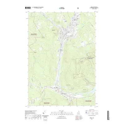 2021 Berlin2021 Print · USGSCovers Randolph, including Berlin, Gorham, and other nearby areas
 - 2021 Map of Mount Washington, 2021 Print
 2021 Mount Washington2021 Print · USGSCovers Randolph, including Bean's Grant, Bowman, and other nearby areas
 - 2021 Map of Mount Crescent, 2021 Print
 2021 Mount Crescent2021 Print · USGSCovers Randolph, including Berlin, Kilkenny, and other nearby areas
 - 2024 Map of Mount Crescent, 2024 Print
 2024 Mount Crescent2024 Print · USGSCoos County in the modern era maintains its character as a rugged landscape of high peaks and storied hiking trails. Local researchers can locate the Durand Road Cem near Randolph Hill or trace the remote shores of the Pond of Safety.
Showing maps 1-25 of 30
Top cities near Randolph
- Berlin historical maps
- Lancaster historical maps
- Gorham historical maps
- Whitefield historical maps
- Northumberland historical maps
- Milan historical maps
See more
Top neighborhoods of Randolph
Frequently asked questions
- What are the different types of historical maps available for Randolph?
- What is the oldest map of Randolph?
- Where can I purchase historical maps of Randolph for my home or office?
- Where can I download high-res historical maps of Randolph?
- Are there historical topographic maps available for Randolph?
- Is there historical aerial imagery available for Randolph?
- Where are historical maps of Randolph sourced from?