Old Maps of Success, New Hampshire for Academic Research
Study the evolution of Success with 42 high-resolution historic maps. Whether you're teaching, researching, or modeling changes in land use, these maps provide essential visual documentation of urban, environmental, and geographic change.
- Analyze long-term change: Track patterns in development, transportation, and natural features.
- Ideal for environmental or urban studies: Support academic projects with primary historical map data.
- Use in the classroom or lab: Educators and researchers rely on these maps to bring historical context to life.
These maps are a powerful tool for teaching, research, and visualizing how Success has changed over the decades.
Success, NH maps
(42)- 1893 Map of Gorham
 1893 Gorham1893 Print · USGSThe northern White Mountains at the height of the 1890s show a landscape shaped by early tourism and the timber industry. Genealogists and hikers can trace historic routes like Madison Path and locate vanished landmarks such as Glen House or the rail yards at Berlin Fall.8 unique versions available
 - 1896 Map of Gorham
 1896 Gorham1896 Print · USGSThe White Mountains were a bustling hub of rail activity and early tourism in the 1890s as industry met the wilderness. Genealogists and hikers can trace the original routes of the Grand Trunk Railroad, find the historic Glen House, and locate landmarks like Berlin Falls.
 - 1930 Map of Milan, 1952 Print
 1930 Milan1952 Print · USGSThe upper Androscoggin River valley is captured here in the early thirties, showing a rugged landscape of timber ridges and river-fed settlements. Genealogists can locate several local schools such as Jewett Sch and the rail-side village of Milan.3 unique versions available
 - 1933 Map of Milan, 1940 Print
 1933 Milan1940 Print · USGSCoos County at the start of the 1930s shows a landscape of timbered peaks and river-valley settlements connected by the Grand Trunk. Genealogists can locate several rural schools like Jewett Sch and Milan Hill Sch alongside the Berlin Landing Field.
 - 1934 Map of Milan
 1934 Milan1934 Print · USGSThe northern New Hampshire timberlands near Milan and the Maine border are seen here in the mid-1930s. Genealogists and hikers can trace the original Mahoosuc Trail or locate vanished rural schoolhouses like Hamlin Sch and Pontook Sch.2 unique versions available
 - 1937 Map of Gorham
 1937 Gorham1937 Print · USGSNew Hampshire's high peaks and river valleys are shown in detail during the late 1930s as the regional economy balanced rail industry with forest conservation. Genealogists and hikers can trace the Appalachian Trail, locate Civilian Conservation Corps sites like CCC Camp Gorham, and study the industrial corridors of the Grand Trunk Railway.6 unique versions available
 - 1942 Map of Gorham
 1942 Gorham1942 Print · USGSIn the early 1940s, the high peaks of the New Hampshire border region were already a hub for hikers and rail travel. Trace the historical routes of the Appalachian Trail and find landmarks like the Mascot Mine, the Glen House, and the Grand Trunk railroad.3 unique versions available
 - 1950 Map of Lewiston
 1950 Lewiston1950 Print · USGSThe Maine and New Hampshire borderlands come alive in this post-war survey of the White Mountains and Androscoggin valley. Genealogists and historians can trace rail lines like the Maine Central Railroad and find high-altitude landmarks from Mount Washington to Bretton Woods.2 unique versions available
 - 1956 Map of Lewiston, 1975 Print
 1956 Lewiston1975 Print · USGSThe Northern New England interior is documented here in the mid-fifties, from the industrial Androscoggin River to the high peaks of the White Mountains. Trace the Grand Trunk Railway through mountain passes or locate family landmarks near Sabbathday Lake and Bretton Woods.
 - 1961 Map of Lewiston
 1961 Lewiston1961 Print · USGSWestern Maine and the White Mountains appear here during the early sixties, showing the industrial river towns and vast timberlands before the modern interstate era. Genealogists and historians can trace the Grand Trunk RR through Berlin or locate landmarks like Old Speck Mountain and Elephant Mountain.
 - 1962 Map of Lewiston
 1962 Lewiston1962 Print · USGSThe industrial river valleys and high peaks of Maine and New Hampshire define the region in the early sixties. Trace the rail-and-river network from Lewiston to the White Mountains, passing through mill towns like Berlin and Rumford.
 - 1969 Map of Lewiston
 1969 Lewiston1969 Print · USGSThe northern New England highlands come into focus during the mid-fifties, showing the vital rail and river networks connecting industrial centers to the deep woods. Researchers can trace the path of the Grand Trunk RR or locate landmarks like Mt Washington and Rangeley Lake.
 - 1970 Map of Berlin, 1972 Print
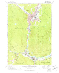 1970 Berlin1972 Print · USGSBerlin and Gorham sat at a busy industrial crossroads in the early seventies, where the timber-rich mountains met the rail lines of the Androscoggin Valley. Researchers can trace family history at St Kieran Cem, locate Libby Airfield, or follow the Grand Trunk tracks.4 unique versions available
 - 1970 Map of Shelburne, 1972 Print
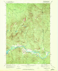 1970 Shelburne1972 Print · USGSShelburne and the high Mahoosuc Range are documented in the early 1970s as the river valley served as a vital corridor for rail and energy transit. Trace the historic Appalachian Trail route past Gentian Pond or locate the Hazelton Cem and the Grand Trunk Railway line.3 unique versions available
 - 1976 Map of Success Pond, 1983 Print
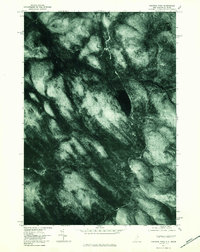 1976 Success Pond1983 Print · USGSThe timbered borderlands between New Hampshire and Maine are captured from the air during the mid-seventies. Researchers can trace the exact 1976 shorelines of Success Pond and the forested slopes of Bald Mountain near Silver Stream.
 - 1986 Map of Mount Washington
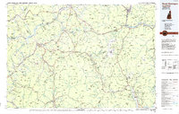 1986 Mount Washington1986 Print · USGSThe northern New England highlands are shown here in the mid-eighties, centered on the high peaks and river valleys of the New Hampshire borderlands. Researchers can trace historic transportation lines like the Mount Washington Cog Railway and the Maine Central Railroad near Gorham and Lancaster.
 - 1986 Map of Groveton
 1986 Groveton1986 Print · USGSThe North Country's rugged borderlands come into focus in the mid-1980s, tracing the river-and-rail corridors of the Connecticut River valley. Genealogists and historians can locate family landmarks in North Stratford, Groveton, and Guildhall or trace the Canadian National RR.2 unique versions available
 - 1988 Map of Success Pond
 1988 Success Pond1988 Print · USGSThe northern woods of New Hampshire and Maine are captured here in the late 1980s, showing a landscape of timber roads and mountain peaks. You can trace the high-elevation terrain from Success Pond to the rugged Mahoosuc Range and find remote sites like the lakeside Shelter.
 - 1988 Map of Milan
 1988 Milan1988 Print · USGSCoos County life in the late eighties centers on the river valleys and timberlands of the White Mountains. Genealogists and historians can trace local family lands near the Androscoggin River, the Milan Hill Lookout Tower, and small settlements like Dummer and Copperville.2 unique versions available
 - 1988 Map of Mount Washington, 1989 Print
 1988 Mount Washington1989 Print · USGSThe New Hampshire high country in the late 1980s is defined by its iconic peaks and the legacy of mountain tourism. Trace the routes of the historic Mount Washington Cog Railway and the Maine Central RR through the gaps of Crawford Notch State Park.
 - 1995 Map of Shelburne, 2001 Print
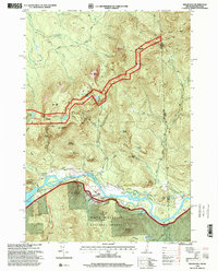 1995 Shelburne2001 Print · USGSThe northern New Hampshire border and the Wild River territory come alive in the mid-1990s as the Androscoggin River valley meets the high peaks. Hikers and historians can trace the Appalachian Scenic Trail past Gentian Pond and locate the historic Hazelton Cem near Shelburne.
 - 1995 Map of Berlin, 2001 Print
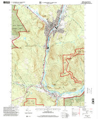 1995 Berlin2001 Print · USGSThe industrial corridor of the North Country comes into sharp focus during the 1990s as the Androscoggin River winds through the mill towns. Genealogists and local historians can trace the foundations of these communities through landmarks like Notre Dame High Sch, City Cemetery, and the St Lawrence and Atlantic RR.
 - 2012 Map of Milan, 2012 Print
 2012 Milan2012 Print · USGSCoos County at the start of the 2010s shows a landscape of river-valley industry and upland ridges along the Androscoggin River. Genealogists and locals can trace landmarks from the Berlin Regional Airport to the Berlin Ski Jump and the Milan post office.
 - 2012 Map of Success Pond, 2012 Print
 2012 Success Pond2012 Print · USGSThe backcountry of Coos County is documented here in the early twenty-first century, showing the remote high-ground north of Berlin. Researchers can trace the drainage of Chickwolnepy Stream and locate local landmarks like Success Pond and Bald Mountain.
 - 2012 Map of Shelburne, 2012 Print
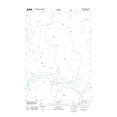 2012 Shelburne2012 Print · USGSShelburne and the White Mountain peaks are shown here in the early twenty-first century, centered on the winding Androscoggin River. Trace local history at Hazelton Cem or explore the backcountry trail network featuring the Nansen Hut and Gentian Shelter.
Showing maps 1-25 of 42
Top cities near Success
- Berlin historical maps
- Gorham historical maps
- Bethel historical maps
- Milan historical maps
- Newry historical maps
- Shelburne historical maps
See more
Frequently asked questions
- What are the different types of historical maps available for Success?
- What is the oldest map of Success?
- Where can I purchase historical maps of Success for my home or office?
- Where can I download high-res historical maps of Success?
- Are there historical topographic maps available for Success?
- Is there historical aerial imagery available for Success?
- Where are historical maps of Success sourced from?