Old Maps of Lisbon, New Hampshire for Genealogy
Trace your family roots with 38 historic maps of Lisbon. These high-res maps reveal old neighborhoods, homesites, landmarks, and streets — helping you uncover where your ancestors lived and how the area evolved over time.
- Explore historic neighborhoods: Identify where your relatives may have lived in the 1800s or 1900s.
- Compare maps over time: Trace the changes in streets, buildings, and landmarks for multi-generational research.
- Perfect for genealogy & ancestry research: Used by family historians and researchers to map out lineage and migration.
These maps are an incredible resource for exploring your personal connection to Lisbon's past.
Lisbon, NH maps
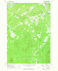
(38)- 1929 Map of Moosilauke, 1959 Print
 1929 Moosilauke1959 Print · USGSGrafton County's upland townships and the White Mountain National Forest are shown here in the late twenties during a period of mountain transition. Locate family landmarks and vanished crossroads like Oliverian Sta, Swiftwater, and several rural schools including Brier Hill Sch.
 - 1931 Map of Littleton
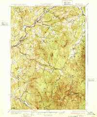
 1931 Littleton1931 Print · USGSUpper Connecticut River Valley life is recorded here in the early thirties, just as aerial photography began to modernize topographic surveying. Genealogists can locate family-named hills and district schools like the Walker Hill Sch and Gilmanton Sch.2 unique versions available
 - 1932 Map of Littleton
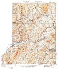
 1932 Littleton1932 Print · USGSThe Upper Connecticut River valley and the hills of Vermont's Northeast Kingdom appear here in the early thirties. Trace family connections through numerous rural schoolhouses like Sugar Hill Sch or locate the old Kirby Mtn Quarries and the original path of the Maine Central Railroad.3 unique versions available
 - 1932 Map of Moosilauke
 1932 Moosilauke1932 Print · USGSGrafton County is captured in the early thirties as a hub of mountain recreation and rail transport within the White Mountain National Forest. Genealogists and hikers can trace early routes of the Appalachian Trail and locate family landmarks like Moulton Hill Cemetery or Pettyboro Sch.5 unique versions available
 - 1935 Map of Littleton
 1935 Littleton1935 Print · USGSThe Upper Connecticut River Valley comes alive in the mid-1930s, showing the borderlands of Vermont and New Hampshire during a period of hydroelectric and rail expansion. Researchers can trace the legacy of local education and industry through sites like the Kirby Mtn Quarries, the Frank D. Comerford Hydro-Electric Plant, and the Slate Ledge Sch.4 unique versions available
 - 1950 Map of Lewiston
 1950 Lewiston1950 Print · USGSThe Maine and New Hampshire borderlands come alive in this post-war survey of the White Mountains and Androscoggin valley. Genealogists and historians can trace rail lines like the Maine Central Railroad and find high-altitude landmarks from Mount Washington to Bretton Woods.2 unique versions available
 - 1956 Map of Lewiston, 1975 Print
 1956 Lewiston1975 Print · USGSThe Northern New England interior is documented here in the mid-fifties, from the industrial Androscoggin River to the high peaks of the White Mountains. Trace the Grand Trunk Railway through mountain passes or locate family landmarks near Sabbathday Lake and Bretton Woods.
 - 1961 Map of Lewiston
 1961 Lewiston1961 Print · USGSWestern Maine and the White Mountains appear here during the early sixties, showing the industrial river towns and vast timberlands before the modern interstate era. Genealogists and historians can trace the Grand Trunk RR through Berlin or locate landmarks like Old Speck Mountain and Elephant Mountain.
 - 1962 Map of Lewiston
 1962 Lewiston1962 Print · USGSThe industrial river valleys and high peaks of Maine and New Hampshire define the region in the early sixties. Trace the rail-and-river network from Lewiston to the White Mountains, passing through mill towns like Berlin and Rumford.
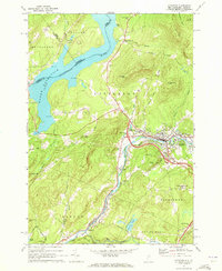
 - 1967 Map of Lisbon, 1972 Print
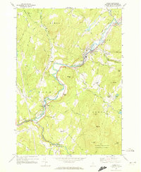 1967 Lisbon1972 Print · USGSGrafton County in the late sixties reveals a valley shaped by the Ammonoosuc River and its rail-and-timber history. Trace family roots and local landmarks through the Covered Bridge, Sugar Hill Sta, and several cemeteries like Grove Hill Cem.5 unique versions available
 - 1967 Map of Lower Waterford, 1973 Print
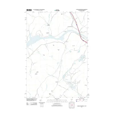
 1967 Lower Waterford1973 Print · USGSThe Connecticut River corridor at the Vermont and New Hampshire border is captured here in the late sixties. Genealogists can trace family names at Riverside Cem and Center Cem or locate the Ogontz White Mtn Camp and Tinkerville.3 unique versions available
 - 1967 Map of Sugar Hill, 1973 Print
 1967 Sugar Hill1973 Print · USGSGrafton County's upland terrain is documented here in the mid-1960s, showing the intersection of mountain life and the White Mountain National Forest. Researchers can locate family plots at Sunnyside Cem, trace the Boston and Maine rail line, or explore the village of Sugar Hill.3 unique versions available
 - 1969 Map of Lewiston
 1969 Lewiston1969 Print · USGSThe northern New England highlands come into focus during the mid-fifties, showing the vital rail and river networks connecting industrial centers to the deep woods. Researchers can trace the path of the Grand Trunk RR or locate landmarks like Mt Washington and Rangeley Lake.
 - 1971 Map of Littleton, 1973 Print
 1971 Littleton1973 Print · USGSLittleton and the Ammonoosuc River valley appear here in the early 1970s as modern interstates began to intersect with older rail and river economies. Researchers can trace family sites at North Littleton Cemetery or follow the Boston and Maine line through Barrett.3 unique versions available
 - 1986 Map of Mount Washington
 1986 Mount Washington1986 Print · USGSThe northern New England highlands are shown here in the mid-eighties, centered on the high peaks and river valleys of the New Hampshire borderlands. Researchers can trace historic transportation lines like the Mount Washington Cog Railway and the Maine Central Railroad near Gorham and Lancaster.
 - 1988 Map of Mount Washington, 1989 Print
 1988 Mount Washington1989 Print · USGSThe New Hampshire high country in the late 1980s is defined by its iconic peaks and the legacy of mountain tourism. Trace the routes of the historic Mount Washington Cog Railway and the Maine Central RR through the gaps of Crawford Notch State Park.
 - 1995 Map of Sugar Hill, 2000 Print
 1995 Sugar Hill2000 Print · USGSThe hills of Grafton County are captured here in the mid-1990s, showing the transition from the White Mountain National Forest to the settlements of Sugar Hill and Franconia. Local history researchers can trace family landmarks and burial grounds at Sunnyside Cemetery or Willow Cemetery, alongside infrastructure like the Franconia Airport.
 - 1995 Map of Lisbon, 2000 Print
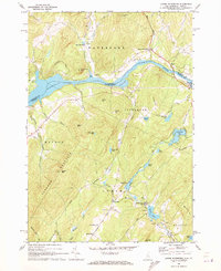
 1995 Lisbon2000 Print · USGSLisbon and the surrounding hill towns are captured in the mid-1990s as they follow the winding course of the Ammonoosuc River. Genealogists and local historians can trace rural schoolhouses like Blue School, the Covered Bridge at Bath, and numerous family-named landmarks from Babbitt Hill to Pettyboro.
 - 2012 Map of Lower Waterford, 2012 Print
 2012 Lower Waterford2012 Print · USGSCovers Lisbon, including Littleton, Monroe, and other nearby areas
 - 2012 Map of Sugar Hill, 2012 Print
 2012 Sugar Hill2012 Print · USGSCovers Lisbon, including Franconia, Sugar Hill, and other nearby areas
 - 2012 Map of Littleton, 2012 Print
 2012 Littleton2012 Print · USGSCovers Lisbon, including Littleton, Concord, and other nearby areas
 - 2012 Map of Lisbon, 2012 Print
 2012 Lisbon2012 Print · USGSCovers Lisbon, including Haverhill, Bath, and other nearby areas
 - 2015 Map of Lisbon, 2015 Print
 2015 Lisbon2015 Print · USGSCovers Lisbon, including Haverhill, Bath, and other nearby areas
 - 2015 Map of Littleton, 2015 Print
 2015 Littleton2015 Print · USGSCovers Lisbon, including Littleton, Concord, and other nearby areas
 - 2015 Map of Sugar Hill, 2015 Print
 2015 Sugar Hill2015 Print · USGSCovers Lisbon, including Franconia, Sugar Hill, and other nearby areas
Showing maps 1-25 of 38
Top cities near Lisbon
- Saint Johnsbury historical maps
- Littleton historical maps
- Haverhill historical maps
- Lancaster historical maps
- Thornton historical maps
- Whitefield historical maps
See more
Top neighborhoods of Lisbon
Frequently asked questions
- What are the different types of historical maps available for Lisbon?
- What is the oldest map of Lisbon?
- Where can I purchase historical maps of Lisbon for my home or office?
- Where can I download high-res historical maps of Lisbon?
- Are there historical topographic maps available for Lisbon?
- Is there historical aerial imagery available for Lisbon?
- Where are historical maps of Lisbon sourced from?