Old Maps of Hill, New Hampshire for Metal Detecting
Plan your next treasure hunt with 45 historic maps of Hill. Find old homesites, ghost towns, trails, and gathering spots that may be lost to time — perfect for identifying promising metal detecting locations.
- Locate forgotten sites: Uncover places like long-lost settlements, abandoned rail lines, or gathering spots.
- Plan better hunts: Use map overlays combined with LiDAR or satellite views to narrow in on historically rich areas.
- Made for detectorists: Thousands of hobbyists use these maps to discover relics, coins, and hidden history.
Use these historic maps to boost your research and find new opportunities beneath the surface of Hill.
Hill, NH maps
(45)- 1925 Map of Holderness, 1956 Print
 1925 Holderness1956 Print · USGSCentral New Hampshire in the mid-twenties centers on the Pemigewasset River and the bustling rail corridor. Genealogists can trace a network of rural schoolhouses like Sargent School and landmarks including Profile Falls and the Bay Meeting House.
 - 1927 Map of Penacook
 1927 Penacook1927 Print · USGSThe Merrimack and Winnipesaukee valleys in the mid-1920s reveal a landscape of river-powered industry and rural school districts. Researchers can trace dozens of family-named landmarks and institutions, from Kezer Seminary to the Soldiers Home and Swetts Mills.8 unique versions available
 - 1927 Map of Holderness
 1927 Holderness1927 Print · USGSThe Lakes Region in the late twenties reveals a landscape of small hill-town schools and winding river valleys. Genealogists can locate family landmarks like Sargent School, Dana Church, and numerous small waters from Squam Lake to Wickwas Pond.6 unique versions available
 - 1927 Map of Cardigan, 1957 Print
 1927 Cardigan1957 Print · USGSGrafton and Merrimack Counties were defined by rail-side industry and early lakeside tourism in the late 1920s. Genealogists and historians can trace defunct schoolhouses like School No 8 and find deep-woods sites like the Alexandria Mica Mine.
 - 1928 Map of Mount Kearsarge
 1928 Mount Kearsarge1928 Print · USGSMerrimack County and the surrounding highlands are captured in the late 1920s as the rail-and-river economy flourished. Genealogists and historians can trace defunct schools and rural crossroads like Scribners Corner, the BOSTON AND MAINE RR corridor, and the COAL HEARTH CEMETERY.5 unique versions available
 - 1930 Map of Cardigan
 1930 Cardigan1930 Print · USGSGrafton County's granite hills and lakeside settlements are captured here in the late prohibition era. Genealogists and hikers can trace the original locations of rural schoolhouses like Crawford Sch, the workings of the Alexandria Mica Mines, and the old rail stops at Grafton Sta.7 unique versions available
 - 1931 Map of Mount Kearsarge
 1931 Mount Kearsarge1931 Print · USGSMerrimack County during the interwar years shows a New Hampshire landscape of river-powered hamlets and rail depots. Genealogists can trace family roots through specific sites like Coalhearth Cemetery, the Langley School, and junctions like Scribners Corner.
 - 1949 Map of Portland
 1949 Portland1949 Print · USGSCoastal Maine and the New Hampshire interior are shown in detail during the late forties, from the bustling harbors to the lakeside villages. Researchers can trace historical rail networks like the Boston & Maine RR and locate coastal defenses such as Fort Preble.3 unique versions available
 - 1956 Map of Cardigan, 1958 Print
 1956 Cardigan1958 Print · USGSGrafton County's high ridges and lake shores are captured here during the mid-fifties, showing the region's transition toward recreation and conservation. Genealogists and hikers can trace the Boston and Maine rail line through Grafton Center or locate old district sites like the Red Sch and Alexandria Mica Mine.3 unique versions available
 - 1956 Map of Penacook, 1959 Print
 1956 Penacook1959 Print · USGSMerrimack County’s river valleys and rail lines are captured here in the mid-fifties, showing the industrial and civic hubs of Franklin and Penacook. Genealogists can locate family landmarks like Snyders Mill and Gerrish Corner or historic sites like the Daniel Webster Birthplace.3 unique versions available
 - 1956 Map of Holderness, 1959 Print
 1956 Holderness1959 Print · USGSNew Hampshire’s Lakes Region and the Pemigewasset valley are captured here in the mid-fifties as the area’s rail-and-road network supported growing tourism and local industry. Genealogists can trace family sites at the Bay Meetinghouse, North Sanbornton, and small rural schoolhouses like River Road Sch.3 unique versions available
 - 1956 Map of Mt. Kearsarge, 1959 Print
 1956 Mt. Kearsarge1959 Print · USGSMerrimack County’s upland terrain and valley settlements are captured in the mid-1950s, showing the height of the region’s rail-and-resort character. Researchers can trace the Boston & Maine RR line through Potter Place and locate historic markers like Colby Jr College and Lake Massasecum.4 unique versions available
 - 1956 Map of Portland, 1963 Print
 1956 Portland1963 Print · USGSSouthern Maine and eastern New Hampshire are captured here in the mid-fifties, during a time of major highway expansion and military growth. You can trace the path of the Maine Turnpike and locate landmarks like the Portsmouth Naval Shipyard and Sebago Lake.4 unique versions available
 - 1959 Map of Portland
 1959 Portland1959 Print · USGSThe Maine and New Hampshire coastlines meet in this mid-century portrait of maritime commerce and inland rail networks. Researchers can trace the legacy of coastal defense at Fort Williams and follow the historic path of the Maine Central RR through the White Mountain National Forest.2 unique versions available
 - 1963 Map of Portland
 1963 Portland1963 Print · USGSCoastal Maine and New Hampshire thrived as maritime and industrial hubs during the mid-sixties, linked by a dense network of rail and river. Researchers can trace historic transit corridors like the Maine Central RR and locate key sites such as the Portsmouth Naval Shipyard or Pease Air Force Base.3 unique versions available
 - 1986 Map of Lake Winnipesaukee
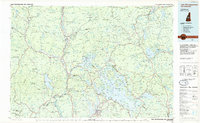 1986 Lake Winnipesaukee1986 Print · USGSThe Lakes Region in the mid-eighties shows a landscape of dense water bodies and mountain ranges at the peak of its twentieth-century character. Trace the legacy of old rail lines like the Boston and Maine RR and locate historic centers from Rumney Depot to Melvin Village.2 unique versions available
 - 1986 Map of Concord
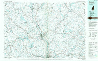 1986 Concord1986 Print · USGSCentral New Hampshire in the mid-eighties shows a landscape of river-valley cities and rural villages connected by the growing interstate system. Genealogists and historians can trace old community centers like Gilmanton Ironworks or follow the Boston and Maine Railroad through Concord and Tilton.
 - 1987 Map of Bristol
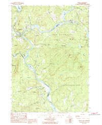 1987 Bristol1987 Print · USGSCentral New Hampshire in the late eighties reveals a landscape of river valleys and timbered peaks across Grafton and Belknap counties. Genealogists and hikers can trace family-named landmarks like Huses Mountain or explore Sugar Hill State Forest and New Hampton.
 - 1987 Map of Danbury
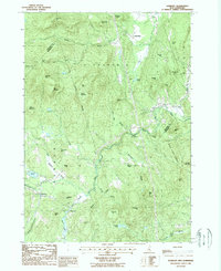 1987 Danbury1987 Print · USGSMerrimack and Grafton counties meet along the rugged ridgelines of this 1980s New Hampshire interior. Genealogists and local historians can trace family-named heights like Braley Hill and Taylor Hill or locate old cemeteries near Danbury and Elmwood.
 - 1987 Map of Franklin
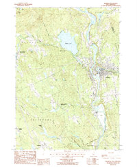 1987 Franklin1987 Print · USGSMerrimack County at the end of the 1980s shows a landscape defined by its famous river forks and the legacy of its early statesmen. Genealogists and historians can trace family-named sites from Webster Place to the Daniel Webster Birthplace, while mapping the development around Webster Lake and Franklin.
 - 1987 Map of Andover
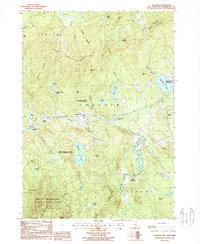 1987 Andover1987 Print · USGSMerrimack County comes into focus in the late eighties, documenting the enduring rural character of Andover and West Salisbury. Genealogists and historians can trace small communities like Cilleyville, Potter Place, and the old station at East Andover.
 - 1988 Map of Concord
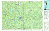 1988 Concord1988 Print · USGSCentral New Hampshire in the late eighties centers on the industrial and political hub of Concord. Researchers can trace the Boston and Maine RR along the Merrimack River or locate recreation landmarks like Bear Brook State Park and Massabesic Lake.
 - 1998 Map of Andover, 2001 Print
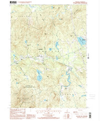 1998 Andover2001 Print · USGSMerrimack County at the close of the twentieth century shows a landscape of mountain forests and clustered lakeside villages. Genealogists and local historians can trace the foundations of Potter Place, Cilleyville, and East Andover alongside the slopes of Mount Kearsarge.
 - 2000 Map of Franklin, 2001 Print
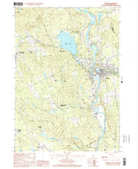 2000 Franklin2001 Print · USGSFranklin and its neighbors thrive at the turn of the millennium where the Pemigewasset and Winnipesaukee rivers meet. Genealogists and historians can trace local landmarks like the Daniel Webster Birthplace, the old Halcyon Sta, and Webster Place.
 - 2000 Map of Bristol, 2001 Print
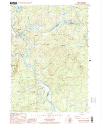 2000 Bristol2001 Print · USGSThe Pemigewasset River valley comes to life at the turn of the millennium, showing the intersecting boundaries of three New Hampshire counties. Researchers can trace the legacy of local conservation and industry through the New Hampton State Fish Hatchery and the high ridges of Huses Mountain.
Showing maps 1-25 of 45
Top cities near Hill
- Concord historical maps
- Laconia historical maps
- Franklin historical maps
- Belmont historical maps
- Northfield historical maps
- Plymouth historical maps
See more
Top neighborhoods of Hill
- South Alexandria historical maps
- Murray Hill historical maps
- Hill Center historical maps
- Murray Hill Summer Home District historical maps
Frequently asked questions
- What are the different types of historical maps available for Hill?
- What is the oldest map of Hill?
- Where can I purchase historical maps of Hill for my home or office?
- Where can I download high-res historical maps of Hill?
- Are there historical topographic maps available for Hill?
- Is there historical aerial imagery available for Hill?
- Where are historical maps of Hill sourced from?