1990s Maps of Sullivan County, New Hampshire
Explore 17 historic maps of Sullivan County from the 1990s. These maps offer a rare glimpse into what life looked like during the 1990s — showing old roads, neighborhoods, homes, and landmarks that have changed or disappeared over time.
Whether you're researching your family's past, planning a metal detecting trip, or studying how Sullivan County's landscape evolved across the 1990s, these high-resolution maps are a powerful tool for exploring the history of this region.
- Focus on a specific era: All maps on this page are from the 1990s, giving you a focused view of this time period.
- See what’s changed: Compare century-old streets, trails, and buildings to today's modern landscape using overlays and satellite layers.
- Research with precision: Use these maps for genealogy, historical research, land use analysis, or educational projects.
- View, download, or print: Maps are fully viewable online in high resolution, and can be downloaded or printed for your own records.
Start exploring Sullivan County's history through authentic maps from the 1990s. This is your window into the past.
Sullivan County, NH maps
(17)- 1998 Map of North Hartland
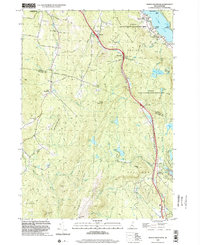
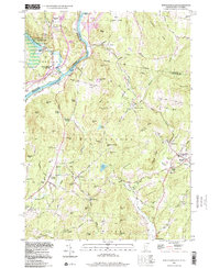 1998 North Hartland1998 Print · USGSThe Connecticut River valley along the Vermont and New Hampshire border comes to life in this late-century survey. Researchers can trace family history through sites like Kimball Union Academy and numerous burial grounds such as Plainfield Cem and Raynes-Ford Cem.
 - 1998 Map of Hartland, 1999 Print
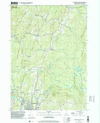
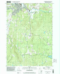
 1998 Hartland1999 Print · USGSLate twentieth-century Windsor County reveals a landscape of high hills and river junctions along the New Hampshire border. Genealogists can trace family names across Hoisington Cem, Aldrich Cem, and historic hamlets like Quakers Village.
 - 1998 Map of New London, 2001 Print
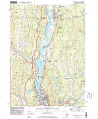
 1998 New London2001 Print · USGSNew London and the surrounding hill towns are shown at the close of the twentieth century. Researchers can trace the layout of Colby Jr College, the historic station at South Danbury, and the village at Wilmot Flat.
 - 1998 Map of Claremont North, 2002 Print
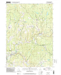
 1998 Claremont North2002 Print · USGSSullivan County at the close of the twentieth century shows a landscape where historic preservation meets modern industry. Genealogists can trace family names at Edminster Cem and Cornings Cem, while historians can locate the Covered Bridge and the Saint Gaudens National Historic Site.
 - 1998 Map of Sunapee Lake North, 2002 Print
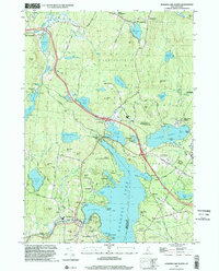 1998 Sunapee Lake North2002 Print · USGSSullivan County lake life and upland forests are on full display in this late-nineties survey. Local researchers can trace family lands near Georges Mills, locate the Eastman Cem, and study the early resort footprints at Soo Nipi Park and Granliden.
 - 1998 Map of Newport, 2002 Print
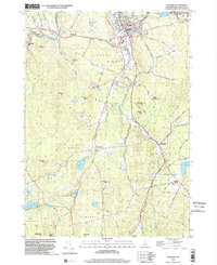 1998 Newport2002 Print · USGSSullivan County at the close of the twentieth century reveals a landscape shaped by the Sugar River and its industrial corridors. Researchers can trace the OLD RR GRADE through historic hamlets like Chandlers Mills and locate family names at Maple Street Cem.
 - 1998 Map of Springfield, 2002 Print
 1998 Springfield2002 Print · USGSThe Connecticut River valley at the close of the twentieth century shows a region of industrial towns and conserved forests. Researchers can trace local genealogy and rail history through Eureka Cem, the Claremont & Concord RR, and Goulds Mill.
 - 1998 Map of Washington, 2002 Print
 1998 Washington2002 Print · USGSSullivan County at the close of the twentieth century remains a landscape of deep woods and interconnected glacial ponds. Genealogists and hikers can trace the village layout of Washington or locate historic landmarks like Bradford Spring and the Center Sch.
 - 1998 Map of East Lempster, 2002 Print
 1998 East Lempster2002 Print · USGSThe highland forests and millponds of Sullivan and Cheshire counties are captured here in the late nineties. Local researchers can trace the roads to Marlow Junction, locate the Perkins Sch, and follow the Monadnock-Sunapee Trail through the hills.
 - 1998 Map of North Grantham, 2002 Print
 1998 North Grantham2002 Print · USGSSullivan and Grafton Counties in the late nineties show a landscape where historic communal settlements meet modern transportation corridors. Researchers can trace the heritage of Lower Shaker Village, locate the Gleason Cem, or explore the wooded heights of Methodist Hill.
 - 1998 Map of Windsor, 2002 Print
 1998 Windsor2002 Print · USGSWindsor and the Connecticut River Valley are captured here in the late nineties, showing the region's transition between conserved highlands and riverfront industry. Trace local landmarks like the Cornish Bridge, the Central Vermont rail line, and the slopes of Mt Ascutney.
 - 1998 Map of Grantham, 2002 Print
 1998 Grantham2002 Print · USGSSullivan County at the close of the twentieth century shows a landscape of river-valley hamlets and timbered ridges. Researchers can trace the Old Railroad Grade through Guild or locate old upland sites near Croydon Four Corners and Ryder Corner.
 - 1998 Map of Enfield Center, 2002 Print
 1998 Enfield Center2002 Print · USGSGrafton County's hill country near the Sullivan County line is captured here in the late nineties, showing a landscape of forest reserves and glacial lakes. Genealogists and locals can trace family landmarks and rural crossroads like Washburn Corner, Crystal Lake Dam Lockehaven, and Banks Pinnacle.
 - 1998 Map of Sunapee Lake South, 2002 Print
 1998 Sunapee Lake South2002 Print · USGSMerrimack and Sullivan Counties at the close of the twentieth century show a landscape defined by forest conservation and mountain tourism. Researchers can trace the Old Railroad Grade and locate historic points like Blodgett Landing or Sunapee Station.
 - 1998 Map of Claremont South, 2002 Print
 1998 Claremont South2002 Print · USGSSullivan County upland life and industry converge in the late nineties, from the bustling streets of Claremont to the quiet heights of Unity Mountain. Researchers can trace historic hamlets like Quaker City and Puckershire or locate the Hubbard Cem and County Home.
 - 1998 Map of Bellows Falls, 2002 Print
 1998 Bellows Falls2002 Print · USGSThe borderlands of Vermont and New Hampshire come alive in the 1990s as the river economy transitions toward modern infrastructure. Trace family names and landmarks from Bellows Falls to Charlestown, finding sites like Bates Mill Pond and the Mt Kilburn Tower.
 - 1998 Map of Alstead, 2002 Print
 1998 Alstead2002 Print · USGSSullivan and Cheshire Counties appear at the end of the twentieth century, showing a landscape of upland forests and river valleys. Genealogists and hikers can trace the winding Old Settlers Road, locate the Covered Bridge near Langdon, or find family landmarks like Forristalls Corner.
End of results
Showing maps 1-17 of 17
Top cities of Sullivan County
- Claremont historical maps
- Newport historical maps
- Grantham historical maps
- Sunapee historical maps
- Plainfield historical maps
- Unity historical maps
See more
Frequently asked questions
- What are the different types of historical maps available for Sullivan County?
- What is the oldest map of Sullivan County?
- Where can I purchase historical maps of Sullivan County for my home or office?
- Where can I download high-res historical maps of Sullivan County?
- Are there historical topographic maps available for Sullivan County?
- Is there historical aerial imagery available for Sullivan County?
- Where are historical maps of Sullivan County sourced from?