Old Maps of Sullivan County, New Hampshire for Genealogy
Trace your family roots with 154 historic maps of Sullivan County. These high-res maps reveal old neighborhoods, homesites, landmarks, and streets — helping you uncover where your ancestors lived and how the area evolved over time.
- Explore historic neighborhoods: Identify where your relatives may have lived in the 1800s or 1900s.
- Compare maps over time: Trace the changes in streets, buildings, and landmarks for multi-generational research.
- Perfect for genealogy & ancestry research: Used by family historians and researchers to map out lineage and migration.
These maps are an incredible resource for exploring your personal connection to Sullivan County's past.
Sullivan County, NH maps
(154)- 1902 Map of Sunapee, 1947 Print
 1902 Sunapee1947 Print · USGSSullivan County at the dawn of the twentieth century shows a vibrant landscape of lakeside landings and upland mill villages. Trace family roots and old transit routes from the Steamboat Route on Lake Sunapee to the Boston and Maine Railroad depots at Kelleyville and Wendell.
 - 1905 Map of Sunapee, 1947 Print
 1905 Sunapee1947 Print · USGSSullivan County's lakeside and rail economies are captured here just after the turn of the century. Genealogists can trace family lines through old post offices at North Newport PO and Mt Sunapee Chandler-ville PO, or follow the Steamboat Route to Soo Nipi Park.
 - 1906 Map of Hanover, 1956 Print
 1906 Hanover1956 Print · USGSThe Upper Connecticut River Valley at the turn of the century is a hub of rail activity and collegiate life. Researchers can trace the early footprints of Dartmouth College or locate vanished rail infrastructure at White River Junction and Deweys Mills.2 unique versions available
 - 1907 Map of Sunapee
 1907 Sunapee1907 Print · USGSSullivan County at the dawn of the twentieth century was a landscape of mountain ridges and busy lakeside resorts. Genealogists can trace family names among the many peaks and locate local centers like Newport, Mill Village, and Blodgett Landing.7 unique versions available
 - 1908 Map of Hanover
 1908 Hanover1908 Print · USGSThe Upper Valley at the dawn of the twentieth century was a vital junction of Vermont and New Hampshire rail lines and river commerce. Researchers can trace the early layout of Dartmouth College, the rail yards of White River Junction, and numerous rural schoolhouses like Podunk School.7 unique versions available
 - 1926 Map of Claremont, 1955 Print
 1926 Claremont1955 Print · USGSThe Connecticut River valley thrives in the mid-twenties as a hub of industry and transit between Vermont and New Hampshire. Tracing these hills reveals historic crossings like Cornish Bridge, the Sullivan County Farm, and the early Claremont Airport.
 - 1927 Map of Bellows Falls
 1927 Bellows Falls1927 Print · USGSThe borderlands of the Connecticut River valley are captured in the late 1920s, showing the vital rail links between Vermont and New Hampshire. Genealogists and local historians can trace rural schoolhouse districts like Mica Mine Sch, the grounds of the Kern-Hattin Home, and the layout of Westmoreland Depot.4 unique versions available
 - 1927 Map of Cardigan, 1957 Print
 1927 Cardigan1957 Print · USGSGrafton and Merrimack Counties were defined by rail-side industry and early lakeside tourism in the late 1920s. Genealogists and historians can trace defunct schoolhouses like School No 8 and find deep-woods sites like the Alexandria Mica Mine.
 - 1927 Map of Mascoma, 1957 Print
 1927 Mascoma1957 Print · USGSGrafton County's hill towns and valleys are caught in detail during the late 1920s, showing the settled character of the New Hampshire interior. Genealogists can trace family names through landmarks like Washburn Corner or locate the distinctive Lower Shaker Village and Upper Shaker Village.3 unique versions available
 - 1928 Map of Mount Kearsarge
 1928 Mount Kearsarge1928 Print · USGSMerrimack County and the surrounding highlands are captured in the late 1920s as the rail-and-river economy flourished. Genealogists and historians can trace defunct schools and rural crossroads like Scribners Corner, the BOSTON AND MAINE RR corridor, and the COAL HEARTH CEMETERY.5 unique versions available
 - 1929 Map of Claremont
 1929 Claremont1929 Print · USGSThe Upper Connecticut River Valley thrives in the late twenties as a hub of manufacturing and mountain farming. You can trace early rail-and-river industrial sites at Claremont and Windsor, or locate ancestral rural schoolhouses like Brick Sch and Red Sch.4 unique versions available
 - 1930 Map of Cardigan
 1930 Cardigan1930 Print · USGSGrafton County's granite hills and lakeside settlements are captured here in the late prohibition era. Genealogists and hikers can trace the original locations of rural schoolhouses like Crawford Sch, the workings of the Alexandria Mica Mines, and the old rail stops at Grafton Sta.7 unique versions available
 - 1930 Map of Lovewell Mountain
 1930 Lovewell Mountain1930 Print · USGSThe Cheshire and Sullivan County borderlands come alive in this late 1920s survey of the New Hampshire highlands. Researchers can locate long-standing crossroads like East Lempster, find vanished rural education at Fifield Sch, or trace the old Loverens Mill site.4 unique versions available
 - 1930 Map of Bellows Falls
 1930 Bellows Falls1930 Print · USGSThe Connecticut River valley thrives between Vermont and New Hampshire in the late twenties, anchored by the rail hub at Bellows Falls. Researchers can trace old district schools like Derry Hill Sch and find family-named landmarks such as Dodge Tavern.7 unique versions available
 - 1931 Map of Mount Kearsarge
 1931 Mount Kearsarge1931 Print · USGSMerrimack County during the interwar years shows a New Hampshire landscape of river-powered hamlets and rail depots. Genealogists can trace family roots through specific sites like Coalhearth Cemetery, the Langley School, and junctions like Scribners Corner.
 - 1932 Map of Mascoma
 1932 Mascoma1932 Print · USGSGrafton County in the early thirties shows a unique landscape of communal settlements and rugged upland farms. Genealogists can trace family roots through numerous local schoolhouses and rural hamlets like Hanover Center and Lower Shaker Village.5 unique versions available
 - 1942 Map of Lovewell Mountain
 1942 Lovewell Mountain1942 Print · USGSSullivan and Cheshire Counties are shown in detail during the early 1940s, capturing the high-country pond and mill culture of the New Hampshire hills. Researchers can trace family roots through upland landmarks like Advent Ch, School No 5, and the old Meetinghouse.4 unique versions available
 - 1949 Map of Portland
 1949 Portland1949 Print · USGSCoastal Maine and the New Hampshire interior are shown in detail during the late forties, from the bustling harbors to the lakeside villages. Researchers can trace historical rail networks like the Boston & Maine RR and locate coastal defenses such as Fort Preble.3 unique versions available
 - 1950 Map of Glens Falls
 1950 Glens Falls1950 Print · USGSThe Adirondacks and the Green Mountains meet in this mid-century survey of the New York and Vermont borderlands. Researchers can trace the industrial rail corridors of the Rutland RR and Delaware & Hudson RR connecting Glens Falls, Rutland, and the shores of Lake George.
 - 1955 Map of Sunapee, 1957 Print
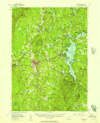 1955 Sunapee1957 Print · USGSSullivan County in the mid-fifties is captured here as a landscape of granite ridges, industrial valleys, and developing lakefronts. Genealogists and historians can locate the Little Red Schoolhouse Museum, the Wayside Chapel, and active rail lines like the Boston and Maine RR.3 unique versions available
 - 1956 Map of Cardigan, 1958 Print
 1956 Cardigan1958 Print · USGSGrafton County's high ridges and lake shores are captured here during the mid-fifties, showing the region's transition toward recreation and conservation. Genealogists and hikers can trace the Boston and Maine rail line through Grafton Center or locate old district sites like the Red Sch and Alexandria Mica Mine.3 unique versions available
 - 1956 Map of Mt. Kearsarge, 1959 Print
 1956 Mt. Kearsarge1959 Print · USGSMerrimack County’s upland terrain and valley settlements are captured in the mid-1950s, showing the height of the region’s rail-and-resort character. Researchers can trace the Boston & Maine RR line through Potter Place and locate historic markers like Colby Jr College and Lake Massasecum.4 unique versions available
 - 1956 Map of Portland, 1963 Print
 1956 Portland1963 Print · USGSSouthern Maine and eastern New Hampshire are captured here in the mid-fifties, during a time of major highway expansion and military growth. You can trace the path of the Maine Turnpike and locate landmarks like the Portsmouth Naval Shipyard and Sebago Lake.4 unique versions available
 - 1956 Map of Glens Falls, 1968 Print
 1956 Glens Falls1968 Print · USGSUpper New York and the Vermont mountains are captured here in the mid-fifties, showing the rugged rail-and-river network of the Northeast. Researchers can trace the paths of the Delaware and Hudson RR and Rutland RR as they wind through valley towns like Poultney and Whitehall.3 unique versions available
 - 1957 Map of Lovewell Mountain, 1959 Print
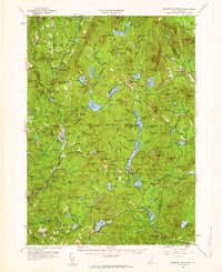 1957 Lovewell Mountain1959 Print · USGSThe hill country of southwestern New Hampshire is captured here in the mid-1950s, showing the intersection of Sullivan, Cheshire, and Hillsborough counties. Researchers can trace old routes like the Dartmouth College Highway and locate rural landmarks such as Advent Ch, Mill Village, and East Lempster.4 unique versions available
Showing maps 1-25 of 154
Top cities of Sullivan County
- Claremont historical maps
- Newport historical maps
- Grantham historical maps
- Sunapee historical maps
- Plainfield historical maps
- Unity historical maps
See more
Frequently asked questions
- What are the different types of historical maps available for Sullivan County?
- What is the oldest map of Sullivan County?
- Where can I purchase historical maps of Sullivan County for my home or office?
- Where can I download high-res historical maps of Sullivan County?
- Are there historical topographic maps available for Sullivan County?
- Is there historical aerial imagery available for Sullivan County?
- Where are historical maps of Sullivan County sourced from?