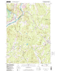
1998 Map of North Hartland
USGS Topo · Published 1998About this map
The Ottauquechee River and Connecticut River define this corner of the Vermont and New Hampshire border, where industrial water power and agricultural valleys meet. At the northern end, the North Hartland Reservoir and North Hartland Dam dominate the landscape near North Hartland, while the Lebanon Municipal Airport sits on the plateau to the east. The map reveals a dense network of local history, particularly in the village of Meriden, home to the Kimball Union Academy and its associated Athletic Field.
Find a feature on this map
104 named features on this map. Tap any name to fly to it.
Don’t see what you’re looking for? This feature index may not catch every label — zoom into the map to look around manually.
Map Details
Editions of this 1998 North Hartland Map
This is the sole edition of this map. No revisions or reprints were ever made.
Other maps of this area

1902 · Sunapee
USGS Topo · 1:62,500

1905 · Sunapee
USGS Topo · 1:62,500

1906 · Hanover
USGS Topo · 1:62,500

1907 · Sunapee
USGS Topo · 1:62,500

1908 · Hanover
USGS Topo · 1:62,500

1926 · Claremont
USGS Topo · 1:62,500

1927 · Mascoma
USGS Topo · 1:62,500

1929 · Claremont
USGS Topo · 1:62,500

1932 · Mascoma
USGS Topo · 1:62,500

1950 · Glens Falls
USGS Topo · 1:250,000