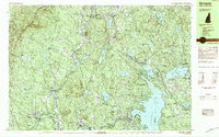
Old Maps of Cornish, New Hampshire for Hiking & Exploration
Hike through history with 58 historic maps of Cornish. Explore old trails, ghost towns, and forgotten backroads — perfect for outdoor adventurers and local explorers.
- Rediscover forgotten places: Map out old mining camps, roads, and footpaths that no longer exist on modern maps.
- Layer with modern tools: Combine with LiDAR or satellite views to plan hikes through historical terrain.
- Made for exploration: Popular among hikers, overlanders, and local history lovers.
Use these maps to find adventure and explore the hidden past of Cornish.
Cornish, NH maps
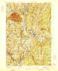
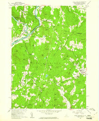
(58)- 1902 Map of Sunapee, 1947 Print
 1902 Sunapee1947 Print · USGSSullivan County at the dawn of the twentieth century shows a vibrant landscape of lakeside landings and upland mill villages. Trace family roots and old transit routes from the Steamboat Route on Lake Sunapee to the Boston and Maine Railroad depots at Kelleyville and Wendell.
 - 1905 Map of Sunapee, 1947 Print
 1905 Sunapee1947 Print · USGSSullivan County's lakeside and rail economies are captured here just after the turn of the century. Genealogists can trace family lines through old post offices at North Newport PO and Mt Sunapee Chandler-ville PO, or follow the Steamboat Route to Soo Nipi Park.
 - 1906 Map of Hanover, 1956 Print
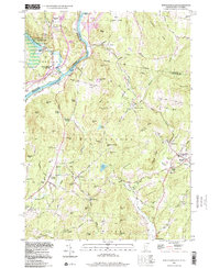
 1906 Hanover1956 Print · USGSThe Upper Connecticut River Valley at the turn of the century is a hub of rail activity and collegiate life. Researchers can trace the early footprints of Dartmouth College or locate vanished rail infrastructure at White River Junction and Deweys Mills.2 unique versions available
 - 1907 Map of Sunapee
 1907 Sunapee1907 Print · USGSSullivan County at the dawn of the twentieth century was a landscape of mountain ridges and busy lakeside resorts. Genealogists can trace family names among the many peaks and locate local centers like Newport, Mill Village, and Blodgett Landing.7 unique versions available
 - 1908 Map of Hanover
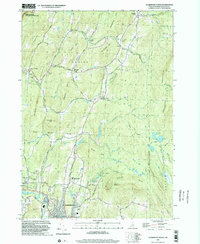
 1908 Hanover1908 Print · USGSThe Upper Valley at the dawn of the twentieth century was a vital junction of Vermont and New Hampshire rail lines and river commerce. Researchers can trace the early layout of Dartmouth College, the rail yards of White River Junction, and numerous rural schoolhouses like Podunk School.7 unique versions available
 - 1926 Map of Claremont, 1955 Print
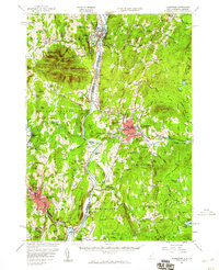
 1926 Claremont1955 Print · USGSThe Connecticut River valley thrives in the mid-twenties as a hub of industry and transit between Vermont and New Hampshire. Tracing these hills reveals historic crossings like Cornish Bridge, the Sullivan County Farm, and the early Claremont Airport.
 - 1927 Map of Mascoma, 1957 Print
 1927 Mascoma1957 Print · USGSGrafton County's hill towns and valleys are caught in detail during the late 1920s, showing the settled character of the New Hampshire interior. Genealogists can trace family names through landmarks like Washburn Corner or locate the distinctive Lower Shaker Village and Upper Shaker Village.3 unique versions available
 - 1929 Map of Claremont
 1929 Claremont1929 Print · USGSThe Upper Connecticut River Valley thrives in the late twenties as a hub of manufacturing and mountain farming. You can trace early rail-and-river industrial sites at Claremont and Windsor, or locate ancestral rural schoolhouses like Brick Sch and Red Sch.4 unique versions available
 - 1932 Map of Mascoma
 1932 Mascoma1932 Print · USGSGrafton County in the early thirties shows a unique landscape of communal settlements and rugged upland farms. Genealogists can trace family roots through numerous local schoolhouses and rural hamlets like Hanover Center and Lower Shaker Village.5 unique versions available
 - 1950 Map of Glens Falls
 1950 Glens Falls1950 Print · USGSThe Adirondacks and the Green Mountains meet in this mid-century survey of the New York and Vermont borderlands. Researchers can trace the industrial rail corridors of the Rutland RR and Delaware & Hudson RR connecting Glens Falls, Rutland, and the shores of Lake George.
 - 1955 Map of Sunapee, 1957 Print
 1955 Sunapee1957 Print · USGSSullivan County in the mid-fifties is captured here as a landscape of granite ridges, industrial valleys, and developing lakefronts. Genealogists and historians can locate the Little Red Schoolhouse Museum, the Wayside Chapel, and active rail lines like the Boston and Maine RR.3 unique versions available
 - 1956 Map of Glens Falls, 1968 Print
 1956 Glens Falls1968 Print · USGSUpper New York and the Vermont mountains are captured here in the mid-fifties, showing the rugged rail-and-river network of the Northeast. Researchers can trace the paths of the Delaware and Hudson RR and Rutland RR as they wind through valley towns like Poultney and Whitehall.3 unique versions available
 - 1957 Map of Claremont, 1960 Print
 1957 Claremont1960 Print · USGSThe Connecticut River valley thrives during the late fifties, showcasing a robust industrial landscape shaped by the Sugar and Black Rivers. Genealogists and local historians can trace family roots through riverside settlements like Weathersfield Bow, rural outposts like Quaker City, and landmarks such as the Cornish Bridge.3 unique versions available
 - 1959 Map of Glens Falls
 1959 Glens Falls1959 Print · USGSUpper New York and Vermont are captured here during the late 1950s, a period of transition for these mountain communities. Researchers can trace the legacy of the region's river-and-rail economy through landmarks like Lake George, Saratoga Springs, and Killington Peak.2 unique versions available
 - 1959 Map of Hartland, 1961 Print
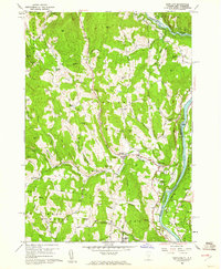 1959 Hartland1961 Print · USGSThe Connecticut River valley south of White River Junction shows its mid-century character, from the State Prison Farm to the North Hartland Reservoir. Researchers can trace old family names at Quaker Village Cem and locate historic sites like Jenneville and the Covered Bridge.4 unique versions available
 - 1959 Map of North Hartland, 1961 Print
 1959 North Hartland1961 Print · USGSThe Upper Connecticut River Valley at the end of the 1950s shows a landscape of river-driven industry and academic tradition. Genealogists and historians can trace the foundations of Meriden, identify the location of the Kimball Union Academy, and locate dozens of family cemeteries such as Gallup Cem.4 unique versions available
 - 1964 Map of Glens Falls
 1964 Glens Falls1964 Print · USGSThe tri-state borderlands of New York, Vermont, and New Hampshire appear here in the mid-1960s. Researchers can trace the rail routes of the Rutland RR and find historic sites like Ticonderoga and Saratoga National Historical Park.
 - 1984 Map of Enfield Center
 1984 Enfield Center1984 Print · USGSThe Shaker heritage and rural highlands of Grafton County are documented here in the mid-1980s. Genealogists and historians can locate family landmarks like Purmort Cem, the historic Lower Shaker Village, and the site of the Fish Market.2 unique versions available
 - 1984 Map of Mt. Ascutney
 1984 Mt. Ascutney1984 Print · USGSThe Vermont and New Hampshire borderlands are captured here in the early eighties, centered on the Connecticut River and the heights of Mt Ascutney. Genealogists can locate family landmarks like Child Cem and Mountainview Cem or the historic Saint-Gaudens National Historic Site.2 unique versions available
 - 1984 Map of Sunapee
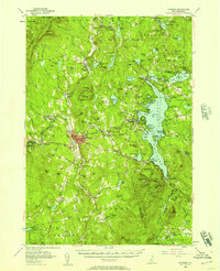
 1984 Sunapee1984 Print · USGSSullivan County in the 1980s shows a landscape of deep-water lakes and forested ridges. Researchers can trace the waterfront development at Sunapee Harbor, the rural crossroads of Croydon Four Corners, and the old path of the Boston and Maine Railroad.2 unique versions available
 - 1985 Map of Claremont, 1986 Print
 1985 Claremont1986 Print · USGSUpper Valley and Green Mountain life are captured here in the mid-eighties, centered on the river-linked hubs of Claremont and Springfield. Trace old family routes and rail lines like the Boston & Maine RR, or locate properties near Lake Sunapee and Mount Ascutney State Park.2 unique versions available
 - 1985 Map of Rutland, 1988 Print
 1985 Rutland1988 Print · USGSThe Upper Valley of the mid-1980s comes to life along the winding Connecticut River as it divides the Green Mountain and Granite states. Historians can trace the industrial rail hubs of White River Junction and the paths of the Appalachian Trail and Long Trail.
 - 1998 Map of North Hartland
 1998 North Hartland1998 Print · USGSThe Connecticut River valley along the Vermont and New Hampshire border comes to life in this late-century survey. Researchers can trace family history through sites like Kimball Union Academy and numerous burial grounds such as Plainfield Cem and Raynes-Ford Cem.
 - 1998 Map of Hartland, 1999 Print
 1998 Hartland1999 Print · USGSLate twentieth-century Windsor County reveals a landscape of high hills and river junctions along the New Hampshire border. Genealogists can trace family names across Hoisington Cem, Aldrich Cem, and historic hamlets like Quakers Village.
 - 1998 Map of Claremont North, 2002 Print
 1998 Claremont North2002 Print · USGSSullivan County at the close of the twentieth century shows a landscape where historic preservation meets modern industry. Genealogists can trace family names at Edminster Cem and Cornings Cem, while historians can locate the Covered Bridge and the Saint Gaudens National Historic Site.
Showing maps 1-25 of 58
Top cities near Cornish
- Lebanon historical maps
- Claremont historical maps
- Hanover historical maps
- Hartford historical maps
- Newport historical maps
- Enfield historical maps
See more
Top neighborhoods of Cornish
- Balloch historical maps
- Cornish Flat historical maps
- Cornish City historical maps
- South Cornish historical maps
- Cornish Center historical maps
- Squag City historical maps
See more
Frequently asked questions
- What are the different types of historical maps available for Cornish?
- What is the oldest map of Cornish?
- Where can I purchase historical maps of Cornish for my home or office?
- Where can I download high-res historical maps of Cornish?
- Are there historical topographic maps available for Cornish?
- Is there historical aerial imagery available for Cornish?
- Where are historical maps of Cornish sourced from?