Old Maps of Penn Place, Washington Township for Academic Research
Study the evolution of Penn Place with 18 high-resolution historic maps. Whether you're teaching, researching, or modeling changes in land use, these maps provide essential visual documentation of urban, environmental, and geographic change.
- Analyze long-term change: Track patterns in development, transportation, and natural features.
- Ideal for environmental or urban studies: Support academic projects with primary historical map data.
- Use in the classroom or lab: Educators and researchers rely on these maps to bring historical context to life.
These maps are a powerful tool for teaching, research, and visualizing how Penn Place has changed over the decades.
Penn Place, Washington Township maps
(18)- 1888 Map of Little Egg Harbor
 1888 Little Egg Harbor1888 Print · USGSThe Jersey Shore and Pine Barrens meet here during the late Victorian era, before the modern development of the coastline. Genealogists and historians can trace the early Tuckerton Railroad through settlements like Staffordville, Nugentown, and Sea Haven.2 unique versions available
 - 1893 Map of Little Egg Harbor
 1893 Little Egg Harbor1893 Print · USGSCoastal New Jersey thrived at the end of the century as a landscape of rail-connected shore towns and intricate salt marsh thoroughfares. Genealogists and historians can trace old family settlements from New Gretna to Tuckerton, or locate maritime landmarks like Little Egg Harbor Light and Stafford Forge.4 unique versions available
 - 1920 Map of Little Egg Harbor
 1920 Little Egg Harbor1920 Print · USGSThe New Jersey shore south of Manahawken was a landscape of salt marshes and pine plains during the early twentieth century. Genealogists and historians can trace the old Tuckerton Railroad line and find now-changed coastal landmarks like Tucker Beach and Stafford Forge.
 - 1942 Map of Tuckerton
 1942 Tuckerton1942 Print · USGSThe Jersey Shore and Pine Barrens meet here just as the coastal infrastructure was maturing before mid-century. Researchers can trace the layout of Tuckerton, locate the old Stafford Forge, and explore the maze of sedges in Little Egg Harbor.2 unique versions available
 - 1946 Map of Wilmington, 1948 Print
 1946 Wilmington1948 Print · USGSThe Delaware Valley and Jersey Shore emerge in this mid-century portrait of a region defined by river commerce and seaside growth. Genealogists and historians can trace the rail networks of the Pennsylvania Railroad, locate early airfields like Dover Airpark, and find river defenses at Fort Delaware.2 unique versions available
 - 1955 Map of Wilmington
 1955 Wilmington1955 Print · USGSThe Delaware Valley and Jersey Shore are seen here during the mid-fifties era of rapid suburban expansion and highway development. You can trace the path of the New Jersey Turnpike, locate the Fort Dix Military Reservation, or explore the rail networks of the Pennsylvania Railroad.
 - 1955 Map of Oswego Lake, 1956 Print
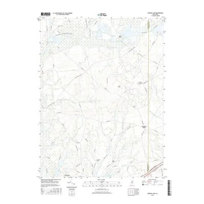
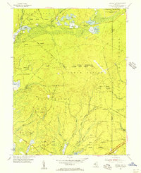 1955 Oswego Lake1956 Print · USGSIn the mid-fifties, this Pine Barrens landscape was a mix of state forests and new federal military installations. Genealogists and historians can trace old homesteads and crossings at Leektown, Sim Place, and Bartletts Bridge amidst the sprawling Penn State Forest.4 unique versions available
 - 1957 Map of Wilmington
 1957 Wilmington1957 Print · USGSThe mid-Atlantic coastal plain comes alive in the mid-fifties as the New Jersey Turnpike and Garden State Parkway redefine travel. Researchers can trace the rail-to-road transition and find landmarks like Ship John Shoal Light and the Fort Dix Military Reservation.2 unique versions available
 - 1959 Map of Wilmington
 1959 Wilmington1959 Print · USGSThe Delaware Valley and Jersey Shore are seen here in the late fifties, during a period of massive suburban and highway expansion. Researchers can trace mid-century infrastructure like the N J Turnpike or locate coastal landmarks from Barnegat Bay to the Maurice River.3 unique versions available
 - 1966 Map of Wilmington, 1968 Print
 1966 Wilmington1968 Print · USGSThe Delaware Valley and Jersey Shore are seen here in the mid-1960s, documenting a landscape of dense industrial cities and emerging coastal resorts. Researchers can trace the sprawling rail networks of the Pennsylvania Railroad or locate landmarks like Fort Dix Military Reservation and Elk Neck State Park.4 unique versions available
 - 1972 Map of Wilmington, 1976 Print
 1972 Wilmington1976 Print · USGSThe Delaware Valley and Jersey Shore are seen here in the 1970s, showcasing the region's dense transport networks and vast state forests. Trace early coastal development near Atlantic City or locate rural landmarks like Mount Holly and Dover Air Force Base.2 unique versions available
 - 1984 Map of Hammonton, 1986 Print
 1984 Hammonton1986 Print · USGSSouthern New Jersey is captured in the mid-eighties as suburban growth pressed against the vast Pinelands. Researchers can trace the development of the Atlantic City Expressway corridor and locate landmarks like Ancora Psychiatric Hospital and the sprawling Wharton State Forest.3 unique versions available
 - 1997 Map of Oswego Lake, 1998 Print
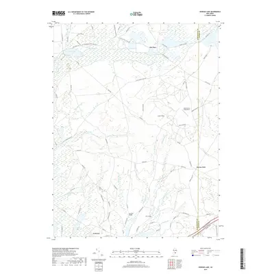
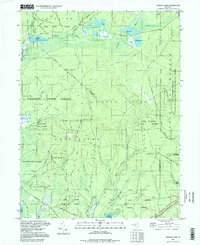 1997 Oswego Lake1998 Print · USGSThe Pine Barrens of the late nineties are defined here by the intersection of four major state forests and the winding Wading River. Researchers can trace historic local sites like Sim Place and Leektown, or find old river crossings at Bartletts Bridge and Dans Bridge.
 - 2011 Map of Oswego Lake, 2011 Print
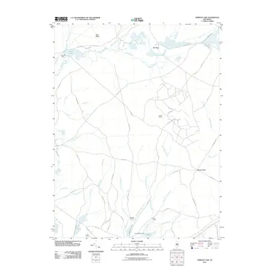 2011 Oswego Lake2011 Print · USGSCovers Penn Place, including Stafford Township, Little Egg Harbor Township, and other nearby areas
 - 2014 Map of Oswego Lake, 2014 Print
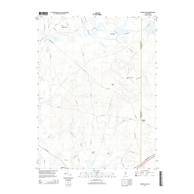 2014 Oswego Lake2014 Print · USGSCovers Penn Place, including Stafford Township, Little Egg Harbor Township, and other nearby areas
 - 2016 Map of Oswego Lake, 2016 Print
 2016 Oswego Lake2016 Print · USGSCovers Penn Place, including Stafford Township, Little Egg Harbor Township, and other nearby areas
 - 2019 Map of Oswego Lake, 2019 Print
 2019 Oswego Lake2019 Print · USGSCovers Penn Place, including Stafford Township, Little Egg Harbor Township, and other nearby areas
 - 2023 Map of Oswego Lake, 2023 Print
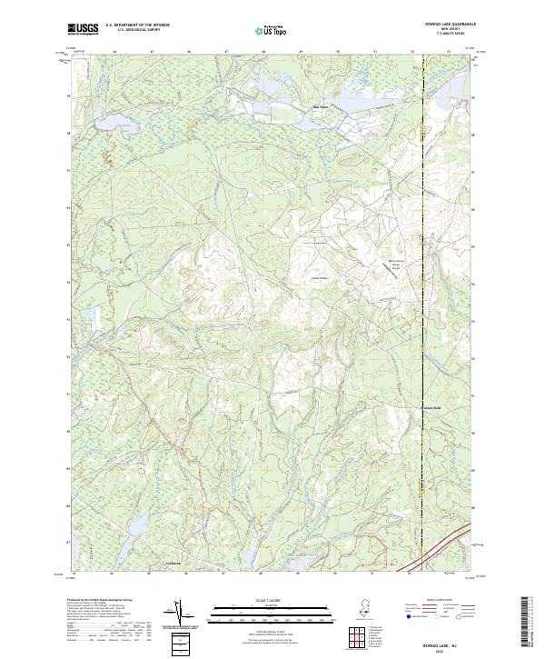 2023 Oswego Lake2023 Print · USGSThe Pine Barrens of Burlington County are shown in detail as they appeared in 2023, where water and defense training shape the landscape. Researchers can trace the Push Line railroad grade, find old settlements like Leektown, and locate landmarks such as Munion Field.
End of results
Showing maps 1-18 of 18
Top cities near Penn Place
- Toms River historical maps
- Manchester Township historical maps
- Berkeley Township historical maps
- Galloway Township historical maps
- Stafford Township historical maps
- Hamilton Township historical maps
See more
Frequently asked questions
- What are the different types of historical maps available for Penn Place?
- What is the oldest map of Penn Place?
- Where can I purchase historical maps of Penn Place for my home or office?
- Where can I download high-res historical maps of Penn Place?
- Are there historical topographic maps available for Penn Place?
- Is there historical aerial imagery available for Penn Place?
- Where are historical maps of Penn Place sourced from?