Old Maps of Cape May County, New Jersey for Hiking & Exploration
Hike through history with 104 historic maps of Cape May County. Explore old trails, ghost towns, and forgotten backroads — perfect for outdoor adventurers and local explorers.
- Rediscover forgotten places: Map out old mining camps, roads, and footpaths that no longer exist on modern maps.
- Layer with modern tools: Combine with LiDAR or satellite views to plan hikes through historical terrain.
- Made for exploration: Popular among hikers, overlanders, and local history lovers.
Use these maps to find adventure and explore the hidden past of Cape May County.
Cape May County, NJ maps
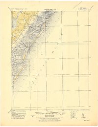
(104)- 1884 Map of Sea Isle
 1884 Sea Isle1884 Print · USGSCovers Cape May County, including Middle Township, Ocean City, and other nearby areas
 - 1887 Map of Atlantic City
 1887 Atlantic City1887 Print · USGSCovers Cape May County, including Egg Harbor Township, Atlantic City, and other nearby areas
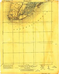
 - 1888 Map of Cape May
 1888 Cape May1888 Print · USGSCovers Cape May County, including Lower Township, Middle Township, and other nearby areas
 - 1888 Map of Dennisville
 1888 Dennisville1888 Print · USGSCovers Cape May County, including Lower Township, Middle Township, and other nearby areas
 - 1888 Map of Sea Isle
 1888 Sea Isle1888 Print · USGSCovers Cape May County, including Middle Township, Ocean City, and other nearby areas
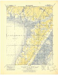
 - 1890 Map of Great Egg Harbor
 1890 Great Egg Harbor1890 Print · USGSCovers Cape May County, including Egg Harbor Township, Atlantic City, and other nearby areas
 - 1890 Map of Tuckahoe
 1890 Tuckahoe1890 Print · USGSCovers Cape May County, including Vineland, Millville, and other nearby areas
 - 1890 Map of Maurice Cove
 1890 Maurice Cove1890 Print · USGSCovers Cape May County, including Maurice River Township, Commercial Township, and other nearby areas
 - 1891 Map of Maurice Cove
 1891 Maurice Cove1891 Print · USGSCovers Cape May County, including Maurice River Township, Commercial Township, and other nearby areas3 unique versions available
 - 1893 Map of Cape May
 1893 Cape May1893 Print · USGSCovers Cape May County, including Lower Township, Middle Township, and other nearby areas4 unique versions available
 - 1893 Map of Great Egg Harbor
 1893 Great Egg Harbor1893 Print · USGSCovers Cape May County, including Egg Harbor Township, Atlantic City, and other nearby areas5 unique versions available
 - 1893 Map of Tuckahoe
 1893 Tuckahoe1893 Print · USGSCovers Cape May County, including Vineland, Millville, and other nearby areas4 unique versions available
 - 1894 Map of Dennisville
 1894 Dennisville1894 Print · USGSCovers Cape May County, including Lower Township, Middle Township, and other nearby areas4 unique versions available
 - 1894 Map of Sea Isle
 1894 Sea Isle1894 Print · USGSCovers Cape May County, including Middle Township, Ocean City, and other nearby areas6 unique versions available
 - 1894 Map of Atlantic City
 1894 Atlantic City1894 Print · USGSCovers Cape May County, including Egg Harbor Township, Atlantic City, and other nearby areas8 unique versions available
 - 1898 Map of Cape May, 1904 Print
 1898 Cape May1904 Print · USGSCovers Cape May County, including Lower Township, Middle Township, and other nearby areas
 - 1899 Map of Vineland
 1899 Vineland1899 Print · USGSCovers Cape May County, including Vineland, Dover, and other nearby areas3 unique versions available
 - 1918 Map of Cape Henlopen
 1918 Cape Henlopen1918 Print · USGSCovers Cape May County, including Lewes, Overbrook Shores, and other nearby areas2 unique versions available
 - 1918 Map of Great Egg Harbor, 1921 Print
 1918 Great Egg Harbor1921 Print · USGSCovers Cape May County, including Egg Harbor Township, Atlantic City, and other nearby areas
 - 1918 Map of Tuckahoe, 1921 Print
 1918 Tuckahoe1921 Print · USGSCovers Cape May County, including Vineland, Millville, and other nearby areas
 - 1918 Map of Cape May, 1921 Print
 1918 Cape May1921 Print · USGSCovers Cape May County, including Lower Township, Middle Township, and other nearby areas
 - 1919 Map of Vineland, 1921 Print
 1919 Vineland1921 Print · USGSCovers Cape May County, including Vineland, Dover, and other nearby areas
 - 1919 Map of Sea Isle, 1921 Print
 1919 Sea Isle1921 Print · USGSCovers Cape May County, including Middle Township, Ocean City, and other nearby areas
 - 1919 Map of Dennisville, 1921 Print
 1919 Dennisville1921 Print · USGSCovers Cape May County, including Lower Township, Middle Township, and other nearby areas
 - 1925 Map of Cape May
 1925 Cape May1925 Print · USGSCovers Cape May County, including Lower Township, Middle Township, and other nearby areas
Showing maps 1-25 of 104
Top cities of Cape May County
- Lower Township historical maps
- Middle Township historical maps
- Ocean City historical maps
- Upper Township historical maps
- Wildwood historical maps
- North Wildwood historical maps
See more
Frequently asked questions
- What are the different types of historical maps available for Cape May County?
- What is the oldest map of Cape May County?
- Where can I purchase historical maps of Cape May County for my home or office?
- Where can I download high-res historical maps of Cape May County?
- Are there historical topographic maps available for Cape May County?
- Is there historical aerial imagery available for Cape May County?
- Where are historical maps of Cape May County sourced from?