1900s (20th Century) Maps of Cape May County, New Jersey
Explore 71 historic maps of Cape May County from the 1900s (20th Century). These maps offer a rare glimpse into what life looked like during the 1900s — showing old roads, neighborhoods, homes, and landmarks that have changed or disappeared over time.
Whether you're researching your family's past, planning a metal detecting trip, or studying how Cape May County's landscape evolved across the 1900s, these high-resolution maps are a powerful tool for exploring the history of this region.
- Focus on a specific era: All maps on this page are from the 1900s, giving you a focused view of this time period.
- See what’s changed: Compare century-old streets, trails, and buildings to today's modern landscape using overlays and satellite layers.
- Research with precision: Use these maps for genealogy, historical research, land use analysis, or educational projects.
- View, download, or print: Maps are fully viewable online in high resolution, and can be downloaded or printed for your own records.
Start exploring Cape May County's history through authentic maps from the 1900s. This is your window into the past.
Cape May County, NJ maps
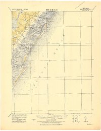
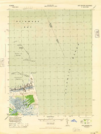
(71)- 1918 Map of Cape Henlopen
 1918 Cape Henlopen1918 Print · USGSCoastal Sussex County is seen here at a pivotal maritime moment, as the bustling port at Lewes manages the traffic of the Delaware Bay. Researchers can trace early twentieth-century rail lines, the historic Cape Henlopen Light, and local landmarks like West Hill School.2 unique versions available
 - 1918 Map of Great Egg Harbor, 1921 Print
 1918 Great Egg Harbor1921 Print · USGSAtlantic County at the close of the Great War reveals a landscape of tidal marshes and pine forests connected by emerging rail lines. Genealogists can locate family-named sites such as Mc Keetown, Steelmans Landing, and the prominent Doughty Mill.
 - 1918 Map of Tuckahoe, 1921 Print
 1918 Tuckahoe1921 Print · USGSSouthern New Jersey’s pine barrens and river valleys are captured here during a period of transition between early industry and railroad expansion. Genealogists and researchers can trace the locations of Walker's Forge, the West Jersey Railroad, and forgotten milling sites like Bennett Mill.
 - 1918 Map of Cape May, 1921 Print
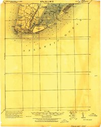
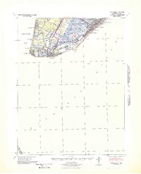
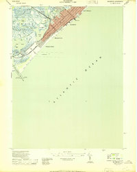
 1918 Cape May1921 Print · USGSCoastal New Jersey is shown here at the height of its early railroad era, before modern development transformed the shoreline. Genealogists and historians can trace rail lines to Cape May City, find old Life Saving Stations, and locate vanished spots like Schellinger's Landing or Bennet.
 - 1919 Map of Vineland, 1921 Print
 1919 Vineland1921 Print · USGSCumberland County’s coastal oyster ports and inland industrial centers are captured here during a period of peak maritime activity. Genealogists and historians can trace rail lines like the Central R. R. of New Jersey or locate vanished sites like Whitehall Ldg. and Sheppards Mill.
 - 1919 Map of Sea Isle, 1921 Print
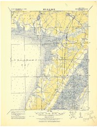
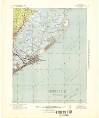
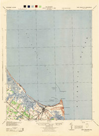
 1919 Sea Isle1921 Print · USGSCoastal Cape May at the end of the Great War reveals a landscape of tidal thoroughfares and early rail-connected resorts. Researchers can trace the tracks of the Penna. R.R. through Ocean View or locate old shore landmarks like L.S.S. Corson Inlet.
 - 1919 Map of Dennisville, 1921 Print
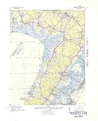
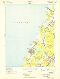
 1919 Dennisville1921 Print · USGSCape May County's southern peninsula is documented here during the height of the coastal rail era, before modern development reshaped the shoreline. Genealogists and historians can trace the foundations of local commerce through sites like Bidwell Town Mill, Goshen Landing, and the many family-named stops along the Philadelphia & Reading R.R.
 - 1925 Map of Cape May
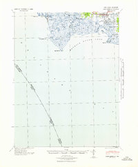
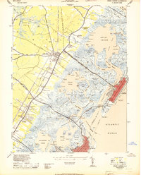
 1925 Cape May1925 Print · USGSThe tip of the New Jersey peninsula is shown in detail during the early twentieth century, featuring a landscape of burgeoning resort towns and maritime defenses. Researchers can trace early railroad lines, find long-standing landmarks like Cape May Light, and explore vanished coastal features such as L.S. Station Turtle Gut.
 - 1937 Map of Cape Henlopen
 1937 Cape Henlopen1937 Print · USGSThe Delaware coastline near Cape Henlopen comes alive in the early twentieth century, showing a landscape defined by maritime safety and rail transport. Trace the routes of the Pennsylvania RR to settlements like Lewes or locate landmarks such as the West Hill School and Cape Henlopen Light.2 unique versions available
 - 1940 Map of Cape May, 1941 Print
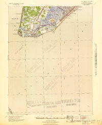
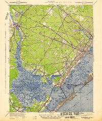
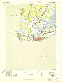
 1940 Cape May1941 Print · USGSCape May County's southern tip was a critical defensive and resort hub during the early fortie. Genealogists and researchers can trace the precise streets of Wildwood, identify the military footprint at the Naval Res, and locate vanished landmarks at South Cape May.
 - 1940 Map of Atlantic City, 1953 Print
 1940 Atlantic City1953 Print · USGSThe New Jersey coastline during the pre-war era is mapped here in detail, showcasing the resort boom and rail connections of the day. Researchers can trace the layout of famous boardwalk landmarks like the Steel Pier and the Pennsylvania-Reading Seashore Lines into the city.
 - 1941 Map of Cape May
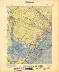
 1941 Cape May1941 Print · USGSCape May County is caught at a pivotal moment in the early 1940s as coastal defenses and resort life coexist. Researchers can trace the legacy of vanished landmarks and transit routes like the Reading Lines railroad, South Cape May, and the U. S. Naval Res.
 - 1941 Map of Dennisville
 1941 Dennisville1941 Print · USGSCape May County's interior and coastal marshes are captured here in the early 1940s, from the bay-side landings to the Atlantic sounds. Trace the rail corridors of the Pennsylvania-Reading Seashore Lines through Dennisville and locate the State Prison Farm.2 unique versions available
 - 1941 Map of Atlantic City
 1941 Atlantic City1941 Print · USGSAtlantic City and its neighboring shore towns are captured in the early 1940s, showing a world of grand boardwalk piers and intricate tidal marshlands. Trace the routes of the Pennsylvania-Reading Seashore Lines or locate landmarks like Absecon Light and the Heinz Pier.2 unique versions available
 - 1941 Map of Port Norris
 1941 Port Norris1941 Print · USGSCumberland County's maritime heart is captured here during the early 1940s, as the oyster industry centered on Bivalve and Port Norris reached its mid-century peak. Researchers can trace the Reading Seashore Lines to the coast or locate remote outposts like Fortescue and Matts Landing.
 - 1941 Map of Sea Isle City
 1941 Sea Isle City1941 Print · USGSCoastal Cape May County is captured here in the early days of the Second World War, showing the delicate balance of tidal marshes and growing seaside resorts. Genealogists and historians can trace rail lines to Sea Isle City or locate landmarks like the Ludlam Beach Light and the community of Strathmere.
 - 1941 Map of Tuckahoe
 1941 Tuckahoe1941 Print · USGSCoastal New Jersey at the start of the 1940s reveals a landscape defined by sand mining and a dense network of steam and electric rail. Genealogists and historians can trace the paths of the Pennsylvania Reading Seashore Lines through rural stops like Port Elizabeth, Mizpah, and Walkers Forge.
 - 1942 Map of Pleasantville
 1942 Pleasantville1942 Print · USGSCoastal Atlantic County comes alive in the early 1940s, showing the intricate tidal marshes and railroad towns before modern suburban expansion. Trace the historic Pennsylvania Reading Seashore Lines and find family landmarks in Bargaintown, Scullville, and Mays Landing.2 unique versions available
 - 1943 Map of Pleasantville
 1943 Pleasantville1943 Print · USGSCoastal Atlantic County and the Great Egg Harbor estuary are captured here during the wartime era. Genealogists and historians can trace the rail-and-road economy through McKee City Station or explore established hamlets like English Creek and Scullville.
 - 1944 Map of Wildwood
 1944 Wildwood1944 Print · USGSThe Wildwoods are captured here during the mid-1940s as thriving coastal resorts tied together by the Pennsylvania-Reading Seashore Lines. Local historians can trace the development of North Wildwood down to Wildwood Gables, alongside maritime sites like the Ocean Pier and Cold Spring Harbor Dock.2 unique versions available
 - 1944 Map of Cape Henlopen
 1944 Cape Henlopen1944 Print · USGSThe Delaware coastline at the height of the war shows a strategic landscape of maritime defense and industrial fishing. Trace the military fortifications of Fort Miles Military Reservation, the docks of Consolidated Fisheries, and the old Abandoned LH near Lewes.2 unique versions available
 - 1944 Map of Cape Henlopen
 1944 Cape Henlopen1944 Print · USGSCoastal Delaware during the mid-forties reveals a landscape of vital maritime defense and rural crossroads. Genealogists and historians can trace the Pennsylvania rail line through Lewes and locate landmarks like the West Hill Sch and Coast Guard Sta.
 - 1944 Map of Rio Grande
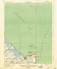
 1944 Rio Grande1944 Print · USGSCape May's western shore and interior settlements are captured during the peak of the Second World War. Researchers can trace the sprawling Wildwood US Naval Air Station and historic local communities such as Rio Grande, Nummytown, and Dias Creek.2 unique versions available
 - 1944 Map of Stone Harbor
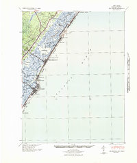
 1944 Stone Harbor1944 Print · USGSCoastal Cape May County thrived as a rail-linked summer destination during the mid-1940s, balancing mainland hubs with growing seaside resorts. Researchers can trace the heritage of Whitesboro and Mayville or locate landmarks like the Stone Harbor CG Station and Bowers Municipal Fishing Pier.3 unique versions available
 - 1944 Map of Cape May
 1944 Cape May1944 Print · USGSCoastal New Jersey during the mid-forties shows the strategic importance of the peninsula during the war years. Local historians can trace the new Cape May Canal, the Cape May Coast Artillery Reserve, and the rails of the Reading Seashore Lines.2 unique versions available
Showing maps 1-25 of 71
Top cities of Cape May County
- Lower Township historical maps
- Middle Township historical maps
- Ocean City historical maps
- Upper Township historical maps
- Wildwood historical maps
- North Wildwood historical maps
See more
Frequently asked questions
- What are the different types of historical maps available for Cape May County?
- What is the oldest map of Cape May County?
- Where can I purchase historical maps of Cape May County for my home or office?
- Where can I download high-res historical maps of Cape May County?
- Are there historical topographic maps available for Cape May County?
- Is there historical aerial imagery available for Cape May County?
- Where are historical maps of Cape May County sourced from?