Old Maps of Cape May County, New Jersey for Genealogy
Trace your family roots with 168 historic maps of Cape May County. These high-res maps reveal old neighborhoods, homesites, landmarks, and streets — helping you uncover where your ancestors lived and how the area evolved over time.
- Explore historic neighborhoods: Identify where your relatives may have lived in the 1800s or 1900s.
- Compare maps over time: Trace the changes in streets, buildings, and landmarks for multi-generational research.
- Perfect for genealogy & ancestry research: Used by family historians and researchers to map out lineage and migration.
These maps are an incredible resource for exploring your personal connection to Cape May County's past.
Cape May County, NJ maps
(168)- 1884 Map of Sea Isle
 1884 Sea Isle1884 Print · USGSThe Jersey Shore emerges as a Victorian-era destination in this late nineteenth-century survey of the Cape May coast. Trace the early rail lines of the West Jersey Railroad and locate maritime landmarks like L.S. Station Sea Isle City and Corson's Inlet.
 - 1887 Map of Atlantic City
 1887 Atlantic City1887 Print · USGSCoastal New Jersey in the late 1800s reveals a rapidly growing resort landscape defined by its heavy rail connections and maritime safety network. You can trace the early city grid of Atlantic City, follow the West Jersey and Atlantic Railroad over the marshes, or locate the Absecon Light and shorebound Life Saving Stations.
 - 1888 Map of Cape May
 1888 Cape May1888 Print · USGSCape May County's southern shoreline is captured in the late nineteenth century as Victorian resorts and maritime stations defined the coast. Genealogists and historians can trace early railroad lines like the Cape May and Sewell's Point R.R. or locate legacy landmarks such as Higbee's Landing and Cape May Point.
 - 1888 Map of Dennisville
 1888 Dennisville1888 Print · USGSCoastal Cape May County thrived in the late nineteenth century as a network of rail lines and tide-water landings. Genealogists can trace family names and vanished settlements from Cape May Court House to the West Jersey Railroad depots at Swain Station and Burleigh.
 - 1888 Map of Sea Isle
 1888 Sea Isle1888 Print · USGSCoastal Cape May County emerges in the 1880s as railroads began to bridge the marshes. Trace the early development of Sea Isle City and the locations of maritime safety outposts like L. S. Station Townsend's Inlet and L. S. Station Tatham's.
 - 1890 Map of Great Egg Harbor
 1890 Great Egg Harbor1890 Print · USGSCoastal New Jersey thrived on a network of river landings and new rail lines during the 1880s. Genealogists and local historians can trace family ties through landmarks like Doughty's Mill, Bargaintown, and early outposts like Life Saving Station (29).
 - 1890 Map of Tuckahoe
 1890 Tuckahoe1890 Print · USGSCoastal New Jersey in the 1890s shows a landscape of riverfront villages and early industrial sites connected by new rails. Genealogists can trace family roots through riverside settlements like Mauricetown or locate historic industry at Old Etna Furnace and Monroe Forge.
 - 1890 Map of Maurice Cove
 1890 Maurice Cove1890 Print · USGSCumberland County’s shoreline in the late nineteenth century is a complex landscape of tidal creeks and maritime infrastructure. Researchers can trace the early rail terminus at Port Norris or locate offshore hazards like Dead Man's Shoal and Egg Island Light.
 - 1891 Map of Maurice Cove
 1891 Maurice Cove1891 Print · USGSCumberland County's coastal marshlands and the Delaware Bay oyster industry are captured here during the late Victorian era. Researchers can trace the dual rail lines serving Port Norris or locate offshore hazards like Dead Man Shoal and Egg Island Light.3 unique versions available
 - 1893 Map of Cape May
 1893 Cape May1893 Print · USGSThe tip of the Jersey Shore appears here in the late Victorian era, before modern development reshaped its coastlines and sounds. Genealogists and historians can trace early settlements like Cold Spring, coastal landmarks like the Cape May Light, and several Life Saving Stations along the shore.4 unique versions available
 - 1893 Map of Great Egg Harbor
 1893 Great Egg Harbor1893 Print · USGSCoastal New Jersey in the late nineteenth century is captured here as the shoreline transitioned into a tourist and maritime hub. Trace the early development of Ocean City and Somers Point, or locate industrial sites like Doughty Mill and the Fish Factory near the inlet.5 unique versions available
 - 1893 Map of Tuckahoe
 1893 Tuckahoe1893 Print · USGSSouthern New Jersey is documented here during the late nineteenth century as the industrial focus shifted from iron forges to the railroad. Genealogists can trace family connections in Port Elizabeth, Tuckahoe, and Mauricetown, or locate historic industrial sites like Old Etna Furnace and Bennett Mill.4 unique versions available
 - 1894 Map of Dennisville
 1894 Dennisville1894 Print · USGSCape May County's maritime and rail landscape is captured here in the late nineteenth century before the modern development of the shore. Genealogists and historians can trace old family settlements and landings like Nummytown, Goshen Landing, and Heislerville.4 unique versions available
 - 1894 Map of Sea Isle
 1894 Sea Isle1894 Print · USGSThe Cape May coast at the end of the nineteenth century reveals a landscape of complex tidal thorofares and early seaside resorts. Trace the path of the West Jersey Railroad and find early maritime landmarks like L.S. Station Corson Inlet.6 unique versions available
 - 1894 Map of Atlantic City
 1894 Atlantic City1894 Print · USGSAtlantic City and its neighboring coastal hamlets are shown at the height of the late Victorian era. Genealogists and historians can trace the early rail networks like the Camden and Atlantic Railroad or locate family roots in Leeds Point and Oceanville.8 unique versions available
 - 1898 Map of Cape May, 1904 Print
 1898 Cape May1904 Print · USGSThe tip of the Jersey Shore at the close of the nineteenth century reveals a landscape of early beach resorts and vital rail connections. Researchers can trace the original footprints of Holly Beach and Cape May Point, or locate maritime landmarks like the Cape May Light and several federal life-saving stations.
 - 1899 Map of Vineland
 1899 Vineland1899 Print · USGSCumberland and Salem counties come alive in the late nineteenth century, showcasing a thriving coastal economy of rail lines and river ports. Genealogists and researchers can trace family lands near Maskells Mill, the oyster docks of Bivalve, or the rural junction at New England Cross Roads.3 unique versions available
 - 1918 Map of Cape Henlopen
 1918 Cape Henlopen1918 Print · USGSCoastal Sussex County is seen here at a pivotal maritime moment, as the bustling port at Lewes manages the traffic of the Delaware Bay. Researchers can trace early twentieth-century rail lines, the historic Cape Henlopen Light, and local landmarks like West Hill School.2 unique versions available
 - 1918 Map of Great Egg Harbor, 1921 Print
 1918 Great Egg Harbor1921 Print · USGSAtlantic County at the close of the Great War reveals a landscape of tidal marshes and pine forests connected by emerging rail lines. Genealogists can locate family-named sites such as Mc Keetown, Steelmans Landing, and the prominent Doughty Mill.
 - 1918 Map of Tuckahoe, 1921 Print
 1918 Tuckahoe1921 Print · USGSSouthern New Jersey’s pine barrens and river valleys are captured here during a period of transition between early industry and railroad expansion. Genealogists and researchers can trace the locations of Walker's Forge, the West Jersey Railroad, and forgotten milling sites like Bennett Mill.
 - 1918 Map of Cape May, 1921 Print
 1918 Cape May1921 Print · USGSCoastal New Jersey is shown here at the height of its early railroad era, before modern development transformed the shoreline. Genealogists and historians can trace rail lines to Cape May City, find old Life Saving Stations, and locate vanished spots like Schellinger's Landing or Bennet.
 - 1919 Map of Vineland, 1921 Print
 1919 Vineland1921 Print · USGSCumberland County’s coastal oyster ports and inland industrial centers are captured here during a period of peak maritime activity. Genealogists and historians can trace rail lines like the Central R. R. of New Jersey or locate vanished sites like Whitehall Ldg. and Sheppards Mill.
 - 1919 Map of Sea Isle, 1921 Print
 1919 Sea Isle1921 Print · USGSCoastal Cape May at the end of the Great War reveals a landscape of tidal thoroughfares and early rail-connected resorts. Researchers can trace the tracks of the Penna. R.R. through Ocean View or locate old shore landmarks like L.S.S. Corson Inlet.
 - 1919 Map of Dennisville, 1921 Print
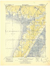 1919 Dennisville1921 Print · USGSCape May County's southern peninsula is documented here during the height of the coastal rail era, before modern development reshaped the shoreline. Genealogists and historians can trace the foundations of local commerce through sites like Bidwell Town Mill, Goshen Landing, and the many family-named stops along the Philadelphia & Reading R.R.
 - 1925 Map of Cape May
 1925 Cape May1925 Print · USGSThe tip of the New Jersey peninsula is shown in detail during the early twentieth century, featuring a landscape of burgeoning resort towns and maritime defenses. Researchers can trace early railroad lines, find long-standing landmarks like Cape May Light, and explore vanished coastal features such as L.S. Station Turtle Gut.
Showing maps 1-25 of 168
Top cities of Cape May County
- Lower Township historical maps
- Middle Township historical maps
- Ocean City historical maps
- Upper Township historical maps
- Wildwood historical maps
- North Wildwood historical maps
See more
Frequently asked questions
- What are the different types of historical maps available for Cape May County?
- What is the oldest map of Cape May County?
- Where can I purchase historical maps of Cape May County for my home or office?
- Where can I download high-res historical maps of Cape May County?
- Are there historical topographic maps available for Cape May County?
- Is there historical aerial imagery available for Cape May County?
- Where are historical maps of Cape May County sourced from?