Old Maps of Tabernacle, Lower Township for Hiking & Exploration
Hike through history with 22 historic maps of Tabernacle. Explore old trails, ghost towns, and forgotten backroads — perfect for outdoor adventurers and local explorers.
- Rediscover forgotten places: Map out old mining camps, roads, and footpaths that no longer exist on modern maps.
- Layer with modern tools: Combine with LiDAR or satellite views to plan hikes through historical terrain.
- Made for exploration: Popular among hikers, overlanders, and local history lovers.
Use these maps to find adventure and explore the hidden past of Tabernacle.
Tabernacle, Lower Township maps
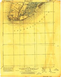
(22)- 1888 Map of Cape May
 1888 Cape May1888 Print · USGSCape May County's southern shoreline is captured in the late nineteenth century as Victorian resorts and maritime stations defined the coast. Genealogists and historians can trace early railroad lines like the Cape May and Sewell's Point R.R. or locate legacy landmarks such as Higbee's Landing and Cape May Point.
 - 1893 Map of Cape May
 1893 Cape May1893 Print · USGSThe tip of the Jersey Shore appears here in the late Victorian era, before modern development reshaped its coastlines and sounds. Genealogists and historians can trace early settlements like Cold Spring, coastal landmarks like the Cape May Light, and several Life Saving Stations along the shore.4 unique versions available
 - 1898 Map of Cape May, 1904 Print
 1898 Cape May1904 Print · USGSThe tip of the Jersey Shore at the close of the nineteenth century reveals a landscape of early beach resorts and vital rail connections. Researchers can trace the original footprints of Holly Beach and Cape May Point, or locate maritime landmarks like the Cape May Light and several federal life-saving stations.
 - 1918 Map of Cape May, 1921 Print
 1918 Cape May1921 Print · USGSCoastal New Jersey is shown here at the height of its early railroad era, before modern development transformed the shoreline. Genealogists and historians can trace rail lines to Cape May City, find old Life Saving Stations, and locate vanished spots like Schellinger's Landing or Bennet.
 - 1925 Map of Cape May
 1925 Cape May1925 Print · USGSThe tip of the New Jersey peninsula is shown in detail during the early twentieth century, featuring a landscape of burgeoning resort towns and maritime defenses. Researchers can trace early railroad lines, find long-standing landmarks like Cape May Light, and explore vanished coastal features such as L.S. Station Turtle Gut.
 - 1940 Map of Cape May, 1941 Print
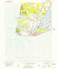
 1940 Cape May1941 Print · USGSCape May County's southern tip was a critical defensive and resort hub during the early fortie. Genealogists and researchers can trace the precise streets of Wildwood, identify the military footprint at the Naval Res, and locate vanished landmarks at South Cape May.
 - 1941 Map of Cape May
 1941 Cape May1941 Print · USGSCape May County is caught at a pivotal moment in the early 1940s as coastal defenses and resort life coexist. Researchers can trace the legacy of vanished landmarks and transit routes like the Reading Lines railroad, South Cape May, and the U. S. Naval Res.
 - 1944 Map of Cape May
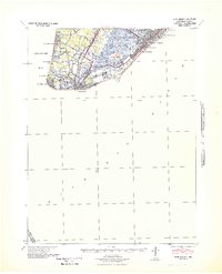
 1944 Cape May1944 Print · USGSCoastal New Jersey during the mid-forties shows the strategic importance of the peninsula during the war years. Local historians can trace the new Cape May Canal, the Cape May Coast Artillery Reserve, and the rails of the Reading Seashore Lines.2 unique versions available
 - 1946 Map of Salisbury, 1948 Print
 1946 Salisbury1948 Print · USGSThe Delmarva Peninsula in the late nineteen-forties shows a landscape defined by its deep river arteries and emerging coastal defenses. Genealogists and historians can trace rail-connected towns like Federalsburg or locate maritime landmarks such as the Ocean City Seaplane Base and Fort Miles Military Reservation.4 unique versions available
 - 1947 Map of Salisbury, 1948 Print
 1947 Salisbury1948 Print · USGSThe Delmarva Peninsula in the late forties reveals a coastal landscape of maritime defense and growing seaside towns. Trace the post-war footprint of Salisbury, the strategic Fort Miles Military Reservation, and the Ocean City Seaplane Base.
 - 1948 Map of Salisbury, 1951 Print
 1948 Salisbury1951 Print · USGSThe Delmarva Peninsula in the late 1940s is shown here as a busy network of rail-towns and coastal outposts. Researchers can trace the legacy of the Pennsylvania Railroad through inland hubs like Georgetown or the maritime reaches of Crisfield and Cape May.
 - 1954 Map of Cape May, 1956 Print
 1954 Cape May1956 Print · USGSCape May and the Jersey Cape appear in the mid-fifties as a landscape of maritime defense and historic crossroads. Genealogists and historians can trace the foundations of Town Bank, locate the Cold Spring Ch, or study the grounds of the US Naval Res.4 unique versions available
 - 1957 Map of Salisbury
 1957 Salisbury1957 Print · USGSThe Delmarva Peninsula in the mid-1950s reveals a landscape of coastal defenses and rail-driven commerce. Researchers can trace the Pennsylvania railroad lines or locate historic landmarks like the Fenwick Island Lighthouse and St Martin church.
 - 1961 Map of Salisbury
 1961 Salisbury1961 Print · USGSThe Delmarva Peninsula comes into focus in the early sixties, showing the vital road and rail networks connecting the Chesapeake to the Atlantic. Genealogists and historians can trace family-named landings and coastal landmarks from Crisfield to the Brandywine Shoal Lighthouse.
 - 1965 Map of Salisbury
 1965 Salisbury1965 Print · USGSThe Delmarva Peninsula in the mid-1960s is depicted here as a landscape of coastal defenses and maritime hubs. Genealogists and local historians can trace the foundations of bayside towns like Crisfield and the tactical positioning of the Fort Miles Military Reservation and Cape May Naval Air Station.
 - 1981 Map of Cape May, 1982 Print
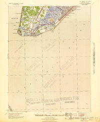
 1981 Cape May1982 Print · USGSThe Jersey Shore's southernmost reaches come into focus during the early eighties, showcasing the maritime infrastructure of the Cape. Researchers can trace the layout of coastal towns like Wildwood Crest and North Cape May or locate the sprawling U.S. Coast Guard Training Center.
 - 1995 Map of Cape May, 2000 Print
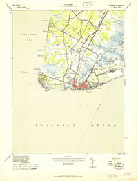
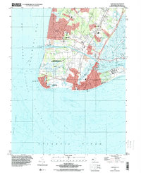 1995 Cape May2000 Print · USGSThe Jersey Shore at the end of the twentieth century shows a landscape of vibrant coastal resorts and maritime heritage. Researchers can trace local landmarks like Petticoat Bridge, the historic Cold Spring Church, and the Cape May Seashore Lines railroad.
 - 2011 Map of Cape May, 2011 Print
 2011 Cape May2011 Print · USGSCovers Tabernacle, including Lower Township, Cape May, and other nearby areas
 - 2014 Map of Cape May, 2014 Print
 2014 Cape May2014 Print · USGSCovers Tabernacle, including Lower Township, Cape May, and other nearby areas
 - 2016 Map of Cape May, 2016 Print
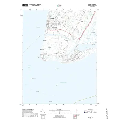
 2016 Cape May2016 Print · USGSCovers Tabernacle, including Lower Township, Cape May, and other nearby areas
 - 2019 Map of Cape May, 2019 Print
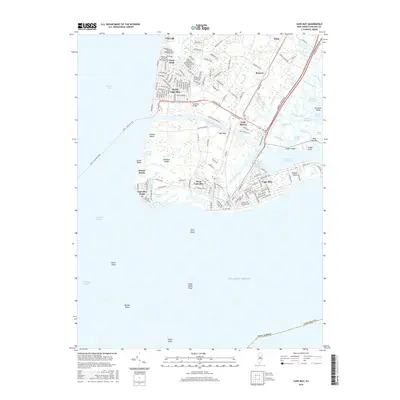
 2019 Cape May2019 Print · USGSCovers Tabernacle, including Lower Township, Cape May, and other nearby areas
 - 2023 Map of Cape May, 2023 Print
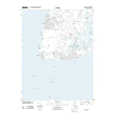
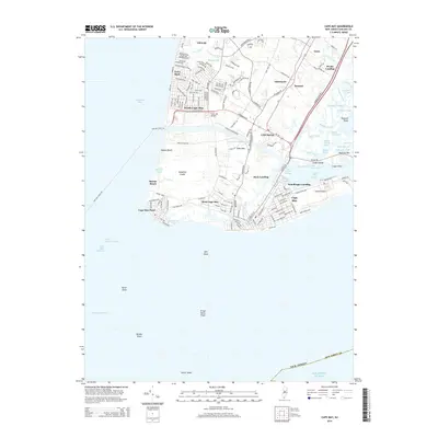
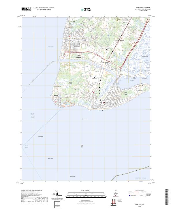 2023 Cape May2023 Print · USGSThe southern tip of the Jersey Shore is shown here in the early twenty-first century, from the tip of Cape May Point to the wetlands of Erma. Researchers can trace the coastal development of VILLAS or locate family plots at Cold Spring Presbyterian Cem and St Mary's Cem.
End of results
Showing maps 1-22 of 22
Top cities near Tabernacle
- Lower Township historical maps
- Middle Township historical maps
- Upper Township historical maps
- Villas historical maps
- Maurice River Township historical maps
- Wildwood historical maps
See more
Frequently asked questions
- What are the different types of historical maps available for Tabernacle?
- What is the oldest map of Tabernacle?
- Where can I purchase historical maps of Tabernacle for my home or office?
- Where can I download high-res historical maps of Tabernacle?
- Are there historical topographic maps available for Tabernacle?
- Is there historical aerial imagery available for Tabernacle?
- Where are historical maps of Tabernacle sourced from?