Old Maps of Vineland, New Jersey for Metal Detecting
Plan your next treasure hunt with 58 historic maps of Vineland. Find old homesites, ghost towns, trails, and gathering spots that may be lost to time — perfect for identifying promising metal detecting locations.
- Locate forgotten sites: Uncover places like long-lost settlements, abandoned rail lines, or gathering spots.
- Plan better hunts: Use map overlays combined with LiDAR or satellite views to narrow in on historically rich areas.
- Made for detectorists: Thousands of hobbyists use these maps to discover relics, coins, and hidden history.
Use these historic maps to boost your research and find new opportunities beneath the surface of Vineland.
Vineland, NJ maps
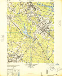
(58)- 1890 Map of Hammonton
 1890 Hammonton1890 Print · USGSThe South Jersey Pine Barrens emerge in the late nineteenth century as a complex network of rail lines and agrarian outposts. Genealogists and local historians can trace the foundations of Hammonton, Williamstown, and vanished stops like Banzard Station and New Germany.
 - 1890 Map of Tuckahoe
 1890 Tuckahoe1890 Print · USGSCoastal New Jersey in the 1890s shows a landscape of riverfront villages and early industrial sites connected by new rails. Genealogists can trace family roots through riverside settlements like Mauricetown or locate historic industry at Old Etna Furnace and Monroe Forge.
 - 1890 Map of Bridgeton
 1890 Bridgeton1890 Print · USGSCumberland County at the close of the nineteenth century is a bustling region of river commerce and intersecting iron rails. Researchers can trace early railroad stations like Finley Station and Rosenhayn or locate coastal landings such as Findell's Landing and Newport Landing.
 - 1890 Map of Glassboro
 1890 Glassboro1890 Print · USGSSouth Jersey was a thriving network of rail-side towns and mills in the late nineteenth century. Genealogists and historians can trace family roots through settlements like Pitman Grove or locate long-standing industry at Ewan's Mills and Frie's Mill.2 unique versions available
 - 1893 Map of Tuckahoe
 1893 Tuckahoe1893 Print · USGSSouthern New Jersey is documented here during the late nineteenth century as the industrial focus shifted from iron forges to the railroad. Genealogists can trace family connections in Port Elizabeth, Tuckahoe, and Mauricetown, or locate historic industrial sites like Old Etna Furnace and Bennett Mill.4 unique versions available
 - 1894 Map of Hammonton
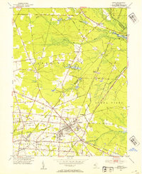
 1894 Hammonton1894 Print · USGSHammonton and the surrounding Pine Barrens appear here in the late nineteenth century as a thriving agricultural and railroad crossroads. Genealogists and historians can trace early property hubs like the Fruit Growers Union, industrial sites such as Pancoast Mill, and the rail junctions at Winslow Junction.
 - 1894 Map of Bridgeton
 1894 Bridgeton1894 Print · USGSCumberland County thrived as a hub of rail and river commerce in the 1880s and 90s, with growing industrial centers and tidal landings. Genealogists and historians can trace family roots through settlements like Gouldtown, Cedarville, and Rosenhayn, or locate vanished rail stops like Bridgeton Junction.4 unique versions available
 - 1898 Map of Glassboro
 1898 Glassboro1898 Print · USGSSouthern New Jersey's rail-and-river network is frozen in time just before the turn of the century. Trace family roots and vanished depots through Glassboro, the crossroads at Elmer, and the winding Maurice River during this era of rapid growth.6 unique versions available
 - 1898 Map of Hammonton
 1898 Hammonton1898 Print · USGSAtlantic and Camden counties are captured here in the late nineteenth century as the Pine Barrens were transformed by fruit farming and a massive rail network. Researchers can trace the legacy of early industry and transport at Fruit Growers Union, Winslow Junction, and the historic Waterford Works.3 unique versions available
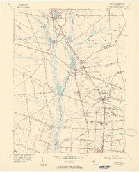
 - 1899 Map of Vineland
 1899 Vineland1899 Print · USGSCumberland and Salem counties come alive in the late nineteenth century, showcasing a thriving coastal economy of rail lines and river ports. Genealogists and researchers can trace family lands near Maskells Mill, the oyster docks of Bivalve, or the rural junction at New England Cross Roads.3 unique versions available
 - 1900 Map of Rancocas
 1900 Rancocas1900 Print · USGSSouthern New Jersey at the turn of the century reveals a land of timber, mills, and emerging rail junctions. Genealogists and historians can trace the locations of family-owned landmarks like Jennings Mill, Ballingers Mill, and early settlements such as Colemantown and Fellowship.2 unique versions available
 - 1901 Map of Camden
 1901 Camden1901 Print · USGSThe Delaware River valley at the turn of the century shows a bustling corridor of early industrial growth and established mill towns. Researchers can trace the heritage of local industry at Sycamore Mills or locate early settlements like Penns Grove and Village Green.3 unique versions available
 - 1918 Map of Tuckahoe, 1921 Print
 1918 Tuckahoe1921 Print · USGSSouthern New Jersey’s pine barrens and river valleys are captured here during a period of transition between early industry and railroad expansion. Genealogists and researchers can trace the locations of Walker's Forge, the West Jersey Railroad, and forgotten milling sites like Bennett Mill.
 - 1919 Map of Hammonton
 1919 Hammonton1919 Print · USGSThe Pine Barrens of the early twentieth century are defined here by a massive web of competing railroads and small mill settlements. Researchers can trace historic family landmarks and transit hubs like Winslow Junction, Iron Mills, and Pestletown during the region's peak agricultural era.
 - 1919 Map of Vineland, 1921 Print
 1919 Vineland1921 Print · USGSCumberland County’s coastal oyster ports and inland industrial centers are captured here during a period of peak maritime activity. Genealogists and historians can trace rail lines like the Central R. R. of New Jersey or locate vanished sites like Whitehall Ldg. and Sheppards Mill.
 - 1941 Map of Tuckahoe
 1941 Tuckahoe1941 Print · USGSCoastal New Jersey at the start of the 1940s reveals a landscape defined by sand mining and a dense network of steam and electric rail. Genealogists and historians can trace the paths of the Pennsylvania Reading Seashore Lines through rural stops like Port Elizabeth, Mizpah, and Walkers Forge.
 - 1942 Map of Camden
 1942 Camden1942 Print · USGSThe Philadelphia and Camden metropolitan corridor is captured here at the height of the Second World War. Genealogists and historians can trace rail networks like the Reading R.R. and locate communities from Swedesboro to Merchantville.
 - 1942 Map of Hammonton
 1942 Hammonton1942 Print · USGSAtlantic and Camden counties come alive in the early 1940s, showing the South Jersey Pinelands just as the modern highway system began to overlap the old rail networks. Trace historical property lines and local hubs like Winslow Junction, Blue Anchor, and the waters of Hammonton Lake.
 - 1942 Map of Bridgeton
 1942 Bridgeton1942 Print · USGSCumberland County during the early war years shows a landscape of busy glass-making towns and rural farming hamlets connected by an intricate rail network. Researchers can trace the lines of the Central Railroad of New Jersey to old mills and landings like Shaws Mill and Tindells Landing.
 - 1946 Map of Wilmington, 1948 Print
 1946 Wilmington1948 Print · USGSThe Delaware Valley and Jersey Shore emerge in this mid-century portrait of a region defined by river commerce and seaside growth. Genealogists and historians can trace the rail networks of the Pennsylvania Railroad, locate early airfields like Dover Airpark, and find river defenses at Fort Delaware.2 unique versions available
 - 1948 Map of Glassboro
 1948 Glassboro1948 Print · USGSSouth Jersey's agricultural heartland and transit corridors are captured here just after the war, showing the area's transition into a modern produce hub. Genealogists can trace family names and small settlements like Brotmanville, Husted Station, and Seabrook Farms.3 unique versions available
 - 1948 Map of Bridgeton
 1948 Bridgeton1948 Print · USGSCumberland County at the close of the 1940s reveals a landscape defined by tidewater rivers and a maturing rail network. Researchers can trace the heritage of rural settlements like Gouldtown and Rosenhayn or locate historic industry at Lummis Mill and Mauricetown Station.3 unique versions available
 - 1948 Map of Hammonton
 1948 Hammonton1948 Print · USGSPost-war South Jersey is defined here by the meeting of rail and road, as the White Horse Pike cuts through the Pinelands. Trace the development of communities like Hammonton and the critical rail hub at Winslow Junction.2 unique versions available
 - 1953 Map of Newfield, 1954 Print
 1953 Newfield1954 Print · USGSSouthern New Jersey's transition from agricultural hinterland to rail-connected boroughs is captured here in the early fifties. Genealogists and researchers can trace family roots through Alliance, Brotmanville, and landmarks like Rose Hill Cem and Zion Ch.7 unique versions available
 - 1953 Map of Buena, 1954 Print
 1953 Buena1954 Print · USGSIn the early fifties, South Jersey was a patchwork of small truck farms and rural crossroads centered around Landisville and Minotola. Trace local history through landmarks like St Marys Cemetery, the Downstown Airfield, and Folsom.4 unique versions available
Showing maps 1-25 of 58
Top cities near Vineland
- Winslow Township historical maps
- Monroe Township historical maps
- Millville historical maps
- Hammonton historical maps
- Hamilton Township historical maps
- Bridgeton historical maps
See more
Top neighborhoods of Vineland
- New Italy historical maps
- Clayville historical maps
- Pleasantville historical maps
- Leamings Mill historical maps
- South Vineland historical maps
- Forest Grove historical maps
See more
Frequently asked questions
- What are the different types of historical maps available for Vineland?
- What is the oldest map of Vineland?
- Where can I purchase historical maps of Vineland for my home or office?
- Where can I download high-res historical maps of Vineland?
- Are there historical topographic maps available for Vineland?
- Is there historical aerial imagery available for Vineland?
- Where are historical maps of Vineland sourced from?