Old Maps of Lebanon Township, New Jersey for Genealogy
Trace your family roots with 45 historic maps of Lebanon Township. These high-res maps reveal old neighborhoods, homesites, landmarks, and streets — helping you uncover where your ancestors lived and how the area evolved over time.
- Explore historic neighborhoods: Identify where your relatives may have lived in the 1800s or 1900s.
- Compare maps over time: Trace the changes in streets, buildings, and landmarks for multi-generational research.
- Perfect for genealogy & ancestry research: Used by family historians and researchers to map out lineage and migration.
These maps are an incredible resource for exploring your personal connection to Lebanon Township's past.
Lebanon Township, NJ maps
(45)- 1888 Map of Hackettstown
 1888 Hackettstown1888 Print · USGSNorthwestern New Jersey in the late nineteenth century was a hub of transit and industry defined by the Morris Canal and competing rail lines. Genealogists and historians can trace old homesteads and industrial sites near Oxford Furnace, Waterloo, and Hackettstown.
 - 1890 Map of High Bridge
 1890 High Bridge1890 Print · USGSHunterdon and Morris counties at the close of the nineteenth century are defined by their complex rail networks and dramatic ridges. Genealogists and historians can trace the early layouts of High Bridge, Clinton, and the settlements surrounding the distinct curve of Cushetunk Mountain.2 unique versions available
 - 1894 Map of Hackettstown
 1894 Hackettstown1894 Print · USGSNorthwestern New Jersey is captured here in the late nineteenth century as a hub of iron production and mountain railroading. Researchers can pinpoint early industrial sites like Oxford Furnace or trace the routes of the Morris and Essex Railroad and Lehigh and Hudson River Railroad.
 - 1898 Map of Hackettstown
 1898 Hackettstown1898 Print · USGSNorthwest New Jersey at the turn of the century is defined by its deep river valleys and the early railroads that pierced its ridge lines. Genealogists and historians can trace the foundations of Hackettstown or locate long-standing landmarks like Swayze Mills and Saxton Falls.2 unique versions available
 - 1898 Map of High Bridge
 1898 High Bridge1898 Print · USGSHunterdon County is mapped in the late nineteenth century as a vital transportation corridor defined by the Cushetunk Mountain range. Genealogists and historians can trace the exact rail routes and rural hamlets of the era, from High Bridge and Glen Gardner to the Lehigh Valley Railroad.2 unique versions available
 - 1900 Map of Raritan
 1900 Raritan1900 Print · USGSNorth Jersey in the late nineteenth century was a complex web of mountain ridges and vital rail corridors. Researchers can trace ancestral routes through old junctions like High Bridge, industrial sites at Mine Hill, and the shores of Lake Hopatcong.
 - 1905 Map of Raritan
 1905 Raritan1905 Print · USGSNorthern New Jersey's ridges and valleys are meticulously detailed here at the turn of the century. You can trace the complex rail networks of the Lehigh Valley R.R. and locate family landmarks from Swayze Mills to the Powder Depot near Picatinny Peak.2 unique versions available
 - 1905 Map of High Bridge
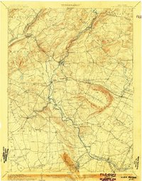 1905 High Bridge1905 Print · USGSHunterdon County at the opening of the twentieth century was a vital junction for New Jersey’s industrial rail lines and river-powered settlements. Researchers can trace the legacy tracks of the Central Railroad of New Jersey and locate early communities like High Bridge, Clinton, and Annandale.4 unique versions available
 - 1905 Map of Hackettstown
 1905 Hackettstown1905 Print · USGSWarren and Morris Counties at the turn of the century show a landscape defined by industrial transport and river valleys. Researchers can trace the historic Morris Canal and the complex rail networks serving towns like Hackettstown, Vienna, and Oxford.5 unique versions available
 - 1943 Map of High Bridge
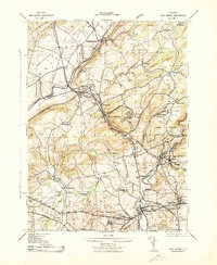 1943 High Bridge1943 Print · USGSWestern New Jersey industrial and institutional corridors are meticulously mapped here during the early war years. Genealogists and historians can trace family locations near the NJ State Hospital or the Grobelis Farm, and identify vanished local landmarks like the Air Raid Station and Asbury Graphite Refinery.
 - 1943 Map of Hackettstown
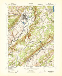 1943 Hackettstown1943 Print · USGSNew Jersey's northwestern hills and valleys come alive in this wartime survey, showing the industry and landscapes of the Musconetcong and Raritan watersheds. Genealogists and historians can trace rail lines to the N J Hosiery Mill, the State Fish Hatchery, and rural centers like Drakestown and Springtown.
 - 1943 Map of Washington
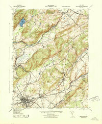 1943 Washington1943 Print · USGSWarren County at the height of the second World War reveals a busy landscape of industry and rail. Genealogists can trace family names at the Pequest Union Cemetery or find historic workplaces like Oxford Furnace and the Magnetite Mine.
 - 1943 Map of Califon
 1943 Califon1943 Print · USGSHunterdon County during the early 1940s maintains its agrarian character along the winding South Branch Raritan River. Genealogists and historians can trace the foundations of local life at New Germantown, the Burrill Mine, and the N. J. State Reformatory.
 - 1944 Map of Newark, 1971 Print
 1944 Newark1971 Print · USGSThe industrial corridor from Philadelphia to New York was in a period of massive transition during the mid-forties. Genealogists and researchers can trace the rail lines of the Lehigh Valley RR, locate military installations like Picatinny Arsenal, and explore the early sprawl near Levittown.5 unique versions available
 - 1949 Map of Newark
 1949 Newark1949 Print · USGSThe industrial corridor between Philadelphia and New York comes alive in this post-war survey. Genealogists and historians can trace the massive rail networks of the Reading Railroad and locate major installations like Fort Dix or Picatinny Arsenal.2 unique versions available
 - 1953 Map of Hackettstown, 1955 Print
 1953 Hackettstown1955 Print · USGSIn the early 1950s, the Musconetcong Valley was a hub of rail activity and collegiate life. Trace the old lines of the Lackawanna Railroad and discover vanished local landmarks like Hackettstown Airfield and the Middle Valley School.6 unique versions available
 - 1954 Map of Washington, 1955 Print
 1954 Washington1955 Print · USGSWarren County in the mid-fifties is characterized by its prominent ridges and a transport network connecting historic valley settlements. Researchers can trace the legacy of the local iron industry near Oxford or explore rail-side communities like Port Colden and Port Murray.6 unique versions available
 - 1954 Map of Califon, 1955 Print
 1954 Califon1955 Print · USGSHunterdon County was a region of river-carved valleys and rail-fed villages in the mid-1950s. Genealogists can trace family names through Fairmount Cem and Union Cem, or locate rural landmarks like McCrea Mills and the State Reformatory.5 unique versions available
 - 1954 Map of High Bridge, 1957 Print
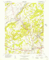 1954 High Bridge1957 Print · USGSMid-century Hunterdon County is captured here as a landscape of industrial river towns and sprawling state institutions. Genealogists and local historians can trace family plots at Evergreen Cem or locate the old Stone Mill near the waters of Lake Solitude.5 unique versions available
 - 1956 Map of Newark
 1956 Newark1956 Print · USGSThe industrial heart of the Mid-Atlantic is captured here at the dawn of the highway era, tracing the dense corridors between Newark and Philadelphia. Genealogists and local historians can map the rail networks of the Reading RR or locate mid-century military life at Fort Dix Military Reservation.2 unique versions available
 - 1957 Map of Newark
 1957 Newark1957 Print · USGSThe industrial and military heart of the Mid-Atlantic is mapped during its post-war suburban boom. Genealogists and historians can trace the intricate rail corridors of the Reading Railroad and locate key landmarks from Princeton University to Fort Hancock.
 - 1960 Map of Newark
 1960 Newark1960 Print · USGSThe industrial heart of the Mid-Atlantic is shown at mid-century, stretching from the dense urban centers of Newark and Philadelphia to the Blue Mountain ridges. Researchers can trace historic rail lines, coastal defenses at Fort Hancock, and the riverfront growth of Trenton and Easton.3 unique versions available
 - 1964 Map of Newark
 1964 Newark1964 Print · USGSGreater New Jersey and eastern Pennsylvania appear at the peak of their industrial and rail-centered development in the mid-sixties. Genealogists and historians can trace the paths of the Pennsylvania RR, identify mid-century landmarks like CAMP KILMER, or follow the Schuylkill River through READING.2 unique versions available
 - 1984 Map of Newark, 1985 Print
 1984 Newark1985 Print · USGSNorthern New Jersey's massive industrial and transit network is on full display in the mid-eighties, showing the region just before modern redevelopment. Genealogists and historians can trace the dense urban grids of Newark, find historic landmarks like Ellis Island, and locate the sprawling Picatinny Arsenal in the western hills.
 - 1986 Map of Newark, 1987 Print
 1986 Newark1987 Print · USGSNorthern New Jersey during the mid-eighties shows an incredible transition from the industrial harbor to the wooded Highlands. Researchers can trace the massive footprints of Picatinny Arsenal and Newark International Airport or explore protected lands like the Great Swamp National Wildlife Refuge.
Showing maps 1-25 of 45
Top cities near Lebanon Township
- Bridgewater Township historical maps
- Hillsborough Township historical maps
- Mount Olive historical maps
- Raritan Township historical maps
- Roxbury Township historical maps
- Readington Township historical maps
See more
Top neighborhoods of Lebanon Township
- Anthony historical maps
- Bunnvale historical maps
- New Hampton historical maps
- Newport historical maps
- Red Mill historical maps
- Spruce Run historical maps
See more
Frequently asked questions
- What are the different types of historical maps available for Lebanon Township?
- What is the oldest map of Lebanon Township?
- Where can I purchase historical maps of Lebanon Township for my home or office?
- Where can I download high-res historical maps of Lebanon Township?
- Are there historical topographic maps available for Lebanon Township?
- Is there historical aerial imagery available for Lebanon Township?
- Where are historical maps of Lebanon Township sourced from?