Old Maps of Princeton, New Jersey
Explore 24 old maps of Princeton, spanning from 1888 to today. These high-resolution historic maps reveal how streets, neighborhoods, landmarks, and natural features evolved over time — perfect for genealogy, metal detecting, research, and local history exploration.
What you can do with these maps:
- See how Princeton changed over time: Compare historical maps to modern-day views to trace roads, homesites, rail lines & more.
- View detailed metadata: Each map includes creators, publishers, year, scale, and archive source.
- Overlay maps with satellite & LiDAR: Visualize the past alongside modern tools to explore terrain & human change.
- Trusted historical sources: Maps sourced from the USGS, Library of Congress, and other archives.
- Access maps your way: View online, download high-res files, or order prints for personal or research use.
Start exploring old maps of Princeton to uncover forgotten places, hidden landmarks, and the deep history beneath your feet.
Princeton, NJ maps
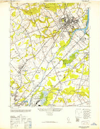
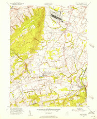
(24)- 1888 Map of Princeton
 1888 Princeton1888 Print · USGSCovers Princeton, including Hamilton Township, Franklin Township, and other nearby areas
 - 1894 Map of Princeton
 1894 Princeton1894 Print · USGSCovers Princeton, including Hamilton Township, Franklin Township, and other nearby areas2 unique versions available
 - 1906 Map of Princeton
 1906 Princeton1906 Print · USGSCovers Princeton, including Hamilton Township, Franklin Township, and other nearby areas5 unique versions available
 - 1907 Map of Trenton
 1907 Trenton1907 Print · USGSCovers Princeton, including Philadelphia, Hamilton Township, and other nearby areas4 unique versions available
 - 1942 Map of Hightstown
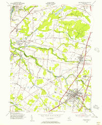
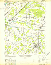 1942 Hightstown1942 Print · USGSCovers Princeton, including Franklin Township, South Brunswick, and other nearby areas
 - 1943 Map of Rocky Hill
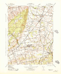 1943 Rocky Hill1943 Print · USGSCovers Princeton, including Franklin Township, Hillsborough Township, and other nearby areas
 - 1944 Map of Newark, 1971 Print
 1944 Newark1971 Print · USGSCovers Princeton, including New York, Philadelphia, and other nearby areas5 unique versions available
 - 1946 Map of Princeton, 1952 Print
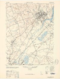 1946 Princeton1952 Print · USGSCovers Princeton, including Hamilton Township, Ewing Township, and other nearby areas
 - 1947 Map of Monmouth Junction
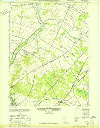 1947 Monmouth Junction1947 Print · USGSCovers Princeton, including Franklin Township, South Brunswick, and other nearby areas
 - 1949 Map of Newark
 1949 Newark1949 Print · USGSCovers Princeton, including New York, Philadelphia, and other nearby areas3 unique versions available
 - 1952 Map of Princeton
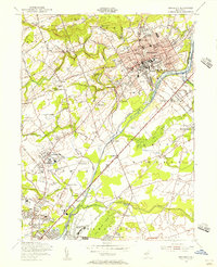
 1952 Princeton1952 Print · USGSCovers Princeton, including Hamilton Township, Ewing Township, and other nearby areas
 - 1954 Map of Princeton, 1956 Print
 1954 Princeton1956 Print · USGSCovers Princeton, including Hamilton Township, Ewing Township, and other nearby areas4 unique versions available
 - 1954 Map of Hightstown, 1956 Print
 1954 Hightstown1956 Print · USGSCovers Princeton, including Franklin Township, South Brunswick, and other nearby areas5 unique versions available
 - 1954 Map of Monmouth Junction, 1956 Print
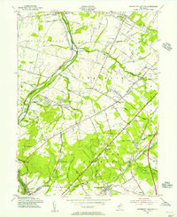 1954 Monmouth Junction1956 Print · USGSCovers Princeton, including Franklin Township, South Brunswick, and other nearby areas6 unique versions available
 - 1954 Map of Rocky Hill, 1956 Print
 1954 Rocky Hill1956 Print · USGSCovers Princeton, including Franklin Township, Hillsborough Township, and other nearby areas4 unique versions available
 - 1956 Map of Newark
 1956 Newark1956 Print · USGSCovers Princeton, including New York, Philadelphia, and other nearby areas2 unique versions available
 - 1957 Map of Newark
 1957 Newark1957 Print · USGSCovers Princeton, including New York, Philadelphia, and other nearby areas
 - 1960 Map of Newark
 1960 Newark1960 Print · USGSCovers Princeton, including New York, Philadelphia, and other nearby areas3 unique versions available
 - 1964 Map of Newark
 1964 Newark1964 Print · USGSCovers Princeton, including New York, Philadelphia, and other nearby areas2 unique versions available
 - 1982 Map of Trenton, 1983 Print
 1982 Trenton1983 Print · USGSCovers Princeton, including New York, Philadelphia, and other nearby areas
 - 1986 Map of Trenton, 1987 Print
 1986 Trenton1987 Print · USGSCovers Princeton, including New York, Philadelphia, and other nearby areas
 - 1995 Map of Hightstown, 2000 Print
 1995 Hightstown2000 Print · USGSCovers Princeton, including Franklin Township, South Brunswick, and other nearby areas
 - 1995 Map of Princeton, 2000 Print
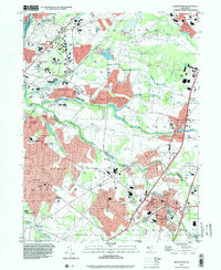
 1995 Princeton2000 Print · USGSCovers Princeton, including Hamilton Township, Ewing Township, and other nearby areas
 - 1995 Map of Rocky Hill, 2000 Print
 1995 Rocky Hill2000 Print · USGSCovers Princeton, including Franklin Township, Hillsborough Township, and other nearby areas
End of results
Showing maps 1-24 of 24
Top cities near Princeton
- Hamilton Township historical maps
- Trenton historical maps
- Franklin Township historical maps
- Jackson Township historical maps
- Levittown historical maps
- Piscataway Township historical maps
See more
Top neighborhoods of Princeton
- Cedar Grove historical maps
- Coxs Corner historical maps
- Western Section historical maps
- Witherspoon-Jackson historical maps
- Battlefield Area historical maps
- Edgerstoune historical maps
See more
Frequently asked questions
- What are the different types of historical maps available for Princeton?
- What is the oldest map of Princeton?
- Where can I purchase historical maps of Princeton for my home or office?
- Where can I download high-res historical maps of Princeton?
- Are there historical topographic maps available for Princeton?
- Is there historical aerial imagery available for Princeton?
- Where are historical maps of Princeton sourced from?