1950s Maps of Edison, New Jersey
Explore 6 historic maps of Edison from the 1950s. These maps offer a rare glimpse into what life looked like during the 1950s — showing old roads, neighborhoods, homes, and landmarks that have changed or disappeared over time.
Whether you're researching your family's past, planning a metal detecting trip, or studying how Edison's landscape evolved across the 1950s, these high-resolution maps are a powerful tool for exploring the history of this region.
- Focus on a specific era: All maps on this page are from the 1950s, giving you a focused view of this time period.
- See what’s changed: Compare century-old streets, trails, and buildings to today's modern landscape using overlays and satellite layers.
- Research with precision: Use these maps for genealogy, historical research, land use analysis, or educational projects.
- View, download, or print: Maps are fully viewable online in high resolution, and can be downloaded or printed for your own records.
Start exploring Edison's history through authentic maps from the 1950s. This is your window into the past.
Edison, NJ maps
(6)- 1954 Map of New Brunswick, 1956 Print
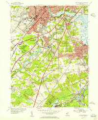 1954 New Brunswick1956 Print · USGSMid-century Middlesex County is captured during a transformative era of suburban growth and institutional expansion. Genealogists and local historians can trace family plots in Elmwood Cemetery or locate old schoolhouses like Weber Sch and McGinnis Sch.5 unique versions available
 - 1954 Map of South Amboy, 1957 Print
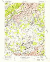
 1954 South Amboy1957 Print · USGSMid-century Middlesex County is captured here during a period of rapid suburban and industrial expansion along the Raritan Bay. Researchers can trace family sites from Sayreville to Old Bridge, finding local landmarks like the Sacred Heart Sch and the Auto Race Track.6 unique versions available
 - 1955 Map of Plainfield, 1957 Print
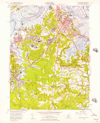
 1955 Plainfield1957 Print · USGSMid-century New Jersey comes to life as industrial rail corridors and the sprawling US Military Reservation Camp Kilmer meet expanding suburbs. Trace early flight at Hadley Airport and local roots at Sacred Heart Sch or Pumptown.5 unique versions available
 - 1956 Map of Newark
 1956 Newark1956 Print · USGSThe industrial heart of the Mid-Atlantic is captured here at the dawn of the highway era, tracing the dense corridors between Newark and Philadelphia. Genealogists and local historians can map the rail networks of the Reading RR or locate mid-century military life at Fort Dix Military Reservation.2 unique versions available
 - 1956 Map of Perth Amboy, 1958 Print
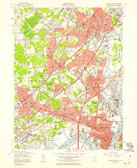 1956 Perth Amboy1958 Print · USGSMiddlesex County emerges as a suburban and industrial powerhouse in the mid-fifties as major highways reshape the landscape. Local researchers can trace family roots through numerous numbered schools and parish sites like St Cecilias Sch or the Edison Memorial Tower.6 unique versions available
 - 1957 Map of Newark
 1957 Newark1957 Print · USGSThe industrial and military heart of the Mid-Atlantic is mapped during its post-war suburban boom. Genealogists and historians can trace the intricate rail corridors of the Reading Railroad and locate key landmarks from Princeton University to Fort Hancock.
End of results
Showing maps 1-6 of 6
Top cities near Edison
- New York historical maps
- Newark historical maps
- Elizabeth historical maps
- Woodbridge Township historical maps
- Franklin Township historical maps
- East Orange historical maps
See more
Top neighborhoods of Edison
- Haven Homes historical maps
- Stelton historical maps
- Lahiere historical maps
- Valentine historical maps
- Washington Park historical maps
- Lindenau historical maps
See more
Frequently asked questions
- What are the different types of historical maps available for Edison?
- What is the oldest map of Edison?
- Where can I purchase historical maps of Edison for my home or office?
- Where can I download high-res historical maps of Edison?
- Are there historical topographic maps available for Edison?
- Is there historical aerial imagery available for Edison?
- Where are historical maps of Edison sourced from?