2020s Maps of Manalapan Township, New Jersey
Explore 4 historic maps of Manalapan Township from the 2020s. These maps offer a rare glimpse into what life looked like during the 2020s — showing old roads, neighborhoods, homes, and landmarks that have changed or disappeared over time.
Whether you're researching your family's past, planning a metal detecting trip, or studying how Manalapan Township's landscape evolved across the 2020s, these high-resolution maps are a powerful tool for exploring the history of this region.
- Focus on a specific era: All maps on this page are from the 2020s, giving you a focused view of this time period.
- See what’s changed: Compare century-old streets, trails, and buildings to today's modern landscape using overlays and satellite layers.
- Research with precision: Use these maps for genealogy, historical research, land use analysis, or educational projects.
- View, download, or print: Maps are fully viewable online in high resolution, and can be downloaded or printed for your own records.
Start exploring Manalapan Township's history through authentic maps from the 2020s. This is your window into the past.
Manalapan Township, NJ maps
(4)- 2023 Map of Adelphia, 2023 Print
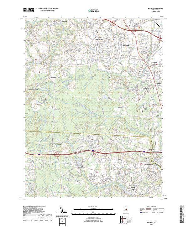 2023 Adelphia2023 Print · USGSMonmouth and Ocean Counties are shown here during a period of modern suburban expansion atop a colonial-era milling landscape. Researchers can trace historic crossroad settlements and old mill sites like Oakland Mills, Wyckoff Mills, and Jacksons Mills.
 - 2023 Map of Freehold, 2023 Print
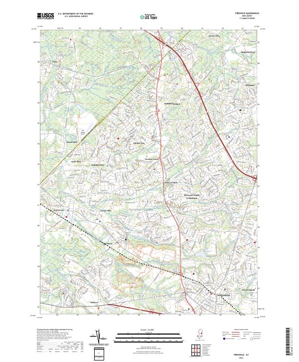 2023 Freehold2023 Print · USGSMonmouth County's suburban development and colonial heritage are visible in this recent study of the Freehold area. Genealogists and local historians can locate the Old Tennent Cem, the Monmouth County Courthouse, and the Old Bridge Airport.
 - 2023 Map of Jamesburg, 2023 Print
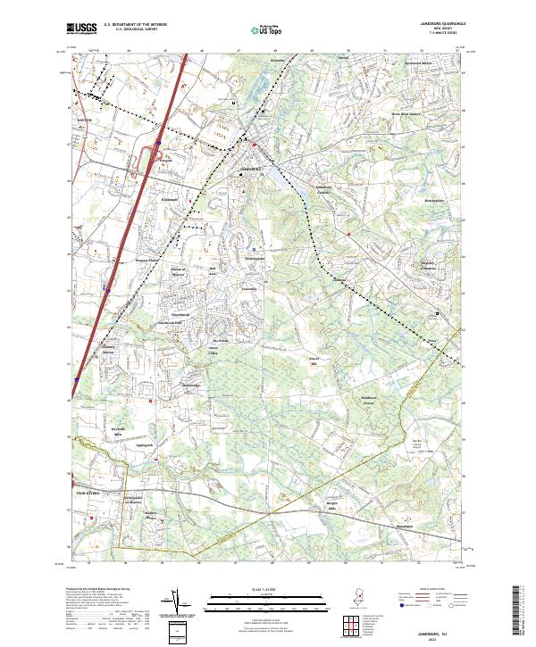 2023 Jamesburg2023 Print · USGSMiddlesex County in the early twenty-first century reveals a intricate landscape of planned communities and ancient watercourses. Researchers can locate family roots in Fernwood Cem or trace the early industrial footprint of Wyckoffs Mills and Cranbury Station.
 - 2023 Map of Roosevelt, 2023 Print
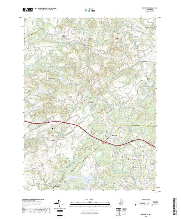 2023 Roosevelt2023 Print · USGSMonmouth County's interior settlements and rural crossroads are captured here during a period of modern growth. Genealogists and local historians can trace early community roots at the Old Yellow Meeting House Cem or explore the water-powered legacy of Francis Mills and Stone Tavern.
End of results
Showing maps 1-4 of 4
Top cities near Manalapan Township
- New York historical maps
- Edison historical maps
- Woodbridge Township historical maps
- Toms River historical maps
- Lakewood Township historical maps
- Brick Township historical maps
See more
Top neighborhoods of Manalapan Township
- Yorketown historical maps
- Lafayette Mills historical maps
- Clarks Mills historical maps
- Gordons Corner historical maps
- Oakland Mills historical maps
- Taylors Mills historical maps
See more
Frequently asked questions
- What are the different types of historical maps available for Manalapan Township?
- What is the oldest map of Manalapan Township?
- Where can I purchase historical maps of Manalapan Township for my home or office?
- Where can I download high-res historical maps of Manalapan Township?
- Are there historical topographic maps available for Manalapan Township?
- Is there historical aerial imagery available for Manalapan Township?
- Where are historical maps of Manalapan Township sourced from?