Old Maps of Capitan Hill, New Mexico for Metal Detecting
Plan your next treasure hunt with 10 historic maps of Capitan Hill. Find old homesites, ghost towns, trails, and gathering spots that may be lost to time — perfect for identifying promising metal detecting locations.
- Locate forgotten sites: Uncover places like long-lost settlements, abandoned rail lines, or gathering spots.
- Plan better hunts: Use map overlays combined with LiDAR or satellite views to narrow in on historically rich areas.
- Made for detectorists: Thousands of hobbyists use these maps to discover relics, coins, and hidden history.
Use these historic maps to boost your research and find new opportunities beneath the surface of Capitan Hill.
Capitan Hill, NM maps
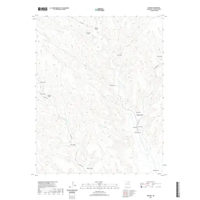
(10)- 1954 Map of Raton, 1963 Print
 1954 Raton1963 Print · USGSNorthern New Mexico's high-country and plains are documented here in the early sixties, showing the region's ranching and mining infrastructure. Trace the legacy of the Maxwell Land Grant, locate remote rural sites like Tafoya School, and follow the Atchison Topeka and Santa Fe Railway through the heart of Raton.3 unique versions available
 - 1955 Map of Cimarron
 1955 Cimarron1955 Print · USGSNorthern New Mexico's ranching and mining heartland is captured here in the mid-fifties, centered on the historic Maxwell Grant. Researchers can trace early infrastructure like the Old Railroad Grade and Dawson Trail, or locate the Umbrella Mine near Dawson.3 unique versions available
 - 1958 Map of Raton
 1958 Raton1958 Print · USGSNorthern New Mexico and the Colorado borderlands are mapped here in the late fifties, showcasing a landscape of high peaks and historic land grants. Genealogists and historians can trace families across Picuris Pueblo, find old schoolhouses like Piedra Lumbre School, or follow the Atchison Topeka and Santa Fe rail line.3 unique versions available
 - 1981 Map of Raton
 1981 Raton1981 Print · USGSNorthern New Mexico's high mesas and mining corridors are preserved here as they appeared in the early eighties. Genealogists and historians can trace the transit networks of the Santa Fe Trail and find company towns like Van Houten and Koehler.
 - 1987 Map of Dawson
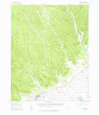
 1987 Dawson1987 Print · USGSIn the canyon-riven country of Colfax County during the 1980s, the settlement of Dawson sits along the winding Vermejo River. Researchers can trace the path of the Atchison Topeka and Santa Fe railroad or locate local landmarks like the Cem and Capitan Hill.
 - 2010 Map of Dawson, 2010 Print
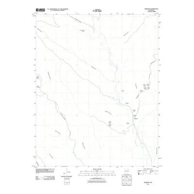 2010 Dawson2010 Print · USGSCovers Capitan Hill, including Dawson, Colfax County, and other nearby areas
 - 2013 Map of Dawson, 2013 Print
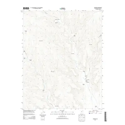 2013 Dawson2013 Print · USGSCovers Capitan Hill, including Dawson, Colfax County, and other nearby areas
 - 2017 Map of Dawson, 2017 Print
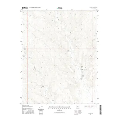 2017 Dawson2017 Print · USGSCovers Capitan Hill, including Dawson, Colfax County, and other nearby areas
 - 2020 Map of Dawson, 2020 Print
 2020 Dawson2020 Print · USGSCovers Capitan Hill, including Dawson, Colfax County, and other nearby areas
 - 2023 Map of Dawson, 2023 Print
 2023 Dawson2023 Print · USGSThe settlement of Dawson and the Vermejo River valley are shown in this contemporary topographical view of northern New Mexico. Researchers can trace the layout of Dawson Cem and the geography of the surrounding Coal Canyon and Capitan Hill.
End of results
Showing maps 1-10 of 10
Top cities near Capitan Hill
Frequently asked questions
- What are the different types of historical maps available for Capitan Hill?
- What is the oldest map of Capitan Hill?
- Where can I purchase historical maps of Capitan Hill for my home or office?
- Where can I download high-res historical maps of Capitan Hill?
- Are there historical topographic maps available for Capitan Hill?
- Is there historical aerial imagery available for Capitan Hill?
- Where are historical maps of Capitan Hill sourced from?