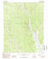
1987 Map of Dawson
USGS Topo · Published 1987About this map
The settlement of Dawson anchors this portion of the Vermejo River valley, situated within the expansive Beaubien and Miranda Grant (Maxwell). In the late 1980s, the landscape here reflects a history shaped by both industry and topography, as evidenced by the Atchison Topeka and Santa Fe railroad alignment following the river's path. Water management infrastructure, including a Headgate, Flume, and Gaging Station, highlights the engineered efforts to utilize the river within this high-altitude environment.
Find a feature on this map
25 named features on this map. Tap any name to fly to it.
Don’t see what you’re looking for? This feature index may not catch every label — zoom into the map to look around manually.
Map Details
Editions of this 1987 Dawson Map
This is the sole edition of this map. No revisions or reprints were ever made.
Other maps of this area

1915 · Brilliant
USGS Topo · 1:62,500

1915 · Koehler
USGS Topo · 1:62,500

1917 · Koehler
USGS Topo · 1:62,500

1954 · Raton
USGS Topo · 1:250,000

1955 · Cimarron
USGS Topo · 1:62,500

1958 · Raton
USGS Topo · 1:250,000

1962 · Casa Grande
USGS Topo · 1:62,500

1971 · Saltpeter Mountain
USGS Topo · 1:24,000
1971 · Curtis Camp
USGS Topo · 1:24,000
1971 · Colfax
USGS Topo · 1:24,000