
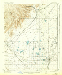
1917 Map of Koehler
USGS Topo · Published 1917About this map
Maxwell Grant covers a substantial portion of this landscape, where the high mesas of the Sangre de Cristo foothills transition into the high plains of northern New Mexico. The Atchison Topeka and Santa Fe railroad serves as the primary corridor for commerce and movement, connecting the mining and ranching outpost of Koehler to the larger settlement of Maxwell. The terrain is characterized by a sophisticated early irrigation network, including the Eagletail Ditch and a numbered series of reservoirs such as Lake No. 2 and Lake No. 11, which sustain ranching operations like the C S Ranch.
Find a feature on this map
57 named features on this map. Tap any name to fly to it.
Don’t see what you’re looking for? This feature index may not catch every label — zoom into the map to look around manually.
Map Details
Editions of this 1917 Koehler Map
2 editions found
Other maps of this area

1912 · Raton
USGS Topo · 1:62,500

1914 · Raton
USGS Topo · 1:62,500

1915 · Brilliant
USGS Topo · 1:62,500

1915 · Koehler
USGS Topo · 1:62,500

1954 · Raton
USGS Topo · 1:250,000

1955 · Cimarron
USGS Topo · 1:62,500

1956 · Miami
USGS Topo · 1:62,500

1958 · Raton
USGS Topo · 1:250,000

1962 · Casa Grande
USGS Topo · 1:62,500

1965 · Abbott NW
USGS Topo · 1:24,000