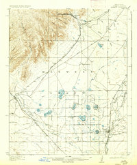
1917 Map of Koehler
USGS Topo · Published 1937About this map
The Maxwell Grant dominates this early twentieth-century landscape, illustrating a region defined by extensive land holdings and an expanding irrigation network. The settlement of Maxwell serves as a central hub near the Canadian River, where the Atchison Topeka and Santa Fe railroad meets a complex system of numbered reservoirs and ditches, including the Eagletail Ditch and Stubblefield Lake. This water management system supported the rural community and schools like Grand Valley School and Red River School.
Find a feature on this map
52 named features on this map. Tap any name to fly to it.
Don’t see what you’re looking for? This feature index may not catch every label — zoom into the map to look around manually.
Map Details
Editions of this 1917 Koehler Map
2 editions found
Other maps of this area

1912 · Raton
USGS Topo · 1:62,500

1914 · Raton
USGS Topo · 1:62,500

1915 · Brilliant
USGS Topo · 1:62,500

1915 · Koehler
USGS Topo · 1:62,500

1917 · Koehler
USGS Topo · 1:62,500

1954 · Raton
USGS Topo · 1:250,000

1955 · Cimarron
USGS Topo · 1:62,500

1956 · Miami
USGS Topo · 1:62,500

1958 · Raton
USGS Topo · 1:250,000

1962 · Casa Grande
USGS Topo · 1:62,500