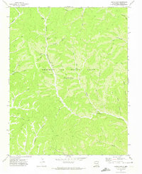
1971 Map of Curtis Camp
USGS Topo · Published 1974About this map
Beaubien and Miranda Grant (Maxwell) lands dominate this 1970s survey, illustrating a landscape defined by industrial exploration and complex drainage systems. The map centers on the high-elevation settlement of Curtis Camp, surrounded by an intricate network of Jeep Trails that negotiate the steep terrain. Evidence of mineral prospecting is visible through numerous Drill Holes and Drift Holes, particularly concentrated near Coal Canyon and McClellan Canyon.
Find a feature on this map
27 named features on this map. Tap any name to fly to it.
Don’t see what you’re looking for? This feature index may not catch every label — zoom into the map to look around manually.
Map Details
Editions of this 1971 Curtis Camp Map
This is the sole edition of this map. No revisions or reprints were ever made.
Other maps of this area

1915 · Brilliant
USGS Topo · 1:62,500

1915 · Koehler
USGS Topo · 1:62,500

1917 · Koehler
USGS Topo · 1:62,500

1954 · Raton
USGS Topo · 1:250,000

1955 · Cimarron
USGS Topo · 1:62,500

1958 · Raton
USGS Topo · 1:250,000

1962 · Casa Grande
USGS Topo · 1:62,500

1971 · Saltpeter Mountain
USGS Topo · 1:24,000
1971 · Red River Peak
USGS Topo · 1:24,000
1971 · Koehler
USGS Topo · 1:24,000