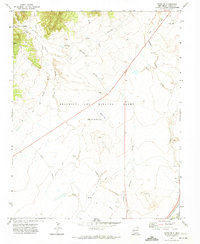
1971 Map of Koehler
USGS Topo · Published 1974About this map
Industrial history and vast land grants define this portion of Colfax County, where the coal mining operations at Koehler are clearly marked. The map details the remnants of the town's productive era, including the Coke Ovens and the Ox Canyon Mine near the head of Crow Canyon. This landscape is part of the massive Beaubien and Miranda Grant (Maxwell), illustrating the enduring influence of Spanish and Mexican land grants on New Mexico's geography.
Find a feature on this map
24 named features on this map. Tap any name to fly to it.
Don’t see what you’re looking for? This feature index may not catch every label — zoom into the map to look around manually.
Map Details
Editions of this 1971 Koehler Map
This is the sole edition of this map. No revisions or reprints were ever made.
Other maps of this area

1912 · Raton
USGS Topo · 1:62,500

1914 · Raton
USGS Topo · 1:62,500

1915 · Brilliant
USGS Topo · 1:62,500

1915 · Koehler
USGS Topo · 1:62,500

1917 · Koehler
USGS Topo · 1:62,500

1954 · Raton
USGS Topo · 1:250,000

1958 · Raton
USGS Topo · 1:250,000

1971 · Clifton House
USGS Topo · 1:24,000

1971 · Saltpeter Mountain
USGS Topo · 1:24,000
1971 · Curtis Camp
USGS Topo · 1:24,000