1900s (20th Century) Maps of Carrizozo, New Mexico
Explore 9 historic maps of Carrizozo from the 1900s (20th Century). These maps offer a rare glimpse into what life looked like during the 1900s — showing old roads, neighborhoods, homes, and landmarks that have changed or disappeared over time.
Whether you're researching your family's past, planning a metal detecting trip, or studying how Carrizozo's landscape evolved across the 1900s, these high-resolution maps are a powerful tool for exploring the history of this region.
- Focus on a specific era: All maps on this page are from the 1900s, giving you a focused view of this time period.
- See what’s changed: Compare century-old streets, trails, and buildings to today's modern landscape using overlays and satellite layers.
- Research with precision: Use these maps for genealogy, historical research, land use analysis, or educational projects.
- View, download, or print: Maps are fully viewable online in high resolution, and can be downloaded or printed for your own records.
Start exploring Carrizozo's history through authentic maps from the 1900s. This is your window into the past.
Carrizozo, NM maps
(9)- 1938 Map of Carrizozo
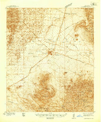 1938 Carrizozo1938 Print · USGSLincoln County in the late 1930s centers on the rail hub of Carrizozo as it transitions from a mining-era landscape to a modern ranching community. Genealogists and local historians can locate early family holdings like Spencer Ranch and remote sites such as Degners Mine.
 - 1943 Map of Carrizozo
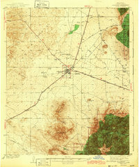 1943 Carrizozo1943 Print · USGSCarrizozo and the high desert of Lincoln County are captured here just before the mid-century, centered on a busy junction of the Southern Pacific railroad. Genealogists and historians can trace legacy holdings like Spencer Ranch and Roberts Ranch or the early layout of the Carrizozo Country Club.
 - 1950 Map of Carrizozo, 1954 Print
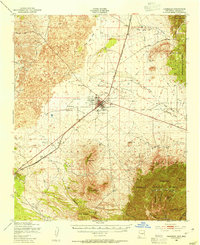 1950 Carrizozo1954 Print · USGSCarrizozo and the surrounding high desert of Lincoln County are captured here at mid-century, centered on the Southern Pacific rail junction. Researchers can trace local history through Evergreen Cemetery, the Junction Mine, and old sidings like Robsart.4 unique versions available
 - 1955 Map of Roswell, 1974 Print
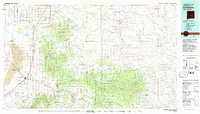
 1955 Roswell1974 Print · USGSSoutheastern New Mexico is shown in transition during the mid-fifties, from the Pecos Valley ranching hubs to the high timber of the Sacramento Mountains. Researchers can trace the Atchison Topeka and Santa Fe RR through Roswell and Hagerman or locate the old barracks at Ft Stanton.3 unique versions available
 - 1958 Map of Roswell
 1958 Roswell1958 Print · USGSThe High Plains and mountain peaks of New Mexico are captured here during the mid-fifties, showing the region before the closure of Walker Air Force Base. Researchers can trace the ranching and rail landscape from Lincoln to the Pecos River valley through Hagerman and Lake Arthur.
 - 1962 Map of Roswell
 1962 Roswell1962 Print · USGSSoutheastern New Mexico in the early sixties shows a landscape defined by high mountain peaks and a growing military presence at Roswell. Genealogists and historians can trace the roads connecting Fort Stanton, Capitan, and the Mescalero Apache Indian Reservation.
 - 1981 Map of Carrizozo
 1981 Carrizozo1981 Print · USGSHigh desert plains meet the timbered slopes of the Capitan and Jicarilla Mountains in the early 1980s. Genealogists and historians can trace rail-side towns like Carrizozo and old mining sites such as the American Mine and the settlement of White Oaks.2 unique versions available
 - 1982 Map of Carrizozo West
 1982 Carrizozo West1982 Print · USGSCarrizozo and the edges of the great lava flows are captured in the early eighties as the town developed along the Southern Pacific tracks. Genealogists and researchers can locate the Evergreen Cem, Scott Spring, and the old Drive-in Theater.
 - 1982 Map of Carrizozo East
 1982 Carrizozo East1982 Print · USGSThe town of Carrizozo and its vital railroad corridor are shown in the early 1980s, flanked by high desert peaks and National Forest land. Researchers can trace local water and ranch history through sites like Manchester Spring, Fetters Spring, and Robsart.
End of results
Showing maps 1-9 of 9
Top cities near Carrizozo
Frequently asked questions
- What are the different types of historical maps available for Carrizozo?
- What is the oldest map of Carrizozo?
- Where can I purchase historical maps of Carrizozo for my home or office?
- Where can I download high-res historical maps of Carrizozo?
- Are there historical topographic maps available for Carrizozo?
- Is there historical aerial imagery available for Carrizozo?
- Where are historical maps of Carrizozo sourced from?