Old Maps of Waterloo, New Mexico for Genealogy
Trace your family roots with 15 historic maps of Waterloo. These high-res maps reveal old neighborhoods, homesites, landmarks, and streets — helping you uncover where your ancestors lived and how the area evolved over time.
- Explore historic neighborhoods: Identify where your relatives may have lived in the 1800s or 1900s.
- Compare maps over time: Trace the changes in streets, buildings, and landmarks for multi-generational research.
- Perfect for genealogy & ancestry research: Used by family historians and researchers to map out lineage and migration.
These maps are an incredible resource for exploring your personal connection to Waterloo's past.
Waterloo, NM maps
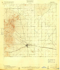
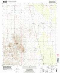
(15)- 1917 Map of Columbus, 1920 Print
 1917 Columbus1920 Print · USGSThe high desert of southern Luna County comes alive in this late-1910s survey of the international border region near Columbus. Researchers can trace the rail corridor of the El Paso and Southwestern and locate remote landmarks like Stephenson Ranch and the Boundary Gate.3 unique versions available
 - 1918 Map of Columbus
 1918 Columbus1918 Print · USGSThe New Mexico borderlands come alive in this survey of the high desert during a period of intense military and rail activity. Genealogists and historians can trace family outposts from Stephenson Ranch to Waterloo, while following the El Paso and Southwestern rail line as it nears the United States Mexico Boundary Line.2 unique versions available
 - 1920 Map of Columbus, 1931 Print
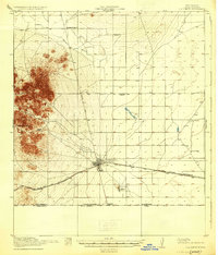 1920 Columbus1931 Print · USGSThe New Mexico borderlands come into focus in the years following the border raids, centered on the strategic railroad town of Columbus. Family historians can trace early ranching life at Stephenson Ranch or locate vanished rural outposts like Waterloo and Mayfield School.3 unique versions available
 - 1953 Map of El Paso
 1953 El Paso1953 Print · USGSEl Paso and the border region are shown here in the early fifties, documenting a landscape of shared river life and rising military presence. Genealogists and historians can trace rail-tied communities like Smeltertown, San Elizario, and the grounds of Fort Bliss.
 - 1959 Map of El Paso, 1968 Print
 1959 El Paso1968 Print · USGSEl Paso and the international borderlands come alive in this mid-century survey of the Chihuahuan Desert. Genealogists and historians can trace rail-side settlements like Columbus and Fabens, locate the sprawling Fort Bliss, and explore the geologically unique Kilbourne Hole.2 unique versions available
 - 1964 Map of El Paso
 1964 El Paso1964 Print · USGSThe El Paso and Juarez borderlands are shown in detail during the mid-sixties, from the urban center to the remote volcanic craters of the West Potrillo Mountains. Trace the rail-and-river network through Asarco Smeltertown, the Fort Bliss Military Reservation, and Columbus.
 - 1965 Map of El Paso
 1965 El Paso1965 Print · USGSEl Paso and the Mesilla Valley are shown in the mid-1960s as the region's military and transport infrastructure expanded. Researchers can trace the irrigation network along the Rio Grande, find old border stations like Columbus, and locate Hueco Tanks.
 - 1965 Map of North Peak, 1967 Print
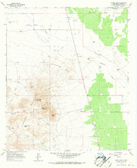 1965 North Peak1967 Print · USGSMid-century Luna County comes into focus in this detailed topographic survey of the high desert and mountain peaks. Researchers can locate remote ranching outposts and mineral sites like the Lindy Ann Mine, Inmon Ranch, and the isolated Lonesome Cabin.2 unique versions available
 - 1981 Map of Columbus
 1981 Columbus1981 Print · USGSSouthern New Mexico’s borderlands are detailed here in the early eighties, centered on the historic village of Columbus. Researchers can trace the legacy of mining and transit through the Mahoney Mines, the Old Railroad Grade, and the grounds of Pancho Villa State Park.
 - 1996 Map of North Peak, 2003 Print
 1996 North Peak2003 Print · USGSSouthern New Mexico ranching and mining come into focus during the mid-1990s as the high peaks of the Florida Mountains region are surveyed. Researchers can trace land use through remote outposts like Inmon Ranch, the Lindy Ann Mine, and the arid paths of Seventysix Draw.
 - 2010 Map of North Peak, 2010 Print
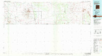
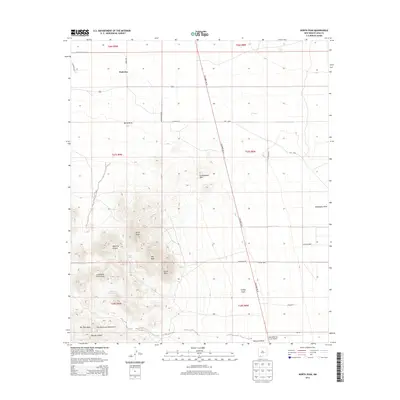
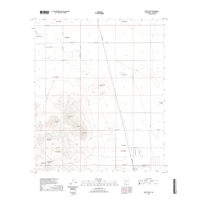
 2010 North Peak2010 Print · USGSCovers Waterloo, including Luna County, United States, and other nearby areas
 - 2013 Map of North Peak, 2013 Print
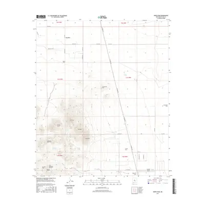
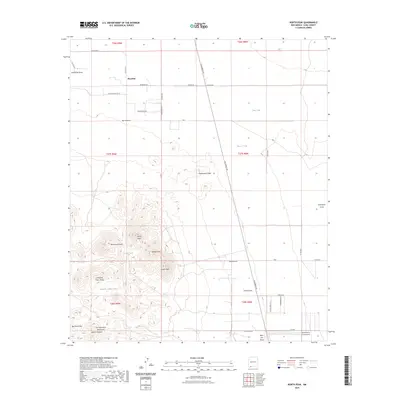
 2013 North Peak2013 Print · USGSCovers Waterloo, including Luna County, United States, and other nearby areas
 - 2017 Map of North Peak, 2017 Print
 2017 North Peak2017 Print · USGSCovers Waterloo, including Luna County, United States, and other nearby areas
 - 2020 Map of North Peak, 2020 Print
 2020 North Peak2020 Print · USGSCovers Waterloo, including Luna County, United States, and other nearby areas
 - 2023 Map of North Peak, 2023 Print
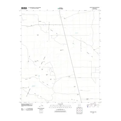
 2023 North Peak2023 Print · USGSSouthern New Mexico’s high desert and the jagged peaks of the Tres Hermanas are captured here in the early twenty-first century. Researchers can trace the drainage of Seventysix Draw and locate local landmarks like Waterloo and the Hacienda Sur Luna Airport.
End of results
Showing maps 1-15 of 15
Top cities near Waterloo
Frequently asked questions
- What are the different types of historical maps available for Waterloo?
- What is the oldest map of Waterloo?
- Where can I purchase historical maps of Waterloo for my home or office?
- Where can I download high-res historical maps of Waterloo?
- Are there historical topographic maps available for Waterloo?
- Is there historical aerial imagery available for Waterloo?
- Where are historical maps of Waterloo sourced from?