1960s Maps of Kirtland, New Mexico
Explore 4 historic maps of Kirtland from the 1960s. These maps offer a rare glimpse into what life looked like during the 1960s — showing old roads, neighborhoods, homes, and landmarks that have changed or disappeared over time.
Whether you're researching your family's past, planning a metal detecting trip, or studying how Kirtland's landscape evolved across the 1960s, these high-resolution maps are a powerful tool for exploring the history of this region.
- Focus on a specific era: All maps on this page are from the 1960s, giving you a focused view of this time period.
- See what’s changed: Compare century-old streets, trails, and buildings to today's modern landscape using overlays and satellite layers.
- Research with precision: Use these maps for genealogy, historical research, land use analysis, or educational projects.
- View, download, or print: Maps are fully viewable online in high resolution, and can be downloaded or printed for your own records.
Start exploring Kirtland's history through authentic maps from the 1960s. This is your window into the past.
Kirtland, NM maps
(4)- 1963 Map of Youngs Lake, 1966 Print
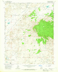 1963 Youngs Lake1966 Print · USGSThe high desert of San Juan County was an active energy frontier in the early 1960s, where industrial development met traditional reservation lands. Trace the footprint of the oil and gas industry at Flare Hill and the Refinery, or locate early recreation spots like Macu Racetrack.3 unique versions available
 - 1963 Map of Waterflow, 1966 Print
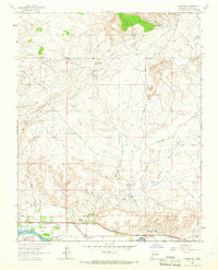 1963 Waterflow1966 Print · USGSJewett Valley and Waterflow sit along the San Juan River in the early sixties, caught between traditional irrigation and a growing energy economy. Researchers can trace local coal history at the Adamson Mines or locate family sites like the Jewett Valley Cem and Sacred Heart Academy.3 unique versions available
 - 1966 Map of Fruitland, 1969 Print
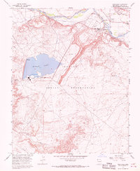 1966 Fruitland1969 Print · USGSIn the mid-sixties, this San Juan County area shows the industrial rise of the Navajo Indian Reservation. Researchers can trace the massive Navajo Mine and Four Corners Powerplant alongside the Nenahnezad Indian Sch and Fruitland.3 unique versions available
 - 1966 Map of Kirtland, 1969 Print
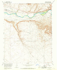 1966 Kirtland1969 Print · USGSSan Juan County comes into focus during the mid-sixties as irrigation and energy production transformed the river valley. Genealogists and historians can locate family landmarks like St Michael Ch, Central High Sch, and the Univ of New Mexico Experimental Farm.2 unique versions available
End of results
Showing maps 1-4 of 4
Top cities near Kirtland
Frequently asked questions
- What are the different types of historical maps available for Kirtland?
- What is the oldest map of Kirtland?
- Where can I purchase historical maps of Kirtland for my home or office?
- Where can I download high-res historical maps of Kirtland?
- Are there historical topographic maps available for Kirtland?
- Is there historical aerial imagery available for Kirtland?
- Where are historical maps of Kirtland sourced from?