Old Maps of Navajo Dam, New Mexico for Academic Research
Study the evolution of Navajo Dam with 14 high-resolution historic maps. Whether you're teaching, researching, or modeling changes in land use, these maps provide essential visual documentation of urban, environmental, and geographic change.
- Analyze long-term change: Track patterns in development, transportation, and natural features.
- Ideal for environmental or urban studies: Support academic projects with primary historical map data.
- Use in the classroom or lab: Educators and researchers rely on these maps to bring historical context to life.
These maps are a powerful tool for teaching, research, and visualizing how Navajo Dam has changed over the decades.
Navajo Dam, NM maps
(14)- 1889 Map of Largo
 1889 Largo1889 Print · USGSNorthwestern New Mexico in the late nineteenth century shows a vast network of desert canyons and river valleys before modern development. Genealogists and researchers can trace early settlements like Bloomfield and Largo or locate landmarks such as Angels Peak and the remote Stinking Lakes Sinks.
 - 1895 Map of Largo, 1897 Print
 1895 Largo1897 Print · USGSNorthwestern New Mexico appears as a rugged frontier of canyons and high peaks in the years before statehood. Researchers can trace early settlements at Bloomfield and Largo or locate iconic landmarks such as El Huerfano and the headwaters of Canon Largo.3 unique versions available
 - 1954 Map of Aztec, 1975 Print
 1954 Aztec1975 Print · USGSNorthern New Mexico and southern Colorado come alive in the mid-1950s, showing the high-country settlements and tribal lands of the San Juan Basin. Genealogists and historians can trace the path of the Denver & Rio Grande Western RR and locate communities like Abiquiu, Park View, and Lumberton.4 unique versions available
 - 1958 Map of Aztec
 1958 Aztec1958 Print · USGSNorthern New Mexico and the southern Colorado border are captured here during the mid-fifties, showing the rugged intersection of national forests and tribal lands. Researchers can trace the Denver and Rio Grande Western rail line and locate remote outposts like Blanco Trading Post or Sargent Ranch.
 - 1959 Map of Navajo Dam, 1962 Print
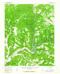 1959 Navajo Dam1962 Print · USGSThe San Juan River valley was entering an era of massive change in the late fifties as the construction of the Navajo Dam began. Researchers can trace the early footprints of Navajo City and Archuleta, as well as rural landmarks like Benito Sch and the Cem before the reservoir waters rose.2 unique versions available
 - 1962 Map of Aztec
 1962 Aztec1962 Print · USGSNorthwestern New Mexico in the early sixties showcases a landscape defined by the arrival of the Navajo Reservoir and the high-altitude timber of the Carson National Forest. Trace the path of the Denver & Rio Grande Western RR or locate historic settlements like Tierra Amarilla and Gobernador.
 - 1965 Map of Aztec
 1965 Aztec1965 Print · USGSNorthern New Mexico and southern Colorado come alive in the mid-sixties, from the San Juan Basin to the high Jemez Mountains. Trace the narrow-gauge Denver & Rio Grande Western RR through Monero or locate old outposts like Blanco Trading Post.
 - 1980 Map of Navajo Reservoir, 1981 Print
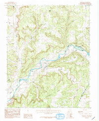
 1980 Navajo Reservoir1981 Print · USGSThe high desert and river valleys of Rio Arriba and San Juan counties are captured here in the early eighties. Genealogists and local historians can trace the development of Aztec and Bloomfield or locate family sites along Gubernador Canyon and the Animas River.
 - 1985 Map of Archuleta
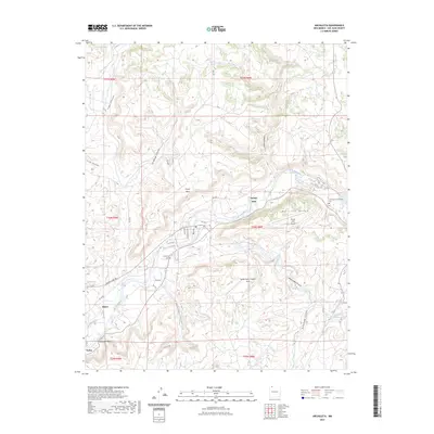
 1985 Archuleta1985 Print · USGSNorthwestern New Mexico's river-fed canyons and mesa lands are captured here in the mid-1980s. Local researchers can trace old irrigation routes along Citizens Ditch and locate family-named landmarks like Martinez and Melquiadis Point.
 - 2010 Map of Archuleta, 2010 Print
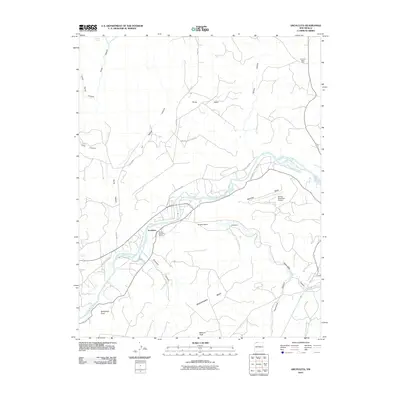 2010 Archuleta2010 Print · USGSCovers Navajo Dam, including Archuleta, San Juan County, and other nearby areas
 - 2013 Map of Archuleta, 2013 Print
 2013 Archuleta2013 Print · USGSCovers Navajo Dam, including Archuleta, San Juan County, and other nearby areas
 - 2017 Map of Archuleta, 2017 Print
 2017 Archuleta2017 Print · USGSCovers Navajo Dam, including Archuleta, San Juan County, and other nearby areas
 - 2020 Map of Archuleta, 2020 Print
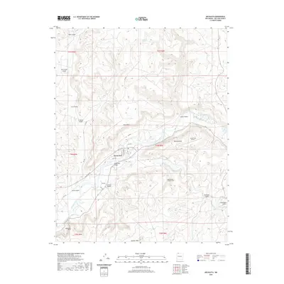 2020 Archuleta2020 Print · USGSCovers Navajo Dam, including Archuleta, San Juan County, and other nearby areas
 - 2023 Map of Archuleta, 2023 Print
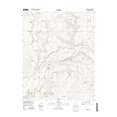
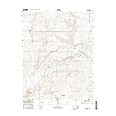
 2023 Archuleta2023 Print · USGSSan Juan County’s river-carved landscape is documented here in the early twenty-first century, showing the enduring communities along the northern river banks. You can trace family history at the Archuleta Cem or explore the area’s unique geology at the Gobernador Canyon Arch.
End of results
Showing maps 1-14 of 14
Top cities near Navajo Dam
Frequently asked questions
- What are the different types of historical maps available for Navajo Dam?
- What is the oldest map of Navajo Dam?
- Where can I purchase historical maps of Navajo Dam for my home or office?
- Where can I download high-res historical maps of Navajo Dam?
- Are there historical topographic maps available for Navajo Dam?
- Is there historical aerial imagery available for Navajo Dam?
- Where are historical maps of Navajo Dam sourced from?