1990s Maps of Algodones, New Mexico
Explore 4 historic maps of Algodones from the 1990s. These maps offer a rare glimpse into what life looked like during the 1990s — showing old roads, neighborhoods, homes, and landmarks that have changed or disappeared over time.
Whether you're researching your family's past, planning a metal detecting trip, or studying how Algodones's landscape evolved across the 1990s, these high-resolution maps are a powerful tool for exploring the history of this region.
- Focus on a specific era: All maps on this page are from the 1990s, giving you a focused view of this time period.
- See what’s changed: Compare century-old streets, trails, and buildings to today's modern landscape using overlays and satellite layers.
- Research with precision: Use these maps for genealogy, historical research, land use analysis, or educational projects.
- View, download, or print: Maps are fully viewable online in high resolution, and can be downloaded or printed for your own records.
Start exploring Algodones's history through authentic maps from the 1990s. This is your window into the past.
Algodones, NM maps
(4)- 1990 Map of Santa Ana Pueblo, 1996 Print
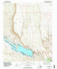 1990 Santa Ana Pueblo1996 Print · USGSSanta Ana Pueblo and the surrounding tribal lands are captured in the 1990s as the Jemez River flows through the high desert. Researchers can trace the path of the Old Railroad Grade and locate features like the Jemez Canyon Dam Spillway and Mesa Santa Rosa De Cubero.
 - 1990 Map of Bernalillo, 1996 Print
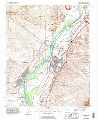 1990 Bernalillo1996 Print · USGSBernalillo and the Rio Grande valley are captured here in the early nineties during a period of suburban expansion alongside ancient pueblo lands. Trace irrigation history through the Bernalillo No 1 Lateral and find local landmarks like Carroll Sch or Sandia Pueblo.
 - 1990 Map of San Felipe Pueblo, 1996 Print
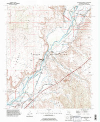 1990 San Felipe Pueblo1996 Print · USGSThe Rio Grande valley in the early nineties reveals a complex landscape of traditional pueblo lands and modern irrigation. Trace the intricate canal networks near San Felipe Pueblo and locate landmarks like the Algodones Sch and Algodones Power Plant.
 - 1990 Map of Placitas, 1998 Print
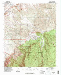 1990 Placitas1998 Print · USGSThe Sandoval County foothills and the Sandia Mountains are captured here in the 1990s as modern boundaries met ancient lands. Researchers can trace the Atchison Topeka and Santa Fe rail line or locate ancestral sites like Sandia Man Cave and Algodones Cem.
End of results
Showing maps 1-4 of 4
Top cities near Algodones
- Albuquerque historical maps
- Rio Rancho historical maps
- Bernalillo historical maps
- Corrales historical maps
- Los Ranchos de Albuquerque historical maps
- Paradise Hills historical maps
See more
Top neighborhoods of Algodones
Frequently asked questions
- What are the different types of historical maps available for Algodones?
- What is the oldest map of Algodones?
- Where can I purchase historical maps of Algodones for my home or office?
- Where can I download high-res historical maps of Algodones?
- Are there historical topographic maps available for Algodones?
- Is there historical aerial imagery available for Algodones?
- Where are historical maps of Algodones sourced from?