Old Maps of Lake Valley, New Mexico
Explore 11 old maps of Lake Valley, spanning from 1955 to today. These high-resolution historic maps reveal how streets, neighborhoods, landmarks, and natural features evolved over time — perfect for genealogy, metal detecting, research, and local history exploration.
What you can do with these maps:
- See how Lake Valley changed over time: Compare historical maps to modern-day views to trace roads, homesites, rail lines & more.
- View detailed metadata: Each map includes creators, publishers, year, scale, and archive source.
- Overlay maps with satellite & LiDAR: Visualize the past alongside modern tools to explore terrain & human change.
- Trusted historical sources: Maps sourced from the USGS, Library of Congress, and other archives.
- Access maps your way: View online, download high-res files, or order prints for personal or research use.
Start exploring old maps of Lake Valley to uncover forgotten places, hidden landmarks, and the deep history beneath your feet.
Lake Valley, NM maps
(11)- 1955 Map of Las Cruces, 1963 Print
 1955 Las Cruces1963 Print · USGSSouthern New Mexico comes into focus during the mid-fifties, showing the growth of Las Cruces alongside major military and scientific installations. Genealogists and historians can trace the Southern Pacific tracks through small rail towns like Cambray and Afton, or locate family sites near Hatch and Deming.3 unique versions available
 - 1958 Map of Las Cruces
 1958 Las Cruces1958 Print · USGSSouthern New Mexico in the late fifties was a landscape of rapid scientific and military growth centered on the Rio Grande. Local historians can trace the development of Las Cruces, the campus of New Mexico A and M College, and remote rail sidings like Aden Siding.
 - 1962 Map of Lake Valley, 1964 Print
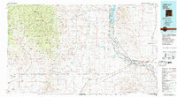
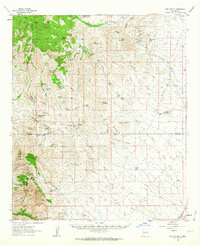 1962 Lake Valley1964 Print · USGSSierra County's mining and ranching history comes alive in this early 1960s survey of the high-desert country. Trace the Old Railroad Grade leading to the famous Bridal Chamber Mine and locate family outposts like the Rooth Ranch and DeMuth Ranch.2 unique versions available
 - 1982 Map of Hatch
 1982 Hatch1982 Print · USGSThe Rio Grande valley and the rugged Mimbres Mountains meet in this early 1980s overview of southern New Mexico. Researchers can trace the path of the Atchison Topeka and Santa Fe railroad or locate historic mining hubs like Hillsboro and Lake Valley.
 - 1989 Map of Lake Valley
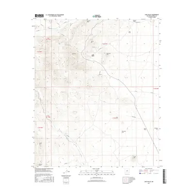
 1989 Lake Valley1989 Print · USGSMining and ranching life intersect in the high desert of Sierra County during the late twentieth century. Genealogists and historians can trace family properties like Nunn Ranch and McKinney Ranch or locate old industrial works such as the Bridal Chamber Mine and the Old Railroad Grade.
 - 1996 Map of Lake Valley, 2002 Print
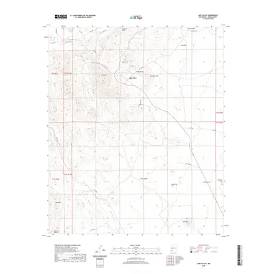
 1996 Lake Valley2002 Print · USGSThe Lake Valley mining district is preserved here in the late twentieth century, showing a landscape defined by silver-mining history and ranching. Genealogists and historians can trace the Old Railroad Grade and locate family landmarks like the Bridal Chamber Mine and Nunn Ranch.
 - 2010 Map of Lake Valley, 2010 Print
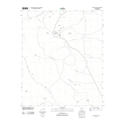 2010 Lake Valley2010 Print · USGSCovers Lake Valley, including Sierra County, United States, and other nearby areas
 - 2013 Map of Lake Valley, 2013 Print
 2013 Lake Valley2013 Print · USGSCovers Lake Valley, including Sierra County, United States, and other nearby areas
 - 2017 Map of Lake Valley, 2017 Print
 2017 Lake Valley2017 Print · USGSCovers Lake Valley, including Sierra County, United States, and other nearby areas
 - 2020 Map of Lake Valley, 2020 Print
 2020 Lake Valley2020 Print · USGSCovers Lake Valley, including Sierra County, United States, and other nearby areas
 - 2023 Map of Lake Valley, 2023 Print
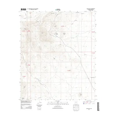
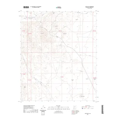 2023 Lake Valley2023 Print · USGSSierra County's high-desert landscape comes into sharp focus during the 2020s, showing a region defined by its rugged peaks and essential water sources. Genealogists and historians can locate the Lake Valley Cem and trace historic routes like the Nachee Trl near Macho Spring.
End of results
Showing maps 1-11 of 11
Top cities near Lake Valley
Frequently asked questions
- What are the different types of historical maps available for Lake Valley?
- What is the oldest map of Lake Valley?
- Where can I purchase historical maps of Lake Valley for my home or office?
- Where can I download high-res historical maps of Lake Valley?
- Are there historical topographic maps available for Lake Valley?
- Is there historical aerial imagery available for Lake Valley?
- Where are historical maps of Lake Valley sourced from?