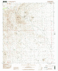
1996 Map of Lake Valley
USGS Topo · Published 2002About this map
Lake Valley sits at the heart of this Sierra County landscape, a community shaped by its proximity to significant mining operations and the high desert terrain. The map documents the extensive industrial footprint in the area, most notably the Bridal Chamber Mine and the Open Pit Mine situated near Apache Hill. These sites, along with numerous prospects, adits, and Mine Shafts, reveal the intensive search for minerals that defined local development. The presence of a Cem and the Old Railroad Grade trace the historical infrastructure that once supported this mining district.
Find a feature on this map
32 named features on this map. Tap any name to fly to it.
Don’t see what you’re looking for? This feature index may not catch every label — zoom into the map to look around manually.
Map Details
Editions of this 1996 Lake Valley Map
This is the sole edition of this map. No revisions or reprints were ever made.
Other maps of this area

1935 · Hillsboro
USGS Topo · 1:48,000

1940 · Hillsboro
USGS Topo · 1:62,500

1955 · Las Cruces
USGS Topo · 1:250,000

1958 · Las Cruces
USGS Topo · 1:250,000

1961 · Nutt
USGS Topo · 1:62,500

1961 · Clark Spring Canyon
USGS Topo · 1:24,000

1962 · Lake Valley
USGS Topo · 1:62,500

1982 · Hatch
USGS Topo · 1:100,000
1985 · P A Mountain
USGS Topo · 1:24,000
1985 · Mc Clede Mountain
USGS Topo · 1:24,000