
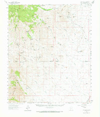
1962 Map of Lake Valley
USGS Topo · Published 1964About this map
Mimbres Mountains and the northern reaches of the Cooks Range dominate this Sierra County landscape, where the legacy of silver mining and high-desert ranching is clearly etched. Near the eastern edge, the legendary Bridal Chamber Mine and the Dude Mine reflect the district's industrial past, supported by an Old Railroad Grade that once connected these remote workings to broader markets. The survey captures a network of family-held operations, from the P Latham Ranch near Schoolhouse Mountain to the White Rock Ranch and Graham Ranch further south.
Find a feature on this map
82 named features on this map. Tap any name to fly to it.
Don’t see what you’re looking for? This feature index may not catch every label — zoom into the map to look around manually.
Map Details
Editions of this 1962 Lake Valley Map
2 editions found
Other maps of this area

1899 · Deming
USGS Topo · 1:125,000

1915 · Deming
USGS Topo · 1:125,000

1935 · Hillsboro
USGS Topo · 1:48,000

1940 · Hillsboro
USGS Topo · 1:62,500

1955 · Las Cruces
USGS Topo · 1:250,000

1956 · Dwyer
USGS Topo · 1:62,500

1956 · San Lorenzo
USGS Topo · 1:62,500

1958 · Las Cruces
USGS Topo · 1:250,000

1961 · Nutt
USGS Topo · 1:62,500

1961 · Clark Spring Canyon
USGS Topo · 1:24,000