1900s (20th Century) Maps of New Scotland, New York
Explore 28 historic maps of New Scotland from the 1900s (20th Century). These maps offer a rare glimpse into what life looked like during the 1900s — showing old roads, neighborhoods, homes, and landmarks that have changed or disappeared over time.
Whether you're researching your family's past, planning a metal detecting trip, or studying how New Scotland's landscape evolved across the 1900s, these high-resolution maps are a powerful tool for exploring the history of this region.
- Focus on a specific era: All maps on this page are from the 1900s, giving you a focused view of this time period.
- See what’s changed: Compare century-old streets, trails, and buildings to today's modern landscape using overlays and satellite layers.
- Research with precision: Use these maps for genealogy, historical research, land use analysis, or educational projects.
- View, download, or print: Maps are fully viewable online in high resolution, and can be downloaded or printed for your own records.
Start exploring New Scotland's history through authentic maps from the 1900s. This is your window into the past.
New Scotland, NY maps
(28)- 1900 Map of Berne, 1954 Print
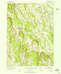
 1900 Berne1954 Print · USGSAlbany County hill towns and the Helderberg Escarpment are captured here at the turn of the century as rural life centered on upland hamlets and rocky creek valleys. Researchers can trace old family sites and forgotten crossroads like Van Leuvans Corners, Chesterville, and Quaker Street.2 unique versions available
 - 1903 Map of Berne
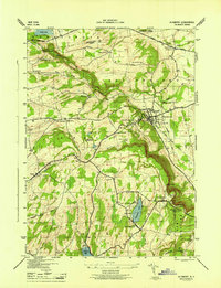
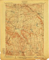 1903 Berne1903 Print · USGSThe Helderberg plateau in the early 1900s reveals a network of isolated hill towns and winding creek valleys. Genealogists can trace family footprints in Rensselaerville, Quaker Street, and the lakeside settlements of Thompsons Lake and Warner Lake.8 unique versions available
 - 1927 Map of Albany
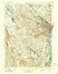
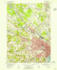
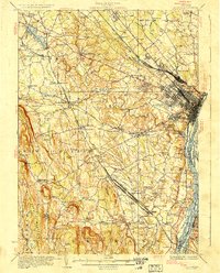 1927 Albany1927 Print · USGSThe Albany riverfront and the Helderberg escarpment define this mid-1920s portrait of New York's capital region. Genealogists can trace a dense network of country schoolhouses and old settlements like Feura Bush, Loudonville, and the Bethlehem Church.5 unique versions available
 - 1943 Map of Westerlo, 1958 Print
 1943 Westerlo1958 Print · USGSAlbany County's upland terrain is captured here during the mid-century, showcasing the rural road networks and hill-country settlements of the Helderbergs. Researchers can trace genealogical roots at Reidsville Cem or locate vanished landmarks like Van Leuvens Sch and Bramans Corners.3 unique versions available
 - 1944 Map of Altamont, 1959 Print
 1944 Altamont1959 Print · USGSAlbany County's steep ridges and valley settlements are captured here during the mid-1940s. Trace old family plots at Severson Cem, visit the Lasalette Seminary, or explore the terrain around Indian Ladder.4 unique versions available
 - 1946 Map of Westerlo
 1946 Westerlo1946 Print · USGSAlbany County's rural uplands are captured here in the mid-1940s, showing a landscape of high ridges and scattered crossroads settlements. Genealogists can trace family names at Westerlo Cem or locate old schoolhouse sites like Van Leuvans Sch and School No 11.
 - 1946 Map of Altamont
 1946 Altamont1946 Print · USGSThe Helderberg Escarpment rises sharply over the village of Altamont in this mid-forties survey of Albany County. Family historians can trace rural roots at Ostrander Cem or locate early landmarks like Indian Ladder and the Lasalette Seminary.
 - 1947 Map of Albany, 1965 Print
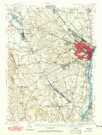 1947 Albany1965 Print · USGSThe Albany capital region is captured here shortly after the war, showing the city's transition into suburban Delmar and Loudonville. Researchers can trace the massive Voorheesville Army Sub Depot, the Albany Airport, and old landmarks like Graceland Cemetery.
 - 1948 Map of Albany, 1951 Print
 1948 Albany1951 Print · USGSThe Hudson and Connecticut River valleys are captured here in the late 1940s, showing the vital rail and water corridors of the Northeast. You can trace the Boston and Maine tracks past Mt Greylock or locate early settlements like Great Barrington and Bennington.
 - 1948 Map of Binghamton, 1980 Print
 1948 Binghamton1980 Print · USGSCentral New York and the Southern Tier thrive in the late 1940s as a hub of rail traffic and mountain industry. Researchers can trace historic transit lines like the Erie Railroad through Binghamton or find old valley settlements near Oneonta and Delhi.
 - 1950 Map of Binghamton
 1950 Binghamton1950 Print · USGSBinghamton and the surrounding Southern Tier are shown in the mid-century era, highlighting the intricate rail and river networks that drove local industry. Researchers can trace the path of the Erie Railroad and locate landmarks from Otsego Lake to Sidney Mountain.2 unique versions available
 - 1950 Map of Albany
 1950 Albany1950 Print · USGSMid-century Albany and its burgeoning suburbs are captured here at a peak of rail and river commerce. Genealogy and local history researchers can trace the New York Central lines to the Selkirk Yards or find family landmarks like Keefers Corners and Bethlehem Church.
 - 1953 Map of Delmar, 1954 Print
 1953 Delmar1954 Print · USGSThe Albany suburbs meet the industrial Hudson Valley in the early fifties, just as the New York State Thruway was being cut through the landscape. Genealogists can trace family names at Bethlehem Cem and Elmwood Cem, or explore the massive rail operations at Selkirk Yards.5 unique versions available
 - 1953 Map of Clarksville, 1956 Print
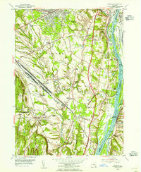
 1953 Clarksville1956 Print · USGSThe Helderberg escarpment overlooks Albany County in the early fifties, showing a landscape of orchards, quarries, and rural hamlets. Researchers can locate family sites in New Salem, Clarksville, and Feura Bush, or trace the grounds of the Delmar State Game Farm.4 unique versions available
 - 1953 Map of Albany, 1956 Print
 1953 Albany1956 Print · USGSMid-century Albany and its northern suburbs are shown here just as the highway network began to reshape the capital region. Genealogists can trace family names and institutions across Graceland Cemetery, the Ann Lee Home Cem, and numerous historic campuses like the Mater Christi Seminary.3 unique versions available
 - 1954 Map of Voorheesville, 1956 Print
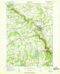
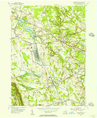 1954 Voorheesville1956 Print · USGSAlbany County during the mid-fifties reveals a landscape balancing heavy infrastructure with growing residential hamlets. Local historians can trace the massive Schenectady General Depot or locate family plots at Guilderland Cem and Mt Pleasant Cem.3 unique versions available
 - 1956 Map of Albany, 1968 Print
 1956 Albany1968 Print · USGSThe industrial heart of the Northeast is revealed in the mid-1950s, from the Hudson Valley to the Connecticut River. Researchers can trace the legacy of the Quabbin Reservoir, locate Westover Air Force Base, or follow the Rutland RR through the Green Mountains.2 unique versions available
 - 1957 Map of Albany
 1957 Albany1957 Print · USGSThe Tri-State region and Connecticut River Valley are captured here during a period of significant postwar growth and infrastructure expansion. Genealogists and historians can trace the rail-and-river economy through landmarks like the Boston and Maine railroad, Quabbin Reservoir, and Westover Air Force Base.
 - 1958 Map of Binghamton
 1958 Binghamton1958 Print · USGSCentral New York in the late fifties was a network of manufacturing cities and river valleys connected by vital rail lines. Genealogists and historians can trace family roots in Oneonta, Norwich, and Cooperstown or locate long-standing farms along Schoharie Creek.
 - 1959 Map of Albany
 1959 Albany1959 Print · USGSThe Hudson and Connecticut River valleys are captured here during the late fifties, showing the region's dense rail networks and massive water projects. Researchers can trace the New York State Thruway or locate local landmarks like Mt Greylock and the Quabbin Reservoir.
 - 1962 Map of Albany
 1962 Albany1962 Print · USGSThe Hudson and Connecticut River valleys meet the Green Mountains and Berkshires in this mid-century overview of the Northeast. Genealogists and historians can trace the industrial hearts of Albany and Springfield or locate features like Quabbin Reservoir and Westover Air Force Base.
 - 1963 Map of Binghamton
 1963 Binghamton1963 Print · USGSThe Southern Tier and Catskill peaks are shown in the early sixties as new reservoirs reshaped the valleys. Trace historic rail corridors like the Erie Lackawanna RR and explore lakeside settlements such as Cooperstown and Oneonta.
 - 1978 Map of Delmar, 1982 Print
 1978 Delmar1982 Print · USGSAlbany and its southern suburbs are captured in the late seventies as the region's industrial and rail corridors expanded. Genealogists and historians can trace the development of Delmar, the rail yards of Selkirk, and the riverfront at Castleton-on-Hudson.
 - 1978 Map of Albany, 1982 Print
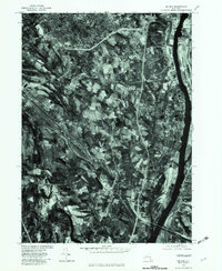
 1978 Albany1982 Print · USGSThe capital region comes into sharp focus in the late seventies through this detailed orthophotoquad. Trace the development of residential neighborhoods and transit networks from Albany out to Colonie, Delmar, and Loudonville.
 - 1985 Map of Amsterdam, 1986 Print
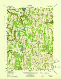
 1985 Amsterdam1986 Print · USGSUpstate New York in the mid-1980s reveals a landscape defined by historic river valleys and expanding interstate corridors. Researchers can trace family sites near Stone Arabia Cemetery or explore the civic centers of Amsterdam and Cooperstown near Otsego Lake.2 unique versions available
Showing maps 1-25 of 28
Top cities near New Scotland
- Albany historical maps
- Colonie historical maps
- Schenectady historical maps
- Clifton Park historical maps
- Guilderland historical maps
- Bethlehem historical maps
See more
Top neighborhoods of New Scotland
- Feura Bush historical maps
- New Salem historical maps
- Tarrytown historical maps
- Clarksville historical maps
- Unionville historical maps
- Voorheesville historical maps
Frequently asked questions
- What are the different types of historical maps available for New Scotland?
- What is the oldest map of New Scotland?
- Where can I purchase historical maps of New Scotland for my home or office?
- Where can I download high-res historical maps of New Scotland?
- Are there historical topographic maps available for New Scotland?
- Is there historical aerial imagery available for New Scotland?
- Where are historical maps of New Scotland sourced from?