Old Maps of Limestone, Carrollton for Academic Research
Study the evolution of Limestone with 21 high-resolution historic maps. Whether you're teaching, researching, or modeling changes in land use, these maps provide essential visual documentation of urban, environmental, and geographic change.
- Analyze long-term change: Track patterns in development, transportation, and natural features.
- Ideal for environmental or urban studies: Support academic projects with primary historical map data.
- Use in the classroom or lab: Educators and researchers rely on these maps to bring historical context to life.
These maps are a powerful tool for teaching, research, and visualizing how Limestone has changed over the decades.
Limestone, Carrollton maps
(21)- 1900 Map of Salamanca
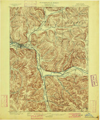 1900 Salamanca1900 Print · USGSCattaraugus County's rail and timber era is documented here as it appeared in the late 1890s, centered on the river-bend hub of Salamanca. Genealogists and historians can trace the early boundaries of the Allegheny Indian Reservation and locate vanished rail stops like Irvine Mills and Peth.6 unique versions available
 - 1938 Map of Salamanca, 1954 Print
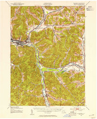 1938 Salamanca1954 Print · USGSIn the late 1930s, this portion of Cattaraugus County was a critical rail and river hub where the Allegheny River meets major transit lines. Researchers can trace the layout of the Allegheny Reservation and locate vanished stop points like Irvine Mills and Kill Buck.2 unique versions available
 - 1943 Map of Salamanca
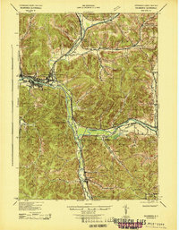 1943 Salamanca1943 Print · USGSCattaraugus County during the early 1940s reveals a landscape defined by the intersection of the Allegheny River and major rail lines. Genealogists and rail historians can trace the paths of the Erie and Baltimore and Ohio railroads through Salamanca and Killbuck.
 - 1960 Map of Buffalo
 1960 Buffalo1960 Print · USGSWestern New York and the Niagara Peninsula thrive during the mid-twentieth century industrial peak. Genealogists and historians can trace family-named points and early settlements from Dunkirk Light to the Allegany Indian Reservation.
 - 1961 Map of Knapp Creek, 1963 Print
 1961 Knapp Creek1963 Print · USGSCattaraugus County in the early sixties reveals a landscape shaped by the Bradford Oil Field and the winding Allegheny River. Genealogists and local historians can trace the rural road networks and settlements of Vandalia, Chipmunk, and Knapp Creek alongside numerous oil and gas wells.2 unique versions available
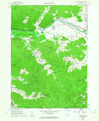
 - 1961 Map of Limestone, 1963 Print
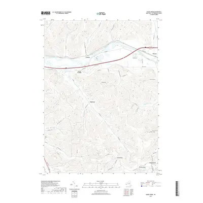
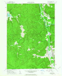 1961 Limestone1963 Print · USGSThe Cattaraugus County borderlands in the early sixties reveal a landscape of deep river valleys and intensive timber and mineral extraction. Genealogists and historians can locate Limestone and Irvine Mills, or trace the rail lines through Riverside Junction and Bradford Junction.4 unique versions available
 - 1962 Map of Buffalo, 1980 Print
 1962 Buffalo1980 Print · USGSThe Niagara Frontier and Western New York are captured here in the early sixties, showing the vital industrial and maritime nexus between the U.S. and Canada. Researchers can trace the path of the Welland Canal, locate the Allegany Indian Reservation, or find family sites near Chautauqua Lake.2 unique versions available
 - 1967 Map of Buffalo
 1967 Buffalo1967 Print · USGSWestern New York and the Lake Erie shoreline are shown here during the mid-1960s industrial peak. Researchers can trace the massive rail networks of the Erie Railroad, locate the Cattaraugus Indian Reservation, or find historic sites like Fort Erie.
 - 1973 Map of Buffalo
 1973 Buffalo1973 Print · USGSWestern New York and Ontario's Golden Horseshoe meet in the early seventies, spanning from the industrial waterfronts of Buffalo to the hills of Allegany State Park. Trace the paths of the Welland Canal and Erie Lackawanna railroad through the lakefront towns of Dunkirk and Port Colborne.
 - 1979 Map of Knapp Creek, 1980 Print
 1979 Knapp Creek1980 Print · USGSSouthern Cattaraugus County in the late seventies is a landscape defined by the winding Allegheny River and the sprawling Bradford Oil Field. Local historians can trace family roots through hamlets like South Vandalia or locate old landmarks like St Johns Ch and the Drive-in Theater.
 - 1986 Map of Olean
 1986 Olean1986 Print · USGSThe Southern Tier and northern Pennsylvania border are captured here in the mid-1980s as the regional rail and river economy evolved. Genealogists and local historians can trace family-named sites across the Allegany Indian Reservation, identify old Oil Field tracts, or locate landmarks like St Bonaventure University and the Tannery.2 unique versions available
 - 2010 Map of Limestone, 2010 Print
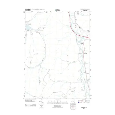
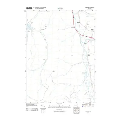 2010 Limestone2010 Print · USGSCovers Limestone, including Carrollton, Red House, and other nearby areas
 - 2010 Map of Knapp Creek, 2010 Print
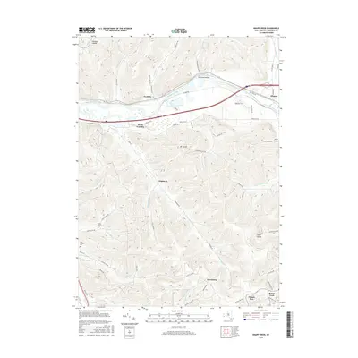
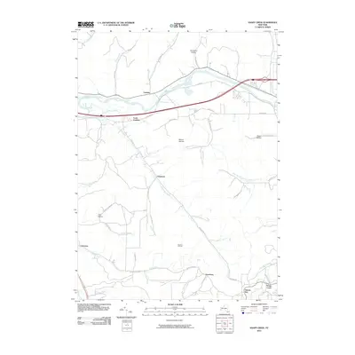 2010 Knapp Creek2010 Print · USGSCovers Limestone, including Allegany, Allegany, and other nearby areas
 - 2013 Map of Knapp Creek, 2013 Print
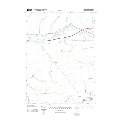 2013 Knapp Creek2013 Print · USGSCovers Limestone, including Allegany, Allegany, and other nearby areas
 - 2013 Map of Limestone, 2013 Print
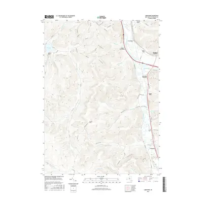
 2013 Limestone2013 Print · USGSCovers Limestone, including Carrollton, Red House, and other nearby areas
 - 2016 Map of Knapp Creek, 2016 Print
 2016 Knapp Creek2016 Print · USGSCovers Limestone, including Allegany, Allegany, and other nearby areas
 - 2016 Map of Limestone, 2016 Print
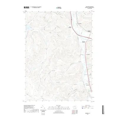
 2016 Limestone2016 Print · USGSCovers Limestone, including Carrollton, Red House, and other nearby areas
 - 2019 Map of Limestone, 2019 Print
 2019 Limestone2019 Print · USGSCovers Limestone, including Carrollton, Red House, and other nearby areas
 - 2019 Map of Knapp Creek, 2019 Print
 2019 Knapp Creek2019 Print · USGSCovers Limestone, including Allegany, Allegany, and other nearby areas
 - 2023 Map of Knapp Creek, 2023 Print
 2023 Knapp Creek2023 Print · USGSCattaraugus County in the early twenty-first century reveals a landscape of isolated river settlements and upland valleys. Trace the routes between Vandalia, Chipmunk, and Knapp Creek, or locate local landmarks like Saint Patricks Cem and Mount Moriah.
 - 2023 Map of Limestone, 2023 Print
 2023 Limestone2023 Print · USGSCattaraugus County in the early twenty-first century reveals a landscape where the vast Allegany State Park meets the Allegheny River valley. Genealogists and historians can trace the roads around Limestone, locate the Limestone Cem, and explore old junctions like Riverside Junction and Bradford Junction.
End of results
Showing maps 1-21 of 21
Top cities near Limestone
- Olean historical maps
- Bradford historical maps
- Allegany historical maps
- Salamanca historical maps
- Lafayette Township historical maps
- Hinsdale historical maps
See more
Frequently asked questions
- What are the different types of historical maps available for Limestone?
- What is the oldest map of Limestone?
- Where can I purchase historical maps of Limestone for my home or office?
- Where can I download high-res historical maps of Limestone?
- Are there historical topographic maps available for Limestone?
- Is there historical aerial imagery available for Limestone?
- Where are historical maps of Limestone sourced from?