Old Maps of Humphrey, New York for Metal Detecting
Plan your next treasure hunt with 41 historic maps of Humphrey. Find old homesites, ghost towns, trails, and gathering spots that may be lost to time — perfect for identifying promising metal detecting locations.
- Locate forgotten sites: Uncover places like long-lost settlements, abandoned rail lines, or gathering spots.
- Plan better hunts: Use map overlays combined with LiDAR or satellite views to narrow in on historically rich areas.
- Made for detectorists: Thousands of hobbyists use these maps to discover relics, coins, and hidden history.
Use these historic maps to boost your research and find new opportunities beneath the surface of Humphrey.
Humphrey, NY maps
(41)- 1898 Map of Olean
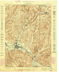 1898 Olean1898 Print · USGSCattaraugus County is shown here at the peak of its rail-and-river era, centered on the major industrial junction at Olean. Genealogists and collectors can trace the sprawling network of the Penna. R.R. and locate vanished local landmarks like the Oil Tanks or the distinct formation at Rock City.5 unique versions available
 - 1900 Map of Salamanca
 1900 Salamanca1900 Print · USGSCattaraugus County's rail and timber era is documented here as it appeared in the late 1890s, centered on the river-bend hub of Salamanca. Genealogists and historians can trace the early boundaries of the Allegheny Indian Reservation and locate vanished rail stops like Irvine Mills and Peth.6 unique versions available
 - 1924 Map of Ellicottville
 1924 Ellicottville1924 Print · USGSCattaraugus County’s steep valleys and rural schools are preserved here in the mid-1920s, showing the region's transition into the early automotive age. Trace family roots and vanished landmarks like Cascade Park, the Dutch Hill Church, and the Buffalo Rochester and Pittsburgh Railroad corridor.3 unique versions available
 - 1924 Map of Franklinville
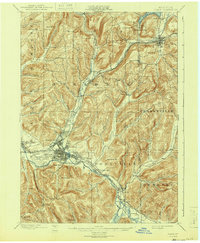
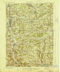 1924 Franklinville1924 Print · USGSCattaraugus County agricultural life and rail commerce are documented here in the mid-twenties. Genealogists and local historians can trace family roots through numerous rural landmarks like Siloam Church, County Line Cem, and the Checkered School.3 unique versions available
 - 1938 Map of Salamanca, 1954 Print
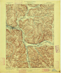
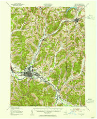
 1938 Salamanca1954 Print · USGSIn the late 1930s, this portion of Cattaraugus County was a critical rail and river hub where the Allegheny River meets major transit lines. Researchers can trace the layout of the Allegheny Reservation and locate vanished stop points like Irvine Mills and Kill Buck.2 unique versions available
 - 1938 Map of Olean, 1955 Print
 1938 Olean1955 Print · USGSOlean and the Allegheny River valley are shown here just before the mid-century, defined by a dense network of Pennsylvania and Erie rail lines. Local historians can trace the development of Westons Mills and the industrial layout near North Olean or locate the Oil Spring Indian Reservation.3 unique versions available
 - 1941 Map of Ellicottville
 1941 Ellicottville1941 Print · USGSCattaraugus County in the early 1940s is shown here as a landscape of rural school districts and rail-side villages. Researchers can trace the Baltimore and Ohio tracks through Riceville Sta or locate family sites near Dutch Hill Church and Fancy Tract.
 - 1942 Map of Franklinville
 1942 Franklinville1942 Print · USGSCattaraugus County during the early war years remains a land of small schoolhouses and essential rail junctions. Trace the family roots of rural New York through local landmarks like Siloam Church, County Line Cem, and the unique Checkered School.
 - 1943 Map of Olean
 1943 Olean1943 Print · USGSCattaraugus County in the late nineteenth century was a corridor of burgeoning rail and industry along the Allegheny. Researchers can trace the path of the Penna. R.R. through old settlements like Hinsdale and Westons Mills, or locate early landmarks like Rock City.
 - 1943 Map of Salamanca
 1943 Salamanca1943 Print · USGSCattaraugus County during the early 1940s reveals a landscape defined by the intersection of the Allegheny River and major rail lines. Genealogists and rail historians can trace the paths of the Erie and Baltimore and Ohio railroads through Salamanca and Killbuck.
 - 1960 Map of Buffalo
 1960 Buffalo1960 Print · USGSWestern New York and the Niagara Peninsula thrive during the mid-twentieth century industrial peak. Genealogists and historians can trace family-named points and early settlements from Dunkirk Light to the Allegany Indian Reservation.
 - 1961 Map of Hinsdale, 1963 Print
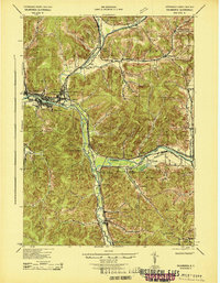
 1961 Hinsdale1963 Print · USGSCattaraugus County in the early 1960s shows a landscape of deep valleys defined by the meeting of Ischua Creek and Oil Creek. Genealogists and historians can trace rail history along the Erie Lackawanna Railroad or locate local landmarks like Maplehurst, Hinsdale Cem, and Union Valley Ch.
 - 1961 Map of Humphrey, 1963 Print
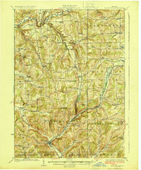
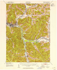
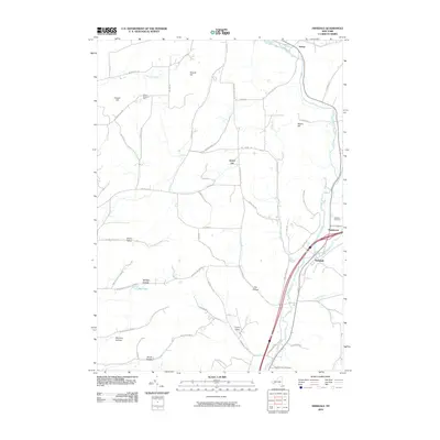
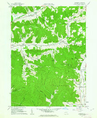 1961 Humphrey1963 Print · USGSThe hills of Cattaraugus County in the early sixties reveal a landscape of secluded hollows and small-scale oil extraction. Genealogists and historians can trace old homesteads and landmarks like St Pacificus Ch, Sugartown, and the Fivemile Cem.4 unique versions available
 - 1962 Map of Buffalo, 1980 Print
 1962 Buffalo1980 Print · USGSThe Niagara Frontier and Western New York are captured here in the early sixties, showing the vital industrial and maritime nexus between the U.S. and Canada. Researchers can trace the path of the Welland Canal, locate the Allegany Indian Reservation, or find family sites near Chautauqua Lake.2 unique versions available
 - 1963 Map of Franklinville, 1964 Print
 1963 Franklinville1964 Print · USGSThe Ischua Creek valley in the early sixties remained a vital corridor for the Pennsylvania railroad and the hill towns of Cattaraugus County. Genealogists can locate family sites at Ten Broeck Cem, while industrial historians can trace the Coal Chutes near Cadiz.2 unique versions available
 - 1964 Map of Ashford, 1965 Print
 1964 Ashford1965 Print · USGSCattaraugus County in the mid-1960s shows a landscape of upland ridges and rail-connected valley settlements. You can trace the path of the Baltimore and Ohio Railroad past Devereaux or locate family sites near Root Cem and Fancy Tract.
 - 1967 Map of Buffalo
 1967 Buffalo1967 Print · USGSWestern New York and the Lake Erie shoreline are shown here during the mid-1960s industrial peak. Researchers can trace the massive rail networks of the Erie Railroad, locate the Cattaraugus Indian Reservation, or find historic sites like Fort Erie.
 - 1971 Map of Hinsdale
 1971 Hinsdale1971 Print · USGSCattaraugus County in the early sixties maintains its character as a transport hub where the Pennsylvania and Erie Lackawanna railroads meet. Trace family roots through local sites like Union Valley Ch and the Maple Grove Cem.
 - 1973 Map of Buffalo
 1973 Buffalo1973 Print · USGSWestern New York and Ontario's Golden Horseshoe meet in the early seventies, spanning from the industrial waterfronts of Buffalo to the hills of Allegany State Park. Trace the paths of the Welland Canal and Erie Lackawanna railroad through the lakefront towns of Dunkirk and Port Colborne.
 - 1979 Map of Hinsdale, 1980 Print
 1979 Hinsdale1980 Print · USGSCattaraugus County valleys were undergoing modern revisions in the late seventies while maintaining their traditional rural character. Researchers can trace the rail lines of Conrail and locate ancestral sites like Union Valley Ch or Hinsdale Cem.
 - 1986 Map of Olean
 1986 Olean1986 Print · USGSThe Southern Tier and northern Pennsylvania border are captured here in the mid-1980s as the regional rail and river economy evolved. Genealogists and local historians can trace family-named sites across the Allegany Indian Reservation, identify old Oil Field tracts, or locate landmarks like St Bonaventure University and the Tannery.2 unique versions available
 - 2010 Map of Franklinville, 2010 Print
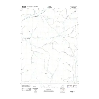
 2010 Franklinville2010 Print · USGSCovers Humphrey, including Franklinville, Machias, and other nearby areas
 - 2010 Map of Ashford, 2010 Print
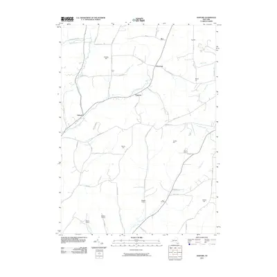 2010 Ashford2010 Print · USGSCovers Humphrey, including Franklinville, Machias, and other nearby areas
 - 2010 Map of Humphrey, 2010 Print
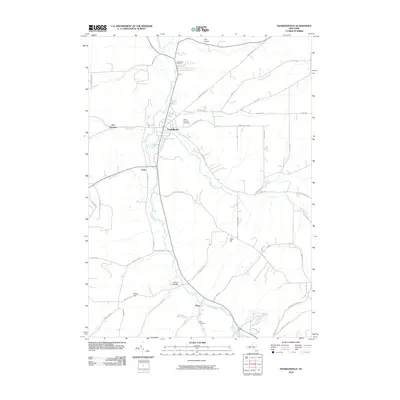
 2010 Humphrey2010 Print · USGSCovers Humphrey, including Allegany, Great Valley, and other nearby areas
 - 2010 Map of Hinsdale, 2010 Print
 2010 Hinsdale2010 Print · USGSCovers Humphrey, including Allegany, Portville, and other nearby areas
Showing maps 1-25 of 41
Top cities near Humphrey
- Olean historical maps
- Allegany historical maps
- Salamanca historical maps
- Portville historical maps
- Cuba historical maps
- Franklinville historical maps
See more
Top neighborhoods of Humphrey
Frequently asked questions
- What are the different types of historical maps available for Humphrey?
- What is the oldest map of Humphrey?
- Where can I purchase historical maps of Humphrey for my home or office?
- Where can I download high-res historical maps of Humphrey?
- Are there historical topographic maps available for Humphrey?
- Is there historical aerial imagery available for Humphrey?
- Where are historical maps of Humphrey sourced from?