1960s Maps of Delaware County, New York
Explore 24 historic maps of Delaware County from the 1960s. These maps offer a rare glimpse into what life looked like during the 1960s — showing old roads, neighborhoods, homes, and landmarks that have changed or disappeared over time.
Whether you're researching your family's past, planning a metal detecting trip, or studying how Delaware County's landscape evolved across the 1960s, these high-resolution maps are a powerful tool for exploring the history of this region.
- Focus on a specific era: All maps on this page are from the 1960s, giving you a focused view of this time period.
- See what’s changed: Compare century-old streets, trails, and buildings to today's modern landscape using overlays and satellite layers.
- Research with precision: Use these maps for genealogy, historical research, land use analysis, or educational projects.
- View, download, or print: Maps are fully viewable online in high resolution, and can be downloaded or printed for your own records.
Start exploring Delaware County's history through authentic maps from the 1960s. This is your window into the past.
Delaware County, NY maps
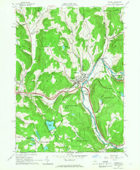
(24)- 1960 Map of West Kill, 1962 Print
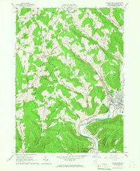
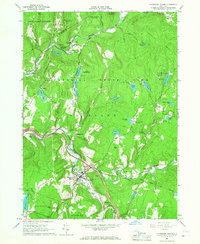
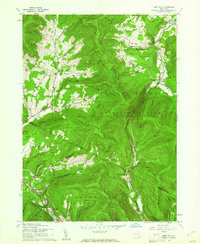 1960 West Kill1962 Print · USGSThe high Catskills of Greene, Ulster, and Delaware counties appear in this mid-century survey as a landscape of isolated mountain hollows and narrow valley roads. Genealogists and local historians can locate Halcott Cem, trace the New York Central rail line near Highmount, and find early school sites like the Hunter Tannersville Central Sch.3 unique versions available
 - 1962 Map of Scranton, 1977 Print
 1962 Scranton1977 Print · USGSThe industrial heart of eastern Pennsylvania and the New York Catskills are captured here in the early sixties. Genealogists and historians can trace the dense valley settlements from Scranton to Wilkes-Barre and the rail lines of the Erie Lackawanna Railroad.2 unique versions available
 - 1963 Map of Binghamton
 1963 Binghamton1963 Print · USGSThe Southern Tier and Catskill peaks are shown in the early sixties as new reservoirs reshaped the valleys. Trace historic rail corridors like the Erie Lackawanna RR and explore lakeside settlements such as Cooperstown and Oneonta.
 - 1965 Map of Scranton
 1965 Scranton1965 Print · USGSThe tri-state highlands of Pennsylvania, New York, and New Jersey come alive in the mid-sixties as industry and recreation converge. Trace the intricate rail lines of the Erie Lackawanna RR or locate landmarks like the U S Military Academy.2 unique versions available
 - 1965 Map of Corbett, 1966 Print
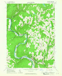
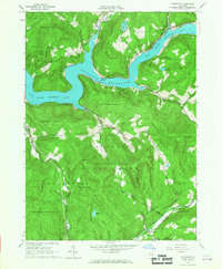
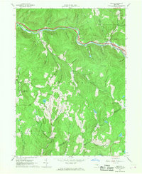
 1965 Corbett1966 Print · USGSThe East Branch of the Delaware River winds through the Catskills in the mid-1960s, connecting small valley settlements. Researchers can trace family sites at the Gregorytown Cem or explore landmarks like the Downsville Airport and Quinn Lake.3 unique versions available
 - 1965 Map of Readburn, 1966 Print
 1965 Readburn1966 Print · USGSDelaware County's river valleys and forest preserves are shown here in the mid-sixties during a period of significant hydrological change. Researchers can trace rural life at Readburn and Beerston, or locate family sites like the Readburn Cem and Community Full Gospel Ch.3 unique versions available
 - 1965 Map of Trout Creek, 1966 Print
 1965 Trout Creek1966 Print · USGSMid-century Delaware County is characterized here by the newly filled Cannonsville Reservoir and the rural upland forests of the 1960s. Genealogists and local historians can trace family-named sites like Austin Cem and settlements such as Ivanhoe and Upper Barbourville.2 unique versions available
 - 1965 Map of Walton West, 1966 Print
 1965 Walton West1966 Print · USGSDelaware County at the height of the 1960s reveals a landscape of river-valley villages and steep Catskill ridges. Local researchers can trace family landmarks and civic sites like the Walton Cem, Dryden Community Ch, and the village Fairgrounds.2 unique versions available
 - 1965 Map of Walton East, 1966 Print
 1965 Walton East1966 Print · USGSDelaware County in the mid-1960s is defined here by the river-cut valleys of the Catskill foothills and the village of Walton. Genealogists and historians can trace family-named landmarks like Mac Gibbon Hollow and the path of the Old Railroad Grade.2 unique versions available
 - 1965 Map of Andes, 1967 Print
 1965 Andes1967 Print · USGSDelaware County’s mountain valleys and hollows are captured here in the mid-1960s, showing the town of Andes and its rural outskirts. Researchers can trace the Old Tremper Railroad Grade or locate old community sites like Cabin Hill Ch and the Rural Cem.3 unique versions available
 - 1965 Map of Hamden, 1967 Print
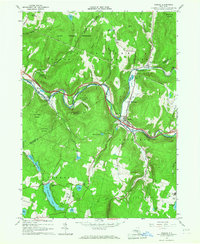
 1965 Hamden1967 Print · USGSMid-century Delaware County life centers on the river valley between Hamden and De Lancey in this mid-1960s survey. Researchers can trace family-named landmarks through the steep terrain, from Arbuckle Hollow to the ridges of the Devils Backbone.2 unique versions available
 - 1965 Map of Callicoon, 1967 Print
 1965 Callicoon1967 Print · USGSThe Upper Delaware River valley in the mid-sixties is captured here, showing the river winding through the borderlands of Sullivan and Wayne counties. Genealogists and local historians can trace the Erie Lackawanna rail line and sites like St Josephs Seminary and Kellams Bridge.3 unique versions available
 - 1965 Map of Lewbeach, 1967 Print
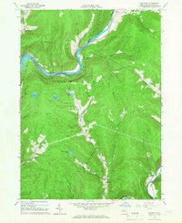
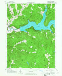
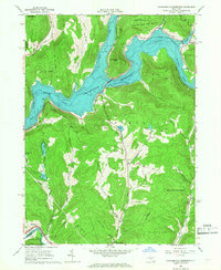
 1965 Lewbeach1967 Print · USGSThe Catskills landscape underwent significant changes by the mid-1960s as the Pepacton Reservoir reshaped the valley. Genealogists and local historians can trace relocated landmarks like Shavertown and the Pepacton Cem or follow the path of the Delaware Aqueduct.4 unique versions available
 - 1965 Map of Roscoe, 1967 Print
 1965 Roscoe1967 Print · USGSThe western Catskills come alive in the mid-1960s at the famous meeting of the Beaver Kill and Willowemoc Creek. Genealogists and historians can trace local family landmarks around Cooks Falls, Tennanah Lake, and the rural Riverside Cem.3 unique versions available
 - 1965 Map of Downsville, 1967 Print
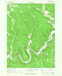
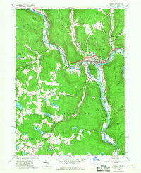
 1965 Downsville1967 Print · USGSDelaware County during the mid-1960s highlights the massive Pepacton Reservoir and the mountain landscape surrounding Downsville. Genealogists and hikers can trace landmarks like the Covered Bridge, Paige Cem, and the high ridges of Colchester Mountain.2 unique versions available
 - 1965 Map of Hancock, 1967 Print
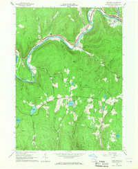
 1965 Hancock1967 Print · USGSThe convergence of the Delaware River branches defines this border region in the mid-1960s, where rail and water transport shaped local growth. Researchers can trace family roots at Kingsbury Hill Cem or explore the industrial footprint of Cadosia and the Erie-Lackawanna Railroad.3 unique versions available
 - 1965 Map of Livingston Manor, 1967 Print
 1965 Livingston Manor1967 Print · USGSLivingston Manor and the western Catskills are captured in the mid-sixties as the new highway interchanges began to reshape the valley. Genealogists can trace family names at St Aloysius Cem, find the Beaverkill Valley Ch, and locate old settlements like Morsston and Deckertown.3 unique versions available
 - 1965 Map of North Sanford, 1967 Print
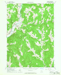
 1965 North Sanford1967 Print · USGSSettled valleys meet state-managed timberlands in this mid-sixties survey of the border between Broome, Chenango, and Delaware counties. Researchers can trace family sites at China and Arctic or locate burial grounds like Beech Hill Cem and Melondy Hill Cem.2 unique versions available
 - 1965 Map of Long Eddy, 1967 Print
 1965 Long Eddy1967 Print · USGSThe Delaware River valley mid-century served as a busy border between New York and Pennsylvania, defined by the winding Erie-Lackawanna rail line. Researchers can trace riverside life in Equinunk or explore inland crossroads and recreation sites like Priceville and Union Lake.3 unique versions available
 - 1965 Map of Cannonsville Reservoir, 1967 Print
 1965 Cannonsville Reservoir1967 Print · USGSThe West Branch Delaware River valley appears in the mid-1960s as the massive Cannonsville Reservoir transforms the landscape. Trace the local rail history along the Erie-Lackawanna RR or locate rural landmarks like Kelsey and the Kingswood Camp.3 unique versions available
 - 1965 Map of Deposit, 1967 Print
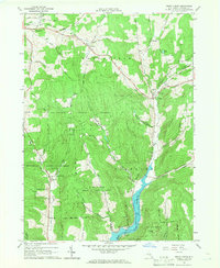
 1965 Deposit1967 Print · USGSThe village of Deposit and its surrounding river valleys are captured here in the mid-sixties, shortly after the completion of the Cannonsville Dam. Genealogists and historians can trace the Erie Lackawanna Railroad and find local landmarks like Pine Grove Cem and Oquaga Lake.2 unique versions available
 - 1965 Map of Horton, 1968 Print
 1965 Horton1968 Print · USGSThe Delaware and Sullivan county borderlands in the mid-1960s reveal a mix of mountain hamlets and protected forest. Genealogists and historians can trace family roots through remote settlements like Goulds and Acidalia or locate family Quarries and the small Cem sites found near the local hollows.2 unique versions available
 - 1965 Map of Fishs Eddy, 1968 Print
 1965 Fishs Eddy1968 Print · USGSThe Catskills river valleys of the mid-sixties are captured here at the confluence of the East Branch Delaware River and the Beaver Kill. Genealogists and hikers can trace old river hamlets like Fishs Eddy and East Branch or find vintage summer sites like Camp Pine Cone and Camp Deerhead.2 unique versions available
 - 1968 Map of Lake Como, 1970 Print
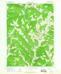
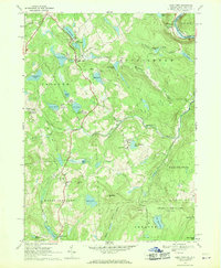 1968 Lake Como1970 Print · USGSWayne County and the New York borderlands appear here in the late sixties, showing a landscape of upland lakes and small dairy-era crossroads. Researchers can trace the Erie Lackawanna line, find St Julianas Ch, and locate family names near Dillontown or Rudes Corner.2 unique versions available
End of results
Showing maps 1-24 of 24
Top cities of Delaware County
- Sidney historical maps
- Walton historical maps
- Delhi historical maps
- Middletown historical maps
- Davenport historical maps
- Hancock historical maps
See more
Frequently asked questions
- What are the different types of historical maps available for Delaware County?
- What is the oldest map of Delaware County?
- Where can I purchase historical maps of Delaware County for my home or office?
- Where can I download high-res historical maps of Delaware County?
- Are there historical topographic maps available for Delaware County?
- Is there historical aerial imagery available for Delaware County?
- Where are historical maps of Delaware County sourced from?