Old Maps of Deposit, New York for Genealogy
Trace your family roots with 50 historic maps of Deposit. These high-res maps reveal old neighborhoods, homesites, landmarks, and streets — helping you uncover where your ancestors lived and how the area evolved over time.
- Explore historic neighborhoods: Identify where your relatives may have lived in the 1800s or 1900s.
- Compare maps over time: Trace the changes in streets, buildings, and landmarks for multi-generational research.
- Perfect for genealogy & ancestry research: Used by family historians and researchers to map out lineage and migration.
These maps are an incredible resource for exploring your personal connection to Deposit's past.
Deposit, NY maps
(50)- 1924 Map of Starrucca
 1924 Starrucca1924 Print · USGSThe river-and-rail economy of the Delaware valley is captured here in the mid-1920s during a period of industrial activity. Researchers can trace the junctions of the Erie RR and locate local landmarks like Cadosia Factories and Stockport Sta.
 - 1924 Map of Deposit, 1957 Print
 1924 Deposit1957 Print · USGSDelaware and Broome Counties are shown here in the mid-twenties, centered on the river-and-rail corridor near Deposit. Researchers can trace the original locations of communities like Cannonsville and Rock Royal, or find ancestral schoolhouses like Slow and Easy School.
 - 1926 Map of Deposit
 1926 Deposit1926 Print · USGSThe West Branch of the Delaware River winds through these hills in the mid-twenties, passing through the villages of Deposit and Cannonsville. Genealogists can trace dozens of rural school districts, including the Slow and Easy School, and find old homesteads near McClure Settlement.4 unique versions available
 - 1926 Map of Starrucca
 1926 Starrucca1926 Print · USGSThe river-and-rail corridor at the New York and Pennsylvania border comes alive in the mid-1920s, showing the vital confluence at Hancock. Genealogists and rail historians can trace the paths of the Erie R R, identifying old transit points like Stockport Sta and Sands Switch.
 - 1930 Map of Starrucca
 1930 Starrucca1930 Print · USGSUpper Wayne County was a major transportation and recreation hub in the 1930s, defined by the Delaware River rail corridors and numerous upland lakes. Genealogists can trace family roots through localized sites like the South Preston Grange Hall and schools like Fairmont Sch.3 unique versions available
 - 1933 Map of Starrucca
 1933 Starrucca1933 Print · USGSUpper Wayne County was a landscape of rail-connected dairy farms and summer camps in the years between the wars. Genealogists can locate family-named rural schools and depots from Stephens Switch and Stockport Sta to Hines Corners.3 unique versions available
 - 1943 Map of Honesdale
 1943 Honesdale1943 Print · USGSThe northern Poconos and the Upper Delaware River valley appear here during the early war years, showing a network of mountain hamlets and riverfront rail towns. Genealogists can trace family roots through numerous remote institutions like Kingsbury Hill Church, Peakville P O, and the Hiawatha School.
 - 1944 Map of Deposit
 1944 Deposit1944 Print · USGSDelaware and Broome Counties come alive in the mid-1940s, showing the river-valley communities before later reservoir projects transformed the landscape. Trace genealogical roots through dozens of rural landmarks like McClure Settlement, Rock Royal, and Hale Eddy.
 - 1948 Map of Binghamton, 1980 Print
 1948 Binghamton1980 Print · USGSCentral New York and the Southern Tier thrive in the late 1940s as a hub of rail traffic and mountain industry. Researchers can trace historic transit lines like the Erie Railroad through Binghamton or find old valley settlements near Oneonta and Delhi.
 - 1950 Map of Binghamton
 1950 Binghamton1950 Print · USGSBinghamton and the surrounding Southern Tier are shown in the mid-century era, highlighting the intricate rail and river networks that drove local industry. Researchers can trace the path of the Erie Railroad and locate landmarks from Otsego Lake to Sidney Mountain.2 unique versions available
 - 1950 Map of Scranton, 1952 Print
 1950 Scranton1952 Print · USGSMid-century Northeast Pennsylvania and the Hudson Valley come alive in this survey of the tri-state region. Genealogists and historians can trace the dense rail networks of the Erie RR and DL&W RR between industrial hubs like Scranton and Wilkes-Barre.
 - 1953 Map of Scranton
 1953 Scranton1953 Print · USGSNortheastern Pennsylvania and the Catskills are shown in great detail during the early fifties, a time when rail lines and river valleys dictated the region's growth. Genealogists and historians can trace the industrial hearts of Scranton and Wilkes-Barre or locate remote landmarks like High Point and Lake Wallenpaupack.
 - 1958 Map of Binghamton
 1958 Binghamton1958 Print · USGSCentral New York in the late fifties was a network of manufacturing cities and river valleys connected by vital rail lines. Genealogists and historians can trace family roots in Oneonta, Norwich, and Cooperstown or locate long-standing farms along Schoharie Creek.
 - 1959 Map of Scranton
 1959 Scranton1959 Print · USGSThe northern coalfields and the Hudson Valley meet in this mid-century survey of the Pennsylvania and New York borderlands. Genealogists and historians can trace the intricate rail networks of the Erie Railroad and the vast waters of Lake Wallenpaupack.2 unique versions available
 - 1962 Map of Scranton, 1977 Print
 1962 Scranton1977 Print · USGSThe industrial heart of eastern Pennsylvania and the New York Catskills are captured here in the early sixties. Genealogists and historians can trace the dense valley settlements from Scranton to Wilkes-Barre and the rail lines of the Erie Lackawanna Railroad.2 unique versions available
 - 1963 Map of Binghamton
 1963 Binghamton1963 Print · USGSThe Southern Tier and Catskill peaks are shown in the early sixties as new reservoirs reshaped the valleys. Trace historic rail corridors like the Erie Lackawanna RR and explore lakeside settlements such as Cooperstown and Oneonta.
 - 1965 Map of Scranton
 1965 Scranton1965 Print · USGSThe tri-state highlands of Pennsylvania, New York, and New Jersey come alive in the mid-sixties as industry and recreation converge. Trace the intricate rail lines of the Erie Lackawanna RR or locate landmarks like the U S Military Academy.2 unique versions available
 - 1965 Map of Trout Creek, 1966 Print
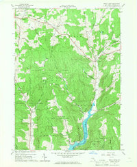 1965 Trout Creek1966 Print · USGSMid-century Delaware County is characterized here by the newly filled Cannonsville Reservoir and the rural upland forests of the 1960s. Genealogists and local historians can trace family-named sites like Austin Cem and settlements such as Ivanhoe and Upper Barbourville.2 unique versions available
 - 1965 Map of Hancock, 1967 Print
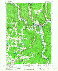 1965 Hancock1967 Print · USGSThe convergence of the Delaware River branches defines this border region in the mid-1960s, where rail and water transport shaped local growth. Researchers can trace family roots at Kingsbury Hill Cem or explore the industrial footprint of Cadosia and the Erie-Lackawanna Railroad.3 unique versions available
 - 1965 Map of North Sanford, 1967 Print
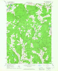 1965 North Sanford1967 Print · USGSSettled valleys meet state-managed timberlands in this mid-sixties survey of the border between Broome, Chenango, and Delaware counties. Researchers can trace family sites at China and Arctic or locate burial grounds like Beech Hill Cem and Melondy Hill Cem.2 unique versions available
 - 1965 Map of Cannonsville Reservoir, 1967 Print
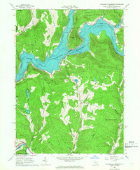 1965 Cannonsville Reservoir1967 Print · USGSThe West Branch Delaware River valley appears in the mid-1960s as the massive Cannonsville Reservoir transforms the landscape. Trace the local rail history along the Erie-Lackawanna RR or locate rural landmarks like Kelsey and the Kingswood Camp.3 unique versions available
 - 1965 Map of Deposit, 1967 Print
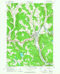 1965 Deposit1967 Print · USGSThe village of Deposit and its surrounding river valleys are captured here in the mid-sixties, shortly after the completion of the Cannonsville Dam. Genealogists and historians can trace the Erie Lackawanna Railroad and find local landmarks like Pine Grove Cem and Oquaga Lake.2 unique versions available
 - 1985 Map of Binghamton, 1986 Print
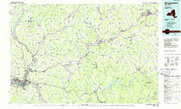 1985 Binghamton1986 Print · USGSThe Southern Tier during the mid-1980s shows a landscape of river-valley industry and expanding university campuses. Genealogists and local historians can trace family roots through riverside towns like Bainbridge, Sidney, and the Calvary Cem in the Binghamton area.2 unique versions available
 - 1986 Map of Honesdale
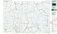 1986 Honesdale1986 Print · USGSNortheastern Pennsylvania and the New York borderlands appear here in the mid-1980s, during a period of transition for the region's industrial river valleys. Genealogists can trace family connections across the Moosic Mountains between the coal towns of Carbondale and the canal-era heritage of Honesdale.2 unique versions available
 - 1992 Map of Hancock, 1995 Print
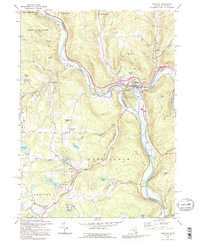 1992 Hancock1995 Print · USGSThe confluence of the Delaware River branches at the New York and Pennsylvania border highlights a landscape of river-town industry and highland lakes. Researchers can trace the rail lines through Hancock, locate family sites at Kingsbury Hill Cem, and explore the rural character of Starlight.2 unique versions available
Showing maps 1-25 of 50
Top cities near Deposit
- Windsor historical maps
- Sidney historical maps
- Walton historical maps
- Colesville historical maps
- Unadilla historical maps
- Sidney historical maps
See more
Top neighborhoods of Deposit
- Hale Eddy historical maps
- Hambletville historical maps
- Barbourville historical maps
- Upper Barbourville historical maps
- Stilesville historical maps
- China historical maps
Frequently asked questions
- What are the different types of historical maps available for Deposit?
- What is the oldest map of Deposit?
- Where can I purchase historical maps of Deposit for my home or office?
- Where can I download high-res historical maps of Deposit?
- Are there historical topographic maps available for Deposit?
- Is there historical aerial imagery available for Deposit?
- Where are historical maps of Deposit sourced from?