Old Maps of Walton, New York for Genealogy
Trace your family roots with 57 historic maps of Walton. These high-res maps reveal old neighborhoods, homesites, landmarks, and streets — helping you uncover where your ancestors lived and how the area evolved over time.
- Explore historic neighborhoods: Identify where your relatives may have lived in the 1800s or 1900s.
- Compare maps over time: Trace the changes in streets, buildings, and landmarks for multi-generational research.
- Perfect for genealogy & ancestry research: Used by family historians and researchers to map out lineage and migration.
These maps are an incredible resource for exploring your personal connection to Walton's past.
Walton, NY maps
(57)- 1915 Map of Oneonta
 1915 Oneonta1915 Print · USGSOtsego and Delaware counties thrived at this moment in the early twentieth century as a busy corridor for the Ulster and Delaware railroad. Genealogists and local historians can trace family-named schoolhouses and the agricultural economy at Arctic Creamery or the rural Franklin Depot.
 - 1918 Map of Oneonta
 1918 Oneonta1918 Print · USGSOneonta and the Susquehanna valley are captured here at a peak of rail-driven commerce during the early twentieth century. Genealogists and historians can locate scores of numbered country schools and rural landmarks like the Arctic Creamery, Wells Bridge, and Franklin Depot.3 unique versions available
 - 1922 Map of Andes, 1955 Print
 1922 Andes1955 Print · USGSThe East Branch Delaware River valley is captured in the 1920s before the creation of the Pepacton Reservoir. Researchers can trace the original locations of Pepacton, Shavertown, and Union Grove, alongside numerous rural schoolhouses like Basin Clove School and Arbuckle School.2 unique versions available
 - 1923 Map of Walton
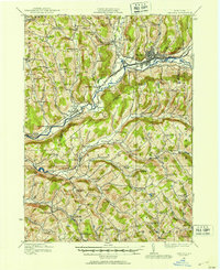
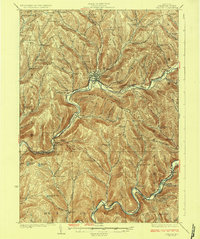
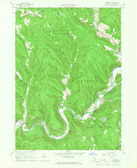
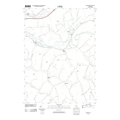
 1923 Walton1923 Print · USGSDelaware County in the early 1920s is defined by the winding Delaware River and the busy New York Ontario and Western RR. Genealogists can locate dozens of rural school sites, from the Texas School to Carcass Brook School, alongside hamlets like Beerston and Rock Rift.3 unique versions available
 - 1924 Map of Andes
 1924 Andes1924 Print · USGSDelaware County during the mid-twenties shows a landscape of mountain hollows and river valley life. Genealogists can locate family-named landmarks and local schoolhouses like Miller Hollow School, the settlement of Shavertown, and Cabin Hill Church.4 unique versions available
 - 1925 Map of Walton
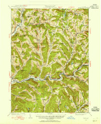
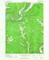
 1925 Walton1925 Print · USGSDelaware County during the mid-1920s is a landscape of rugged river valleys and remote hill-country farming communities. Genealogists can trace family roots through numerous local landmarks like Knickerbocker School, the village of Shinhopple, and the rail stops of the New York Ontario and Western RR.5 unique versions available
 - 1943 Map of Franklin, 1960 Print
 1943 Franklin1960 Print · USGSDelaware County farmland and valley villages are captured here during the 1940s, when the railroad still linked the hollows. Researchers can trace the New York and Ontario Western line to stops like Franklin Depot and Woodford (Northfield Station).4 unique versions available
 - 1943 Map of Treadwell, 1960 Print
 1943 Treadwell1960 Print · USGSDelaware County upland communities are captured in the early 1940s as the rural schoolhouse era remained in full swing. Genealogists can locate family sites near Croton Union Cem or trace ancestor routes through Poverty Hollow and West Delhi.3 unique versions available
 - 1945 Map of Franklin
 1945 Franklin1945 Print · USGSThe rural hills of Delaware County are captured here just after the war, showcasing a landscape of upland dairying and rail-dependent hamlets. Genealogists can locate family landmarks like Barnes Cem, Wells Bridge School No 6, and the New York Ontario and Western Railroad corridor.
 - 1945 Map of Treadwell
 1945 Treadwell1945 Print · USGSMid-century Delaware County is captured here at a time when small schoolhouses still anchored every rural hollow. Genealogists and historians can trace the foundations of local life at Treadwell, Croton Union Cem, and the Freer Hollow School.
 - 1948 Map of Binghamton, 1980 Print
 1948 Binghamton1980 Print · USGSCentral New York and the Southern Tier thrive in the late 1940s as a hub of rail traffic and mountain industry. Researchers can trace historic transit lines like the Erie Railroad through Binghamton or find old valley settlements near Oneonta and Delhi.
 - 1950 Map of Binghamton
 1950 Binghamton1950 Print · USGSBinghamton and the surrounding Southern Tier are shown in the mid-century era, highlighting the intricate rail and river networks that drove local industry. Researchers can trace the path of the Erie Railroad and locate landmarks from Otsego Lake to Sidney Mountain.2 unique versions available
 - 1958 Map of Binghamton
 1958 Binghamton1958 Print · USGSCentral New York in the late fifties was a network of manufacturing cities and river valleys connected by vital rail lines. Genealogists and historians can trace family roots in Oneonta, Norwich, and Cooperstown or locate long-standing farms along Schoharie Creek.
 - 1963 Map of Binghamton
 1963 Binghamton1963 Print · USGSThe Southern Tier and Catskill peaks are shown in the early sixties as new reservoirs reshaped the valleys. Trace historic rail corridors like the Erie Lackawanna RR and explore lakeside settlements such as Cooperstown and Oneonta.
 - 1965 Map of Corbett, 1966 Print
 1965 Corbett1966 Print · USGSThe East Branch of the Delaware River winds through the Catskills in the mid-1960s, connecting small valley settlements. Researchers can trace family sites at the Gregorytown Cem or explore landmarks like the Downsville Airport and Quinn Lake.3 unique versions available
 - 1965 Map of Readburn, 1966 Print
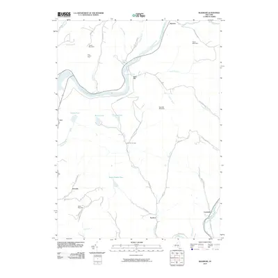
 1965 Readburn1966 Print · USGSDelaware County's river valleys and forest preserves are shown here in the mid-sixties during a period of significant hydrological change. Researchers can trace rural life at Readburn and Beerston, or locate family sites like the Readburn Cem and Community Full Gospel Ch.3 unique versions available
 - 1965 Map of Walton West, 1966 Print
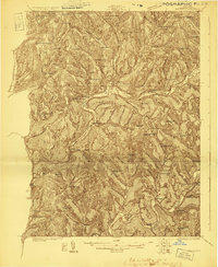
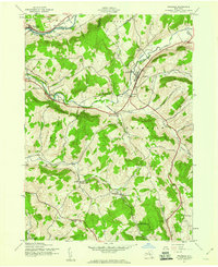
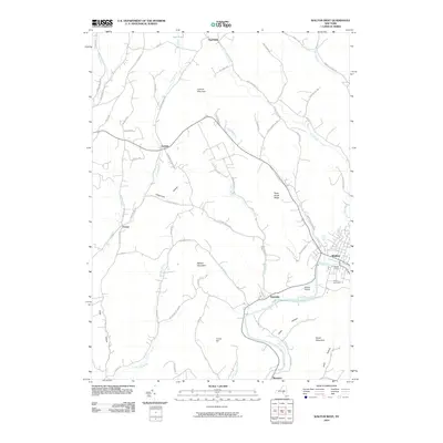
 1965 Walton West1966 Print · USGSDelaware County at the height of the 1960s reveals a landscape of river-valley villages and steep Catskill ridges. Local researchers can trace family landmarks and civic sites like the Walton Cem, Dryden Community Ch, and the village Fairgrounds.2 unique versions available
 - 1965 Map of Walton East, 1966 Print
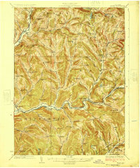
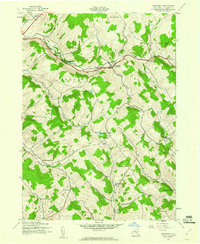
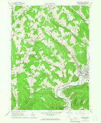
 1965 Walton East1966 Print · USGSDelaware County in the mid-1960s is defined here by the river-cut valleys of the Catskill foothills and the village of Walton. Genealogists and historians can trace family-named landmarks like Mac Gibbon Hollow and the path of the Old Railroad Grade.2 unique versions available
 - 1965 Map of Hamden, 1967 Print
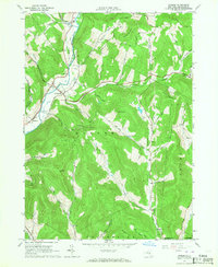 1965 Hamden1967 Print · USGSMid-century Delaware County life centers on the river valley between Hamden and De Lancey in this mid-1960s survey. Researchers can trace family-named landmarks through the steep terrain, from Arbuckle Hollow to the ridges of the Devils Backbone.2 unique versions available
 - 1982 Map of Hamden, 1983 Print
 1982 Hamden1983 Print · USGSDelaware County's river valleys and high ridges appear in detail during the early eighties, showing the traditional settlements along the West Branch Delaware River. Researchers can locate family landmarks like the Covered Bridge or trace the winding paths of Terry Clove Road and Bagley Brook.
 - 1985 Map of Binghamton, 1986 Print
 1985 Binghamton1986 Print · USGSThe Southern Tier during the mid-1980s shows a landscape of river-valley industry and expanding university campuses. Genealogists and local historians can trace family roots through riverside towns like Bainbridge, Sidney, and the Calvary Cem in the Binghamton area.2 unique versions available
 - 1986 Map of Pepacton Reservoir
 1986 Pepacton Reservoir1986 Print · USGSThe Catskills in the mid-eighties show a landscape shaped by the Pepacton Reservoir and protected wilderness. Local historians can trace mountain rail corridors like the Delaware & Ulster RR and locate high-elevation landmarks from Slide Mountain to Hunter Mountain.2 unique versions available
 - 2010 Map of Franklin, 2010 Print
 2010 Franklin2010 Print · USGSCovers Walton, including Sidney, Unadilla, and other nearby areas
 - 2010 Map of Walton West, 2010 Print
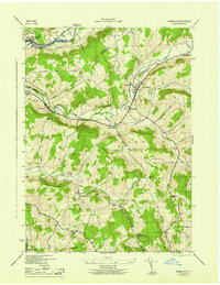
 2010 Walton West2010 Print · USGSCovers Walton, including Sidney, Tompkins, and other nearby areas
 - 2010 Map of Readburn, 2010 Print
 2010 Readburn2010 Print · USGSCovers Walton, including Hancock, Tompkins, and other nearby areas
Showing maps 1-25 of 57
Top cities near Walton
- Sidney historical maps
- Delhi historical maps
- Unadilla historical maps
- Rockland historical maps
- Walton historical maps
- Hancock historical maps
See more
Top neighborhoods of Walton
- Loomis historical maps
- Northfield historical maps
- Pinesville historical maps
- Beerston historical maps
- Walton historical maps
- Colchester historical maps
Frequently asked questions
- What are the different types of historical maps available for Walton?
- What is the oldest map of Walton?
- Where can I purchase historical maps of Walton for my home or office?
- Where can I download high-res historical maps of Walton?
- Are there historical topographic maps available for Walton?
- Is there historical aerial imagery available for Walton?
- Where are historical maps of Walton sourced from?