Old Maps of Aurora, New York for Academic Research
Study the evolution of Aurora with 35 high-resolution historic maps. Whether you're teaching, researching, or modeling changes in land use, these maps provide essential visual documentation of urban, environmental, and geographic change.
- Analyze long-term change: Track patterns in development, transportation, and natural features.
- Ideal for environmental or urban studies: Support academic projects with primary historical map data.
- Use in the classroom or lab: Educators and researchers rely on these maps to bring historical context to life.
These maps are a powerful tool for teaching, research, and visualizing how Aurora has changed over the decades.
Aurora, NY maps
(35)- 1905 Map of Depew
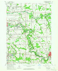
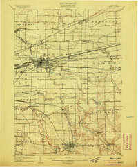 1905 Depew1905 Print · USGSEastern Erie County at the height of the steam era reveals a complex network of major rail lines and rural hamlets. Genealogists and historians can trace old property lines and rail stations like Looneyville, Grimesville, and the early development of Depew.6 unique versions available
 - 1925 Map of Springville
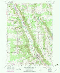
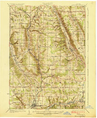 1925 Springville1925 Print · USGSSouthern Erie County in the mid-twenties shows a landscape of deep valleys and rail-connected villages before the expansion of modern highways. Genealogists can trace family footprints through dozens of district schools like Wheeler Hollow School and rural centers such as Sardinia and Griffins Mills.5 unique versions available
 - 1948 Map of Depew, 1953 Print
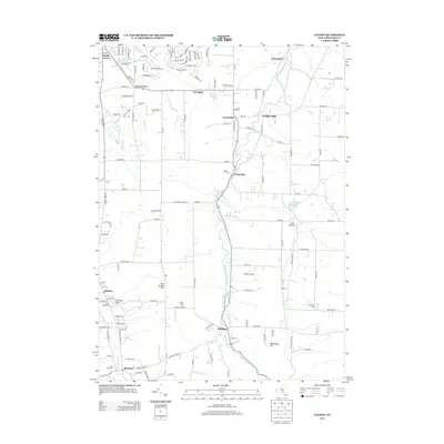
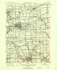 1948 Depew1953 Print · USGSErie County's industrial and civic heart comes into focus during this post-war era of rail and aviation expansion. Researchers can trace ancestral roots at Clarence Fillmore Cemetery or locate old schoolhouses like School No 1 and School No 8 across Harris Hill and Marilla.3 unique versions available
 - 1950 Map of Orchard Park
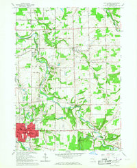
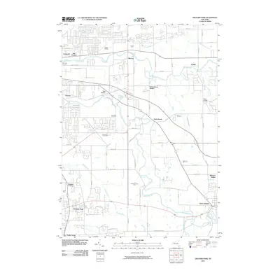
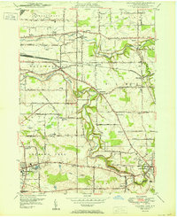 1950 Orchard Park1950 Print · USGSSoutheast of Buffalo in the early fifties, this region shows a landscape of small townships and emerging suburban hubs. Researchers can locate numerous local institutions like Michael Road School, trace the Pennsylvania RR, or find the historic Willink settlement.
 - 1950 Map of East Aurora
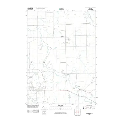
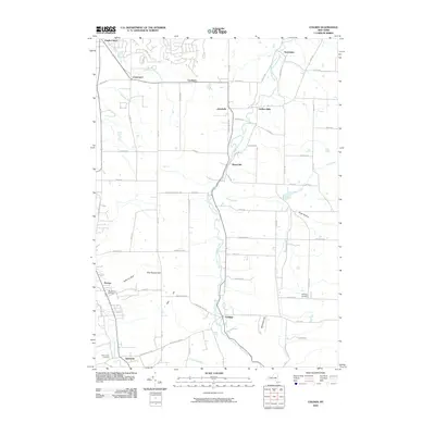
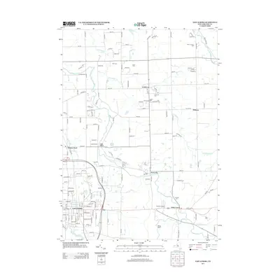
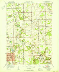 1950 East Aurora1950 Print · USGSMid-century Erie County comes alive in this survey of East Aurora and its surrounding townships during a period of steady post-war growth. Researchers can locate vanished landmarks like the local Tannery, numerous numbered district schools, and family burial grounds including Maplewood Cem and Evergreen Cem.
 - 1955 Map of Holland, 1957 Print
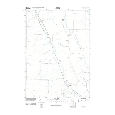
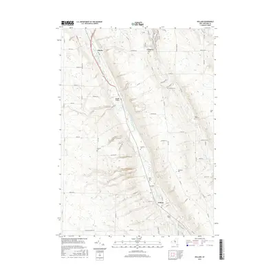
 1955 Holland1957 Print · USGSErie County's southern valleys and highlands are caught mid-century, before modern development bypassed these rural hamlets. Genealogists can trace family names at Humphrey Cem and Hunter Creek Ch, or locate the old Gow Sch near South Wales.2 unique versions available
 - 1955 Map of Colden, 1957 Print
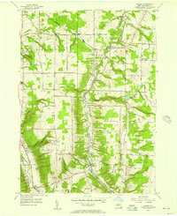 1955 Colden1957 Print · USGSErie County in the mid-fifties shows a landscape of deep creek valleys and rising ridges connected by the Baltimore and Ohio RR. Trace the footprints of West Falls, Colden, and Patchin, or locate family sites near Maple Wood Cem and St Martins Ch.4 unique versions available
 - 1960 Map of Buffalo
 1960 Buffalo1960 Print · USGSWestern New York and the Niagara Peninsula thrive during the mid-twentieth century industrial peak. Genealogists and historians can trace family-named points and early settlements from Dunkirk Light to the Allegany Indian Reservation.
 - 1962 Map of Buffalo, 1980 Print
 1962 Buffalo1980 Print · USGSThe Niagara Frontier and Western New York are captured here in the early sixties, showing the vital industrial and maritime nexus between the U.S. and Canada. Researchers can trace the path of the Welland Canal, locate the Allegany Indian Reservation, or find family sites near Chautauqua Lake.2 unique versions available
 - 1965 Map of East Aurora, 1967 Print
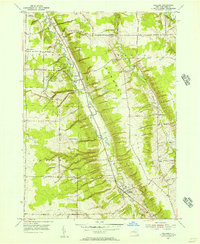
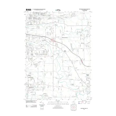
 1965 East Aurora1967 Print · USGSEast Aurora and the surrounding Erie County townships are captured here in the mid-sixties as suburban growth begins to touch rural farmsteads. Researchers can trace family history through sites like Maplewood Cemetery, St Johns Church, and the Wales School.2 unique versions available
 - 1965 Map of Orchard Park, 1967 Print
 1965 Orchard Park1967 Print · USGSSuburban expansion meets established rural townships in 1960s Erie County as small hamlets began to coalesce. Genealogists can trace family footprints through numerous parish sites and settlements like Blossom, Duells Corner, and the West Seneca State School.4 unique versions available
 - 1967 Map of Buffalo
 1967 Buffalo1967 Print · USGSWestern New York and the Lake Erie shoreline are shown here during the mid-1960s industrial peak. Researchers can trace the massive rail networks of the Erie Railroad, locate the Cattaraugus Indian Reservation, or find historic sites like Fort Erie.
 - 1973 Map of Buffalo
 1973 Buffalo1973 Print · USGSWestern New York and Ontario's Golden Horseshoe meet in the early seventies, spanning from the industrial waterfronts of Buffalo to the hills of Allegany State Park. Trace the paths of the Welland Canal and Erie Lackawanna railroad through the lakefront towns of Dunkirk and Port Colborne.
 - 1979 Map of Holland
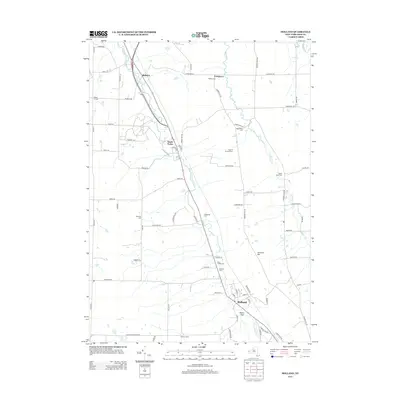
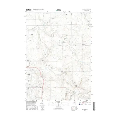
 1979 Holland1979 Print · USGSErie County's rural character is on full display in the late 1970s as agricultural valleys and wooded ridges meet along the East Branch Cazenovia Creek. Family historians can trace numerous burial sites like Humphrey Cem and local landmarks such as the Gow Sch and Emery Park.
 - 1984 Map of Buffalo, 1985 Print
 1984 Buffalo1985 Print · USGSWestern New York's industrial and transport hubs are in full view during the mid-eighties, from the Lake Erie waterfront to the Genesee Valley. Researchers can trace the legacy of the Erie Canal, find ancestral sites like Mount Calvary Cem, or locate the Attica Correctional Facility.2 unique versions available
 - 2010 Map of Orchard Park, 2010 Print
 2010 Orchard Park2010 Print · USGSCovers Aurora, including Cheektowaga, West Seneca, and other nearby areas
 - 2010 Map of East Aurora, 2010 Print
 2010 East Aurora2010 Print · USGSCovers Aurora, including Lancaster, Elma, and other nearby areas
 - 2010 Map of Colden, 2010 Print
 2010 Colden2010 Print · USGSCovers Aurora, including Orchard Park, Boston, and other nearby areas
 - 2010 Map of Holland, 2010 Print
 2010 Holland2010 Print · USGSCovers Aurora, including Holland, Colden, and other nearby areas
 - 2013 Map of Colden, 2013 Print
 2013 Colden2013 Print · USGSCovers Aurora, including Orchard Park, Boston, and other nearby areas
 - 2013 Map of Holland, 2013 Print
 2013 Holland2013 Print · USGSCovers Aurora, including Holland, Colden, and other nearby areas
 - 2013 Map of East Aurora, 2013 Print
 2013 East Aurora2013 Print · USGSCovers Aurora, including Lancaster, Elma, and other nearby areas
 - 2013 Map of Orchard Park, 2013 Print
 2013 Orchard Park2013 Print · USGSCovers Aurora, including Cheektowaga, West Seneca, and other nearby areas
 - 2016 Map of Holland, 2016 Print
 2016 Holland2016 Print · USGSCovers Aurora, including Holland, Colden, and other nearby areas
 - 2016 Map of East Aurora, 2016 Print
 2016 East Aurora2016 Print · USGSCovers Aurora, including Lancaster, Elma, and other nearby areas
Showing maps 1-25 of 35
Top cities near Aurora
- Buffalo historical maps
- Amherst historical maps
- Cheektowaga historical maps
- Tonawanda historical maps
- Hamburg historical maps
- West Seneca historical maps
See more
Top neighborhoods of Aurora
- Jewettville historical maps
- Griffins Mills historical maps
- West Falls historical maps
- East Aurora historical maps
Frequently asked questions
- What are the different types of historical maps available for Aurora?
- What is the oldest map of Aurora?
- Where can I purchase historical maps of Aurora for my home or office?
- Where can I download high-res historical maps of Aurora?
- Are there historical topographic maps available for Aurora?
- Is there historical aerial imagery available for Aurora?
- Where are historical maps of Aurora sourced from?