1970s Maps of Essex County, New York
Explore 18 historic maps of Essex County from the 1970s. These maps offer a rare glimpse into what life looked like during the 1970s — showing old roads, neighborhoods, homes, and landmarks that have changed or disappeared over time.
Whether you're researching your family's past, planning a metal detecting trip, or studying how Essex County's landscape evolved across the 1970s, these high-resolution maps are a powerful tool for exploring the history of this region.
- Focus on a specific era: All maps on this page are from the 1970s, giving you a focused view of this time period.
- See what’s changed: Compare century-old streets, trails, and buildings to today's modern landscape using overlays and satellite layers.
- Research with precision: Use these maps for genealogy, historical research, land use analysis, or educational projects.
- View, download, or print: Maps are fully viewable online in high resolution, and can be downloaded or printed for your own records.
Start exploring Essex County's history through authentic maps from the 1970s. This is your window into the past.
Essex County, NY maps
(18)- 1973 Map of Graphite, 1975 Print
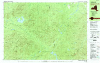
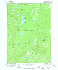 1973 Graphite1975 Print · USGSThe Adirondack high country in the early seventies shows a landscape of isolated hamlets and dense wilderness. Trace family footprints through Hague, find the small May Memorial Cem, or locate the inland mining settlement at Graphite.2 unique versions available
 - 1973 Map of Eagle Lake, 1975 Print
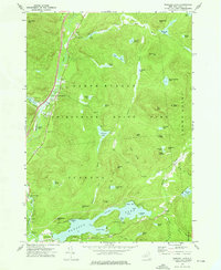
 1973 Eagle Lake1975 Print · USGSEssex County in the early seventies shows a landscape where industrial heritage meets protected wilderness. Genealogists and historians can locate remote settlements like Ironville, old mining sites near Furnace Mtn, and landmarks along Eagle Lake.
 - 1973 Map of Pharaoh Mountain, 1976 Print
 1973 Pharaoh Mountain1976 Print · USGSAdirondack wilderness in the early 1970s is characterized by its high summits and scattered backcountry ponds. Researchers can find old trails, the Sandpit Cem, and family-named landmarks like Wilson Hill or the Lookout Tower on Pharaoh Mountain.
 - 1973 Map of Paradox Lake, 1976 Print
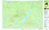
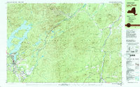
 1973 Paradox Lake1976 Print · USGSThe Adirondack backcountry in the early seventies shows a landscape of deep-woods ponds and growing recreational hubs. Genealogists and hikers can trace old routes near North Hudson or locate family sites by Pine Ridge Cem and Schroon Falls.2 unique versions available
 - 1978 Map of Bloomingdale
 1978 Bloomingdale1978 Print · USGSThe Adirondack High Peaks region during the late 1970s shows a landscape of mountain hamlets and sprawling lakes. Local researchers can trace family names and institutions from Paul Smiths College to quiet burial grounds like Mountain View Cemetery and St Johns Cem.
 - 1978 Map of Saranac Lake
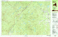
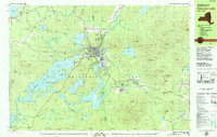
 1978 Saranac Lake1978 Print · USGSSaranac Lake and its surrounding mountain wilderness are captured in the late seventies as a hub of health, education, and recreation. Researchers can trace local history at St Bernards Cem, the settlement of Trudeau, and the Correctional Institution at Ray Brook.
 - 1978 Map of Witherbee, 1979 Print
 1978 Witherbee1979 Print · USGSMining and mountain life in the eastern Adirondacks intersect during the late seventies, showing the industrial pulse of these upland towns. Genealogists and hikers can trace the Lake Champlain and Moriah Railroad, find the SS Peter and Paul Cem, and locate the Belfry Mtn Lookout Tower.
 - 1978 Map of Ampersand Lake, 1979 Print
 1978 Ampersand Lake1979 Print · USGSThe High Peaks wilderness in the late seventies is captured here at the junction of Franklin and Essex Counties. Outdoor historians and researchers can trace the Northville Placid Trail to landmarks like Wanika Falls Shelter, Duck Hole, and the peaks of Seward Mountain.2 unique versions available
 - 1978 Map of Wilmington, 1979 Print
 1978 Wilmington1979 Print · USGSThe Adirondacks near Wilmington in the 1970s reveal a landscape defined by high peaks and mountain industries. Genealogists and hikers can trace the Memorial Highway up Whiteface Mountain or locate old sites like Middle Kilns and Haselton Cem.
 - 1978 Map of Elizabethtown, 1979 Print
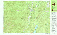 1978 Elizabethtown1979 Print · USGSElizabethtown and the Bouquet River valley are captured in the late seventies as the Adirondack Northway reshaped regional travel. Genealogists and historians can locate the Black River Cem, the Central School, and the Court House at the heart of this mountain community.2 unique versions available
 - 1978 Map of Au Sable Forks, 1979 Print
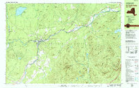 1978 Au Sable Forks1979 Print · USGSIn the Adirondack mountains during the late seventies, the junction of the east and west river branches defines the local landscape. Genealogists can trace family names at Holy Name Cem and Riverview Cem while locating old industries like the Quarries and Arnold Hill mines.3 unique versions available
 - 1978 Map of Lewbeach, 1979 Print
 1978 Lewbeach1979 Print · USGSThe High Peaks region in the late seventies reveals a landscape of high summits and small valley hamlets. Trace the family names of Stowersville and Deerhead, or locate the Central Cemetery and the Covered Bridge along the Ausable River East Branch.
 - 1979 Map of Kempshall Mtn
 1979 Kempshall Mtn1979 Print · USGSThe central Adirondack wilderness comes alive in the late seventies, focused on the deep waters of Long Lake. Trace the primitive Northville Placid Trail past remote landmarks like the Lookout Tower and Shattuck Clearing.2 unique versions available
 - 1979 Map of Saranac Lake
 1979 Saranac Lake1979 Print · USGSSaranac Lake and the surrounding Adirondack wilderness appear here in the late seventies as the region prepared for international athletics. Researchers can trace the Adirondack rail line or locate landmarks like Pine Ridge Cem and the Olympic Village.2 unique versions available
 - 1979 Map of Keene Valley
 1979 Keene Valley1979 Print · USGSThe High Peaks region during the late seventies reveals a landscape prepared for world-class competition. Trace family sites at Norton Cem and Olympic history at the Luge Run or Mt Van Hoevenberg Recreational Center.2 unique versions available
 - 1979 Map of Lake Placid
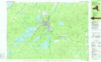
 1979 Lake Placid1979 Print · USGSThe Lake Placid region in the late seventies reveals a landscape on the verge of the Winter Games. Trace the development of Olympic venues like the Olympic Arena and 90-meter Tower alongside local landmarks like John Browns Grave.
 - 1979 Map of Santanoni Peak
 1979 Santanoni Peak1979 Print · USGSThe High Peaks wilderness meets industrial history in the late seventies near the Santanoni Mountains. Researchers can locate the Old MacIntyre Furnace, trace the Northville Placid Trail, and see the footprint of the Tahawus mining operations.
 - 1979 Map of Mount Marcy
 1979 Mount Marcy1979 Print · USGSThe High Peaks wilderness is captured in the late seventies, showing the intricate trail and waterway systems surrounding the state's highest point. Hikers and historians can trace routes like the Guide Board Trail or locate remote spots like Marcy Landing and the Boreas Ponds.
End of results
Showing maps 1-18 of 18
Top cities of Essex County
- North Elba historical maps
- Ticonderoga historical maps
- Moriah historical maps
- Jay historical maps
- Chesterfield historical maps
- Crown Point historical maps
See more
Frequently asked questions
- What are the different types of historical maps available for Essex County?
- What is the oldest map of Essex County?
- Where can I purchase historical maps of Essex County for my home or office?
- Where can I download high-res historical maps of Essex County?
- Are there historical topographic maps available for Essex County?
- Is there historical aerial imagery available for Essex County?
- Where are historical maps of Essex County sourced from?