Old Maps of Craterclub, Essex for Academic Research
Study the evolution of Craterclub with 15 high-resolution historic maps. Whether you're teaching, researching, or modeling changes in land use, these maps provide essential visual documentation of urban, environmental, and geographic change.
- Analyze long-term change: Track patterns in development, transportation, and natural features.
- Ideal for environmental or urban studies: Support academic projects with primary historical map data.
- Use in the classroom or lab: Educators and researchers rely on these maps to bring historical context to life.
These maps are a powerful tool for teaching, research, and visualizing how Craterclub has changed over the decades.
Craterclub, Essex maps
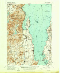
(15)- 1895 Map of Willsboro
 1895 Willsboro1895 Print · USGSLake Champlain and its late 19th-century transport networks are detailed here, showing the era when ferries and steamships linked New York and Vermont. Genealogists and historians can trace old homesteads and landings near Keeseville, the McNeil Ferry, and the tracks of the Central Vermont R. R.7 unique versions available
 - 1941 Map of Willsboro
 1941 Willsboro1941 Print · USGSLake Champlain's shores in New York and Vermont are captured here just before the war, showing a landscape defined by lakefront landings and busy railroads. Trace the routes of the Delaware and Hudson and find local landmarks like Craterclub, Whallonsburg, and St Josephs Ch.2 unique versions available
 - 1943 Map of Willsboro
 1943 Willsboro1943 Print · USGSThe Lake Champlain shoreline in the early 1940s reveals a landscape of mountain-backed villages and vital cross-lake rail connections. Genealogists and researchers can trace local landmarks like St Josephs Ch, Lakeview Cem, and the path of the Delaware and Hudson railroad.3 unique versions available
 - 1950 Map of Lake Champlain
 1950 Lake Champlain1950 Print · USGSThe Lake Champlain valley and its surrounding peaks are captured in detail during the late 1940s, showing the vital rail and road connections between New York and Vermont. Researchers can trace the routes of the Central Vermont Railway or locate old industrial centers like Mineville and Witherbee.2 unique versions available
 - 1956 Map of Willsboro, 1958 Print
 1956 Willsboro1958 Print · USGSLake Champlain and the eastern Adirondacks come alive in the mid-1950s, showing the intricate shoreline from New York to Vermont. Genealogists can trace family roots through sites like Whallon Bay Sch, Boardman Cem, and the Lady of Hope Shrine.4 unique versions available
 - 1958 Map of Lake Champlain
 1958 Lake Champlain1958 Print · USGSThe Champlain Valley and surrounding high peaks are captured here in the late fifties, showcasing the cross-border region from the Adirondacks to the Green Mountains. Researchers can trace historic rail routes like the Rutland Railway or locate old valley settlements such as Keeseville and Vergennes.2 unique versions available
 - 1962 Map of Lake Champlain, 1975 Print
 1962 Lake Champlain1975 Print · USGSLake Champlain and the high peaks of the Adirondacks and Green Mountains are captured here during the mid-twentieth century. Researchers can trace the industrial legacy of the Lyon Mountain Mine and the rail corridors of the Central Vermont RR and Delaware & Hudson RR.3 unique versions available
 - 1980 Map of Willsboro
 1980 Willsboro1980 Print · USGSThe Lake Champlain shoreline at the edge of the Adirondacks was a bustling corridor of rail and water transport in the late twentieth century. Researchers can trace the Delaware and Hudson line between Willsboro and Essex, or locate family sites like Brookfield Cem and St Josephs Ch.
 - 1986 Map of Lake Champlain South
 1986 Lake Champlain South1986 Print · USGSIn the mid-1980s, the shores of Lake Champlain linked the Adirondack high peaks with the Vermont valley. Genealogists and researchers can trace the rail lines of the Delaware & Hudson RR or locate historic settlements like Mineville and Au Sable Forks.2 unique versions available
 - 1999 Map of Willsboro, 2000 Print
 1999 Willsboro2000 Print · USGSSettled along the shores of Lake Champlain at the close of the twentieth century, this area features historic villages and mountain peaks. Genealogists can trace family names at Boardman Cem and Barber Cem or locate the Covered Bridge and St Philip Ch.
 - 2012 Map of Charlotte, 2012 Print
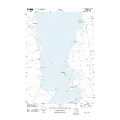 2012 Charlotte2012 Print · USGSCovers Craterclub, including Shelburne, Charlotte, and other nearby areas
 - 2015 Map of Charlotte, 2015 Print
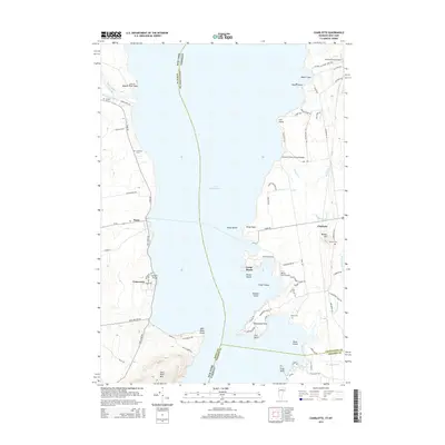 2015 Charlotte2015 Print · USGSCovers Craterclub, including Shelburne, Charlotte, and other nearby areas
 - 2018 Map of Charlotte, 2018 Print
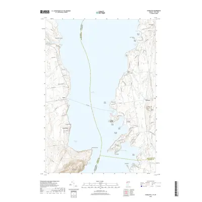 2018 Charlotte2018 Print · USGSCovers Craterclub, including Shelburne, Charlotte, and other nearby areas
 - 2021 Map of Charlotte, 2021 Print
 2021 Charlotte2021 Print · USGSCovers Craterclub, including Shelburne, Charlotte, and other nearby areas
 - 2024 Map of Charlotte, 2024 Print
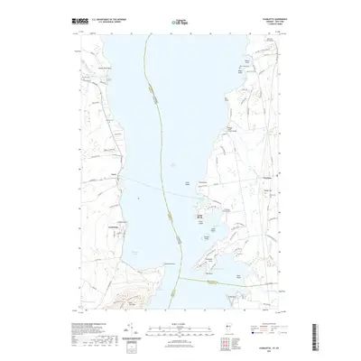
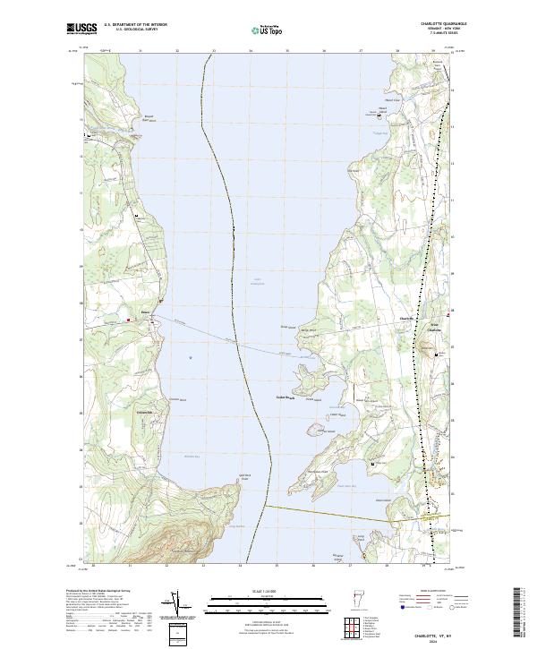 2024 Charlotte2024 Print · USGSLake Champlain serves as the central artery for this border region between Vermont and New York in the early twenty-first century. Genealogists and historians can trace family ties through Meach Island Cem and Barber Cem or follow the path of the Essex Ferry.
End of results
Showing maps 1-15 of 15
Top cities near Craterclub
- Burlington historical maps
- South Burlington historical maps
- Colchester historical maps
- Essex historical maps
- Essex Junction historical maps
- Williston historical maps
See more
Frequently asked questions
- What are the different types of historical maps available for Craterclub?
- What is the oldest map of Craterclub?
- Where can I purchase historical maps of Craterclub for my home or office?
- Where can I download high-res historical maps of Craterclub?
- Are there historical topographic maps available for Craterclub?
- Is there historical aerial imagery available for Craterclub?
- Where are historical maps of Craterclub sourced from?