Old Maps of Mineville, Moriah for Hiking & Exploration
Hike through history with 25 historic maps of Mineville. Explore old trails, ghost towns, and forgotten backroads — perfect for outdoor adventurers and local explorers.
- Rediscover forgotten places: Map out old mining camps, roads, and footpaths that no longer exist on modern maps.
- Layer with modern tools: Combine with LiDAR or satellite views to plan hikes through historical terrain.
- Made for exploration: Popular among hikers, overlanders, and local history lovers.
Use these maps to find adventure and explore the hidden past of Mineville.
Mineville, Moriah maps
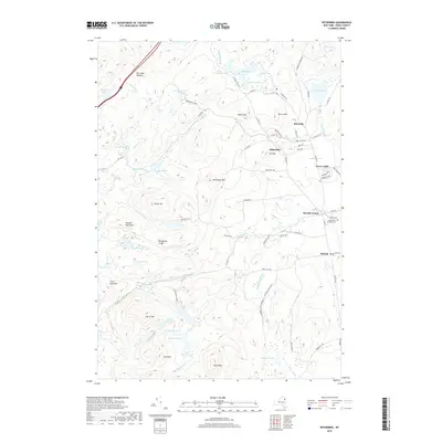
(25)- 1894 Map of Elizabethtown
 1894 Elizabethtown1894 Print · USGSThe Adirondack high country of Essex County is captured here in the 1890s, showcasing a landscape defined by mountain peaks and the iron industry. Trace the early rail lines of the L. C. & M. R. R. into Mineville or locate vanished sites like Euba Mills and New Russia.2 unique versions available
 - 1894 Map of Port Henry
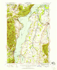
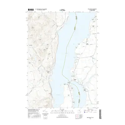
 1894 Port Henry1894 Print · USGSLake Champlain was a bustling corridor of steamships and rail lines during the 1890s, bridging the gap between New York and Vermont. Historians can trace the strategic layout of Crown Point, locate the French Fort Ruins, and explore industrial sites like Wadhams Mills.
 - 1895 Map of Elizabethtown
 1895 Elizabethtown1895 Print · USGSEssex County in the 1890s is shown here as a landscape of timber, iron ore, and river-valley hamlets. Genealogists and historians can trace the early rail corridor of the L.C. & M. R.R. or locate family sites in Mineville, New Russia, and Moriah Center.
 - 1898 Map of Port Henry
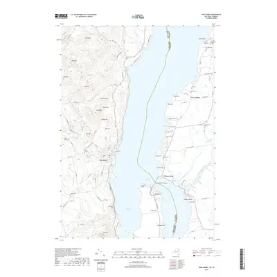
 1898 Port Henry1898 Print · USGSLake Champlain and its historic shores are captured in the late nineteenth century as steam and rail networks connected these borderlands. Researchers can locate the French Fort Ruins, trace the Central Vermont line, and explore old industrial sites like Wadhams Mills.10 unique versions available
 - 1901 Map of Elizabethtown
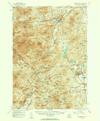
 1901 Elizabethtown1901 Print · USGSEssex County's high peaks and mining districts are captured here at the turn of the century, when the valley roads and mountain notches were the primary arteries of travel. Genealogists and historians can trace old community life in Elizabethtown, the industrial roots of Mineville, and the remote logging and mill sites at Euba Mills.9 unique versions available
 - 1945 Map of Port Henry, 1958 Print
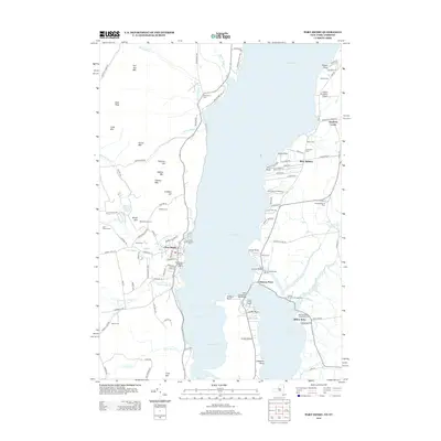
 1945 Port Henry1958 Print · USGSMid-century life along the Vermont and New York border is centered on the waters of Lake Champlain and its historic defenses. Researchers can trace the ruins of Fort Crown Point or locate family roots at Gage Cemetery and Smith School.5 unique versions available
 - 1947 Map of Port Henry
 1947 Port Henry1947 Print · USGSLake Champlain sits at the heart of this late 1940s survey of the New York and Vermont borderlands. Genealogists and local historians can trace legacy sites like the Fort St Frederic Ruins, the Rutland RR corridor, and a high density of country schools including Crane Sch and Smith Sch.2 unique versions available
 - 1950 Map of Lake Champlain
 1950 Lake Champlain1950 Print · USGSThe Lake Champlain valley and its surrounding peaks are captured in detail during the late 1940s, showing the vital rail and road connections between New York and Vermont. Researchers can trace the routes of the Central Vermont Railway or locate old industrial centers like Mineville and Witherbee.2 unique versions available
 - 1955 Map of Elizabethtown, 1957 Print
 1955 Elizabethtown1957 Print · USGSThe Adirondack iron mining district and the high peaks of Essex County are captured here in the mid-fifties. Researchers can trace the industrial footprint of the Fisher Hill Iron Mine and the mining communities of Witherbee and Mineville alongside the wilderness of Giant Mtn.5 unique versions available
 - 1958 Map of Lake Champlain
 1958 Lake Champlain1958 Print · USGSThe Champlain Valley and surrounding high peaks are captured here in the late fifties, showcasing the cross-border region from the Adirondacks to the Green Mountains. Researchers can trace historic rail routes like the Rutland Railway or locate old valley settlements such as Keeseville and Vergennes.2 unique versions available
 - 1962 Map of Lake Champlain, 1975 Print
 1962 Lake Champlain1975 Print · USGSLake Champlain and the high peaks of the Adirondacks and Green Mountains are captured here during the mid-twentieth century. Researchers can trace the industrial legacy of the Lyon Mountain Mine and the rail corridors of the Central Vermont RR and Delaware & Hudson RR.3 unique versions available
 - 1978 Map of Witherbee, 1979 Print
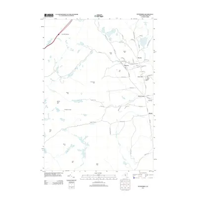
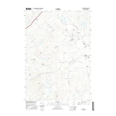
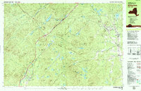 1978 Witherbee1979 Print · USGSMining and mountain life in the eastern Adirondacks intersect during the late seventies, showing the industrial pulse of these upland towns. Genealogists and hikers can trace the Lake Champlain and Moriah Railroad, find the SS Peter and Paul Cem, and locate the Belfry Mtn Lookout Tower.
 - 1980 Map of Port Henry, 1981 Print
 1980 Port Henry1981 Print · USGSLake Champlain's narrows were a hub of activity in the late twentieth century, balancing heavy industry with significant colonial heritage. Genealogists and historians can trace Fort St Frederic Ruins, family cemeteries like Spear Cem, and the path of the Delaware and Hudson railroad.
 - 1986 Map of Lake Champlain South
 1986 Lake Champlain South1986 Print · USGSIn the mid-1980s, the shores of Lake Champlain linked the Adirondack high peaks with the Vermont valley. Genealogists and researchers can trace the rail lines of the Delaware & Hudson RR or locate historic settlements like Mineville and Au Sable Forks.2 unique versions available
 - 1999 Map of Witherbee, 2000 Print
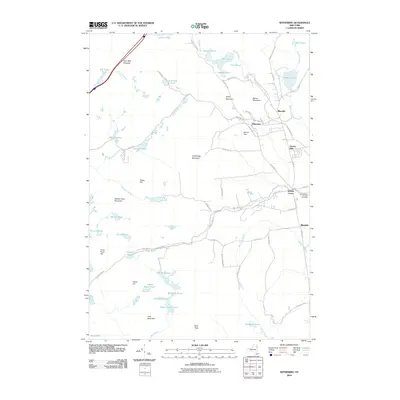
 1999 Witherbee2000 Print · USGSThe Adirondack mining district at the close of the twentieth century shows a landscape shaped by iron and industry. Researchers can trace the Lake Champlain and Moriah Railroad as it connects Witherbee and Mineville near the Belfry Mtn Lookout Tower.
 - 2010 Map of Witherbee, 2010 Print
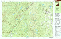
 2010 Witherbee2010 Print · USGSCovers Mineville, including Moriah, Crown Point, and other nearby areas
 - 2012 Map of Port Henry, 2012 Print
 2012 Port Henry2012 Print · USGSCovers Mineville, including Moriah, Crown Point, and other nearby areas
 - 2013 Map of Witherbee, 2013 Print
 2013 Witherbee2013 Print · USGSCovers Mineville, including Moriah, Crown Point, and other nearby areas
 - 2013 Map of Port Henry, 2013 Print
 2013 Port Henry2013 Print · USGSCovers Mineville, including Moriah, Crown Point, and other nearby areas
 - 2016 Map of Witherbee, 2016 Print
 2016 Witherbee2016 Print · USGSCovers Mineville, including Moriah, Crown Point, and other nearby areas
 - 2016 Map of Port Henry, 2016 Print
 2016 Port Henry2016 Print · USGSCovers Mineville, including Moriah, Crown Point, and other nearby areas
 - 2019 Map of Port Henry, 2019 Print
 2019 Port Henry2019 Print · USGSCovers Mineville, including Moriah, Crown Point, and other nearby areas
 - 2019 Map of Witherbee, 2019 Print
 2019 Witherbee2019 Print · USGSCovers Mineville, including Moriah, Crown Point, and other nearby areas
 - 2023 Map of Witherbee, 2023 Print
 2023 Witherbee2023 Print · USGSThe industrial hamlets of Essex County are captured here in the early twenty-first century, showing the enduring layout of mountain settlements. Local researchers can trace the roads connecting Mineville, Witherbee, and Moriah Center or locate the Saints Peter and Paul Cem.
 - 2023 Map of Port Henry, 2023 Print
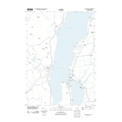
 2023 Port Henry2023 Print · USGSLake Champlain bisects the border of New York and Vermont in this detailed 2023 survey. Researchers can trace historic burial grounds like Saint Patrick Cem and Payne Cem or locate old industrial and lakefront hubs at Port Henry and Mineville.
End of results
Showing maps 1-25 of 25
Top cities near Mineville
- Ticonderoga historical maps
- Moriah historical maps
- Charlotte historical maps
- Ferrisburgh historical maps
- Jay historical maps
- Crown Point historical maps
See more
Top neighborhoods of Mineville
Frequently asked questions
- What are the different types of historical maps available for Mineville?
- What is the oldest map of Mineville?
- Where can I purchase historical maps of Mineville for my home or office?
- Where can I download high-res historical maps of Mineville?
- Are there historical topographic maps available for Mineville?
- Is there historical aerial imagery available for Mineville?
- Where are historical maps of Mineville sourced from?