Old Maps of Tannersville, Hunter
Explore 26 old maps of Tannersville, spanning from 1892 to today. These high-resolution historic maps reveal how streets, neighborhoods, landmarks, and natural features evolved over time — perfect for genealogy, metal detecting, research, and local history exploration.
What you can do with these maps:
- See how Tannersville changed over time: Compare historical maps to modern-day views to trace roads, homesites, rail lines & more.
- View detailed metadata: Each map includes creators, publishers, year, scale, and archive source.
- Overlay maps with satellite & LiDAR: Visualize the past alongside modern tools to explore terrain & human change.
- Trusted historical sources: Maps sourced from the USGS, Library of Congress, and other archives.
- Access maps your way: View online, download high-res files, or order prints for personal or research use.
Start exploring old maps of Tannersville to uncover forgotten places, hidden landmarks, and the deep history beneath your feet.
Tannersville, Hunter maps
(26)- 1892 Map of Kaaterskill, 1957 Print
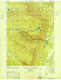
 1892 Kaaterskill1957 Print · USGSThe high Catskills of the 1890s reveal a landscape of grand hotels and rugged peaks during the peak of the mountain resort era. Genealogists and historians can trace the foundations of Onteora Park, the route of the Elevating R. R., and lost hamlets like Dutch Settlement.3 unique versions available
 - 1893 Map of Kaaterskill
 1893 Kaaterskill1893 Print · USGSThe high peaks and resort colonies of the late nineteenth century are mapped here in exceptional detail. Genealogists and rail historians can trace the paths of the Otis Elevating R R and the Catskill Mtn R R or locate old sites like Dutch Settlement and Mountain House.
 - 1894 Map of Kaaterskill
 1894 Kaaterskill1894 Print · USGSThe Catskills come alive in the 1890s as a premier destination for mountain tourism and timber. You can trace the early rail lines serving the Mountain House, locate the Victorian-era enclaves of Onteora Park and Twilight Park, or find family roots in Yankeetown.
 - 1899 Map of Kaaterskill
 1899 Kaaterskill1899 Print · USGSThe Catskills in the late nineteenth century show a unique landscape of mountain tourism and rail infrastructure. Trace the early hotel era through the Mountain House, the Otis Elevating Ry., and the high-elevation hamlets of Tannersville and Onteora Park.2 unique versions available
 - 1903 Map of Kaaterskill, 1906 Print
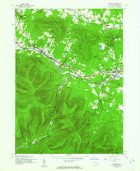
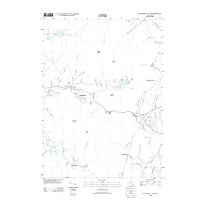
 1903 Kaaterskill1906 Print · USGSThe Catskills come alive in the early twentieth century through this record of mountain resorts and steep-grade rail lines. Researchers can trace the legendary Mountain House, the Otis Elevating R.R., and the remote Dutch Settlement.10 unique versions available
 - 1945 Map of Hunter, 1962 Print
 1945 Hunter1962 Print · USGSThe Greene County highlands in the 1940s show a region shaped by high mountain passes and narrow creek valleys. Genealogists and hikers can trace the foundations of Hunter and Tannersville, locating landmarks like Evergreen Cem and Devils Tombstone.2 unique versions available
 - 1946 Map of Hunter
 1946 Hunter1946 Print · USGSThe northern Catskills appear in the mid-1940s, showing a landscape of mountain resorts and close-knit villages. Genealogists can locate family landmarks like EVERGREEN CEM, St Johns Ch, and the many camps dotting Schoharie Creek.
 - 1946 Map of Kaaterskill
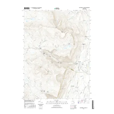
 1946 Kaaterskill1946 Print · USGSThe northern Catskills appear in great detail just after the war, showing the classic resort landscape from Tannersville to Palenville. Genealogists and hikers can trace the original paths to the Mountain House and locate family names at the Shoub Cem.7 unique versions available
 - 1948 Map of Binghamton, 1980 Print
 1948 Binghamton1980 Print · USGSCentral New York and the Southern Tier thrive in the late 1940s as a hub of rail traffic and mountain industry. Researchers can trace historic transit lines like the Erie Railroad through Binghamton or find old valley settlements near Oneonta and Delhi.
 - 1950 Map of Binghamton
 1950 Binghamton1950 Print · USGSBinghamton and the surrounding Southern Tier are shown in the mid-century era, highlighting the intricate rail and river networks that drove local industry. Researchers can trace the path of the Erie Railroad and locate landmarks from Otsego Lake to Sidney Mountain.2 unique versions available
 - 1958 Map of Binghamton
 1958 Binghamton1958 Print · USGSCentral New York in the late fifties was a network of manufacturing cities and river valleys connected by vital rail lines. Genealogists and historians can trace family roots in Oneonta, Norwich, and Cooperstown or locate long-standing farms along Schoharie Creek.
 - 1963 Map of Binghamton
 1963 Binghamton1963 Print · USGSThe Southern Tier and Catskill peaks are shown in the early sixties as new reservoirs reshaped the valleys. Trace historic rail corridors like the Erie Lackawanna RR and explore lakeside settlements such as Cooperstown and Oneonta.
 - 1980 Map of Hunter
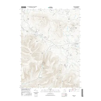
 1980 Hunter1980 Print · USGSThe Catskill high country comes into focus in this study of the mountain corridor before the modern era. Genealogists can trace family names at Evergreen Cem or locate historic parish sites like St Johns Ch and East Kill Valley Ch.
 - 1986 Map of Pepacton Reservoir
 1986 Pepacton Reservoir1986 Print · USGSThe Catskills in the mid-eighties show a landscape shaped by the Pepacton Reservoir and protected wilderness. Local historians can trace mountain rail corridors like the Delaware & Ulster RR and locate high-elevation landmarks from Slide Mountain to Hunter Mountain.2 unique versions available
 - 1997 Map of Hunter, 2001 Print
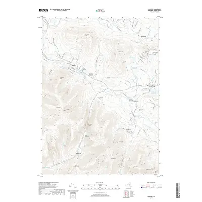
 1997 Hunter2001 Print · USGSThe High Catskills at the close of the twentieth century are captured here, centered on the villages of Hunter and Tannersville. Genealogists and local historians can locate several mountain churches, including St Johns Ch, or trace the legacy of the Old Railroad Grade.
 - 1997 Map of Kaaterskill Clove, 2001 Print
 1997 Kaaterskill Clove2001 Print · USGSThe eastern escarpment of the Catskills is captured here at the close of the millennium, showing the dense network of peaks and ravines that shaped Greene County history. Researchers can trace the Old Railroad Grade through the clove or locate sites like Twilight Park and Mountain House.
 - 2010 Map of Hunter, 2010 Print
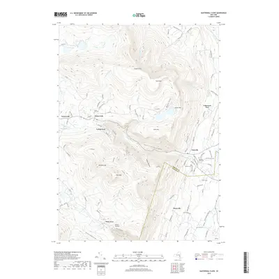
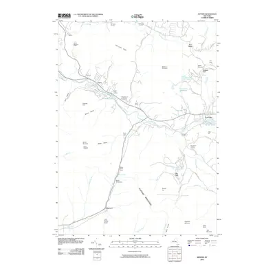 2010 Hunter2010 Print · USGSCovers Tannersville, including Hunter, Jewett, and other nearby areas
 - 2010 Map of Kaaterskill Clove, 2010 Print
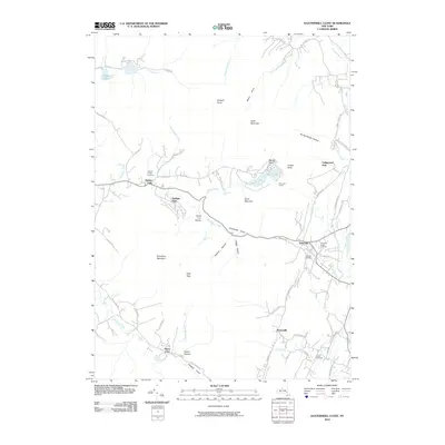 2010 Kaaterskill Clove2010 Print · USGSCovers Tannersville, including Saugerties, Catskill, and other nearby areas
 - 2013 Map of Kaaterskill Clove, 2013 Print
 2013 Kaaterskill Clove2013 Print · USGSCovers Tannersville, including Saugerties, Catskill, and other nearby areas
 - 2013 Map of Hunter, 2013 Print
 2013 Hunter2013 Print · USGSCovers Tannersville, including Hunter, Jewett, and other nearby areas
 - 2016 Map of Kaaterskill Clove, 2016 Print
 2016 Kaaterskill Clove2016 Print · USGSCovers Tannersville, including Saugerties, Catskill, and other nearby areas
 - 2016 Map of Hunter, 2016 Print
 2016 Hunter2016 Print · USGSCovers Tannersville, including Hunter, Jewett, and other nearby areas
 - 2019 Map of Hunter, 2019 Print
 2019 Hunter2019 Print · USGSCovers Tannersville, including Hunter, Jewett, and other nearby areas
 - 2019 Map of Kaaterskill Clove, 2019 Print
 2019 Kaaterskill Clove2019 Print · USGSCovers Tannersville, including Saugerties, Catskill, and other nearby areas
 - 2023 Map of Hunter, 2023 Print
 2023 Hunter2023 Print · USGSIn the heart of the Catskill High Peaks during the early twenty-first century, this area shows a landscape defined by mountain passes and historic resort communities. Genealogists and historians can locate several memorial sites, including Latvian Memorial Park Cem, Evergreen Cem, and the Mill Family Cem.
Showing maps 1-25 of 26
Top cities near Tannersville
- Saugerties historical maps
- Ulster historical maps
- Catskill historical maps
- Red Hook historical maps
- Coxsackie historical maps
- Rhinebeck historical maps
See more
Frequently asked questions
- What are the different types of historical maps available for Tannersville?
- What is the oldest map of Tannersville?
- Where can I purchase historical maps of Tannersville for my home or office?
- Where can I download high-res historical maps of Tannersville?
- Are there historical topographic maps available for Tannersville?
- Is there historical aerial imagery available for Tannersville?
- Where are historical maps of Tannersville sourced from?