
2023 Map of Hunter
USGS Topo · Published 2023About this map
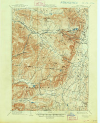
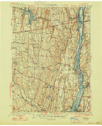
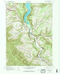
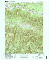
Hunter and Tannersville serve as the primary population centers in this high-elevation landscape of the Catskills, where the headwaters of Schoharie Creek and Stony Clove Creek have carved deep notches through the terrain. The map captures a high density of memorial sites and religious landmarks, including the Latvian Memorial Park Cem and Saint Mary's of the Mountain Church, reflecting the area's history as a place of refuge and community. Geologic features like Devils Tombstone and Stony Clove Notch define the narrow passage between Hunter Mountain and Plateau Mountain, while the resort-town development of the early twentieth century is visible in the planned layouts of Onteora Park and Elka Park. Numerous smaller family plots, such as the Mill Family Cem, and larger grounds like Evergreen Cem provide a clear spatial record for genealogists tracking local family lineages in Greene County.
Find a feature on this map
132 named features on this map. Tap any name to fly to it.
Don’t see what you’re looking for? This feature index may not catch every label — zoom into the map to look around manually.
Map Details
Editions of this 2023 Hunter Map
This is the sole edition of this map. No revisions or reprints were ever made.
Historical Maps of Tannersville Through Time
40 maps found
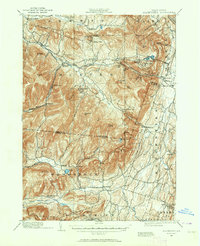
1892 Kaaterskill
Greene County, NY

1893 Coxsackie
Greene County, NY

1893 Durham
Greene County, NY

1893 Kaaterskill
Greene County, NY

1894 Coxsackie
Greene County, NY
1894 Durham
Greene County, NY

1894 Kaaterskill
Greene County, NY
1899 Kaaterskill
Greene County, NY
1903 Kaaterskill
Greene County, NY
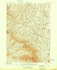
1929 Coxsackie
Greene County, NY
1943 Freehold
Greene County, NY
1945 Ashland
Greene County, NY

1945 Freehold
Greene County, NY

1945 Hensonville
Greene County, NY
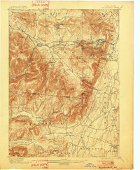
1945 Hunter
Greene County, NY
1945 Prattsville
Greene County, NY

1946 Ashland
Greene County, NY
1946 Hensonville
Greene County, NY

1946 Hunter
Greene County, NY
1946 Kaaterskill
Greene County, NY

1946 Lexington
Greene County, NY

1946 Prattsville
Greene County, NY
1953 Alcove
Greene County, NY
1953 Hudson North
Greene County, NY
1960 Lexington
Greene County, NY

1978 Wilmington
Greene County, NY
1980 Hensonville
Greene County, NY

1980 Hudson North
Greene County, NY

1980 Hunter
Greene County, NY

1997 Hunter
Greene County, NY

1997 Kaaterskill Clove
Greene County, NY

2023 Alcove
Greene County, NY

2023 Ashland
Greene County, NY

2023 Freehold
Greene County, NY

2023 Hensonville
Greene County, NY

2023 Hudson North
Greene County, NY
2023 Hunter
Greene County, NY

2023 Kaaterskill Clove
Greene County, NY

2023 Lexington
Greene County, NY

2023 Prattsville
Greene County, NY