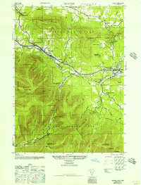
1946 Map of Hunter
USGS Topo · Published 1946About this map
Hunter and Tannersville serve as the primary hubs in this high-altitude landscape during the mid-1940s, situated along the Schoharie Creek and the Van Winkle Trail. The map highlights a community deeply intertwined with its mountain environment, featuring numerous seasonal and religious retreats such as Camp Schoharie, Camp Mayfair, and Stony Grove Camp. Religious life is well-documented through structures like St Francis De Sales Church and St Marys Ch, while the local education system is anchored by the Central School in Hunter and another Central Sch in Tannersville.
Find a feature on this map
61 named features on this map. Tap any name to fly to it.
Don’t see what you’re looking for? This feature index may not catch every label — zoom into the map to look around manually.
Map Details
Editions of this 1946 Hunter Map
This is the sole edition of this map. No revisions or reprints were ever made.
Other maps of this area

1892 · Kaaterskill
USGS Topo · 1:62,500

1893 · Kaaterskill
USGS Topo · 1:62,500

1893 · Durham
USGS Topo · 1:62,500

1894 · Kaaterskill
USGS Topo · 1:62,500

1894 · Durham
USGS Topo · 1:62,500

1899 · Kaaterskill
USGS Topo · 1:62,500

1900 · Phoenicia
USGS Topo · 1:62,500

1901 · Gilboa
USGS Topo · 1:62,500

1903 · Gilboa
USGS Topo · 1:62,500

1903 · Phoenicia
USGS Topo · 1:62,500